| Memorials | : | 0 |
| Location | : | Larvik, Larvik kommune, Norway |
| Coordinate | : | 59.0467240, 10.0353508 |
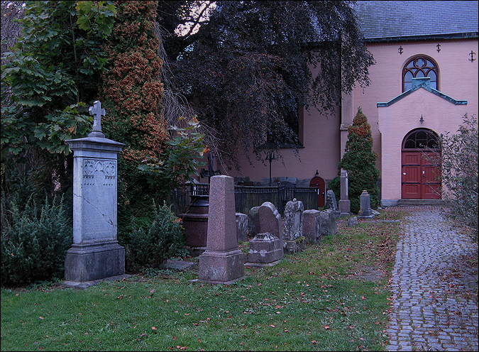
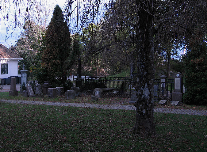
| Description | : | Located to the south of Larvik's Municipal Museum, beyond the railroad. Built in brick 1677, tower in 1762. Contains a portrait of Martin Luther by Lucas Cranach the Elder. It was the illegitimate son of King Frederick III of Denmark, Ulrik Frederik Gyldenløve (1638-1704), who founded the city of Laurvig (now Larvik) 1671. He was named Count of Laurvig, and is still remembered for the construction of Larvik Church as well as The Manor, which is still one of the largest wooden structures in Norway. |
frequently asked questions (FAQ):
-
Where is Larvik Church Cemetery?
Larvik Church Cemetery is located at Larvik, Larvik kommune ,Vestfold fylke ,Norway.
-
Larvik Church Cemetery cemetery's updated grave count on graveviews.com?
0 memorials
-
Where are the coordinates of the Larvik Church Cemetery?
Latitude: 59.0467240
Longitude: 10.0353508
Nearby Cemetories:
1. Larvik Civil Cemetery
Larvik, Larvik kommune, Norway
Coordinate: 59.0450000, 10.0523100
2. Undersbo Cemetery
Larvik, Larvik kommune, Norway
Coordinate: 59.0449470, 10.0541920
3. Fredriksvern kirke
Stavern, Larvik kommune, Norway
Coordinate: 58.9974460, 10.0348850
4. Merchant Marine Memorial
Stavern, Larvik kommune, Norway
Coordinate: 58.9912220, 10.0370980
5. Hedrum Cemetery
Larvik, Larvik kommune, Norway
Coordinate: 59.1153191, 10.0746557
6. Ekeberg Churchyard
Sandefjord, Sandefjord kommune, Norway
Coordinate: 59.1321320, 10.2091410
7. Sandefjord Cemetery
Sandefjord, Sandefjord kommune, Norway
Coordinate: 59.1332397, 10.2218227
8. Sandar Kirke Gravlund
Sandefjord, Sandefjord kommune, Norway
Coordinate: 59.1342980, 10.2267270
9. Orelund gravlund
Sandefjord, Sandefjord kommune, Norway
Coordinate: 59.1366430, 10.2295590
10. Kvelde Kirke
Larvik, Larvik kommune, Norway
Coordinate: 59.1971660, 9.9674980
11. Langesund Cemetery
Langesund, Bamble kommune, Norway
Coordinate: 59.0008710, 9.7462400
12. Brevik Cemetery
Brevik, Porsgrunn kommune, Norway
Coordinate: 59.0520010, 9.7043980
13. Stathelle Cemetery
Stathelle, Bamble kommune, Norway
Coordinate: 59.0416350, 9.6999910
14. Eidanger Kirkegaard
Porsgrunn, Porsgrunn kommune, Norway
Coordinate: 59.1185707, 9.6990687
15. Bamble Cemetery
Bamble kommune, Norway
Coordinate: 59.0094510, 9.6639667
16. Tjøme Kirke
Tjome, Tjøme kommune, Norway
Coordinate: 59.1136550, 10.3924810
17. Veierland Kirke
Notteroy, Nøtterøy kommune, Norway
Coordinate: 59.1627170, 10.3456970
18. Porsgrunn Østre Cemetery
Porsgrunn, Porsgrunn kommune, Norway
Coordinate: 59.1359830, 9.6470850
19. Porsgrunn Vestre Cemetery
Porsgrunn, Porsgrunn kommune, Norway
Coordinate: 59.1429300, 9.6417150
20. Borgestad Churchyard
Skien, Skien kommune, Norway
Coordinate: 59.1602800, 9.6577900
21. Tørmo Cemetery
Porsgrunn, Porsgrunn kommune, Norway
Coordinate: 59.1419430, 9.6338020
22. Nenset Cemetery
Skien, Skien kommune, Norway
Coordinate: 59.1682920, 9.6299470
23. Herre Kirkegaard
Herre, Bamble kommune, Norway
Coordinate: 59.1030040, 9.5625460
24. Nøtterøy kirke
Notteroy, Nøtterøy kommune, Norway
Coordinate: 59.2308570, 10.4078250


