
| Memorials | : | 0 |
| Location | : | Greensboro, Guilford County, USA |
| Coordinate | : | 36.0961740, -79.7319530 |
frequently asked questions (FAQ):
-
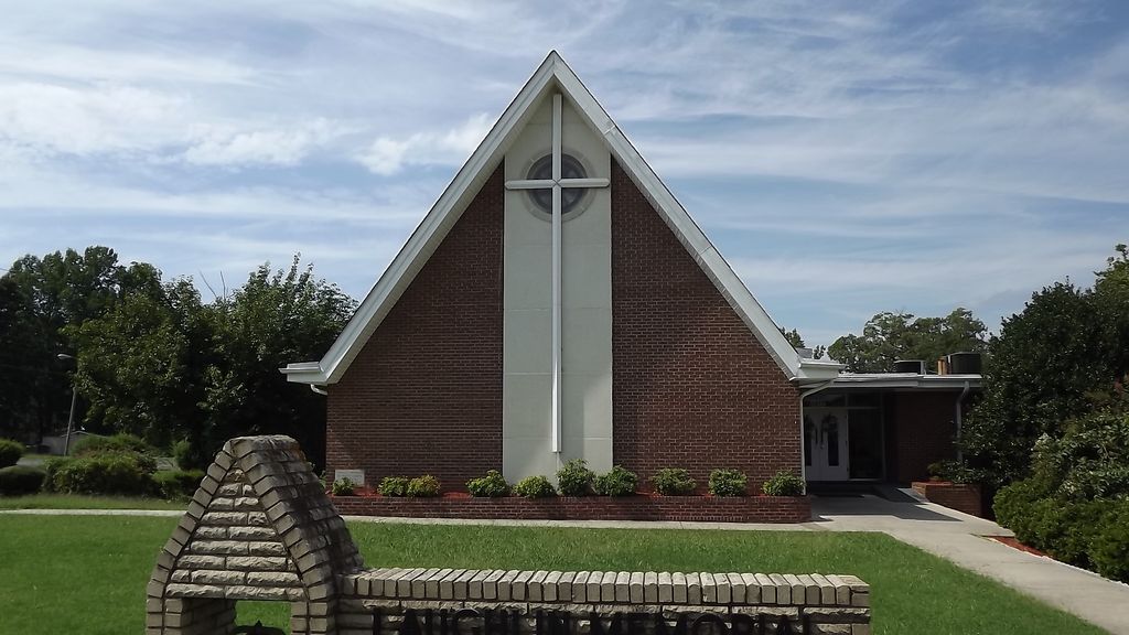
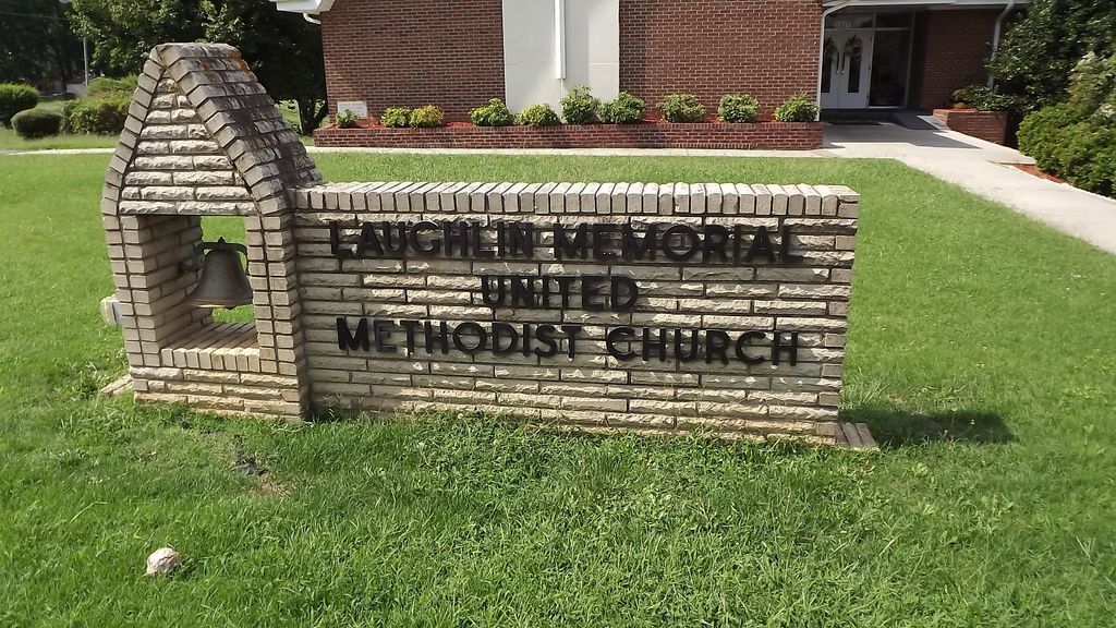
Where is Laughlin Memorial United Methodist Church Cemetery?
Laughlin Memorial United Methodist Church Cemetery is located at 1417 Huffine Mill Rd Greensboro, Guilford County ,North Carolina ,USA.
-
Laughlin Memorial United Methodist Church Cemetery cemetery's updated grave count on graveviews.com?
0 memorials
-
Where are the coordinates of the Laughlin Memorial United Methodist Church Cemetery?
Latitude: 36.0961740
Longitude: -79.7319530

Nearby Cemetories:
1. Mount Zion A.M.E. Church Cemetery
Greensboro, Guilford County, USA
Coordinate: 36.0937000, -79.7312000
2. Proximity Cemetery
Greensboro, Guilford County, USA
Coordinate: 36.0984000, -79.7523000
3. Midway Cemetery
Greensboro, Guilford County, USA
Coordinate: 36.1121000, -79.7150700
4. Phillips Cemetery
Guilford County, USA
Coordinate: 36.1007900, -79.7591520
5. Buchanan Baptist Church Cemetery
Greensboro, Guilford County, USA
Coordinate: 36.0809300, -79.7081420
6. Holts Chapel Cemetery
Greensboro, Guilford County, USA
Coordinate: 36.0759900, -79.7558600
7. Maplewood Cemetery
Greensboro, Guilford County, USA
Coordinate: 36.0734590, -79.7592567
8. Lakeview Memorial Park
Greensboro, Guilford County, USA
Coordinate: 36.1272011, -79.7450027
9. Piedmont Memorial Park
Greensboro, Guilford County, USA
Coordinate: 36.0611000, -79.7497025
10. Cone Cemetery
Guilford County, USA
Coordinate: 36.1098240, -79.7775520
11. Islamic Center of Greensboro Muslim Cemetery
McLeansville, Guilford County, USA
Coordinate: 36.1093310, -79.6860350
12. Buffalo Presbyterian Church Cemetery
Greensboro, Guilford County, USA
Coordinate: 36.1091800, -79.7796600
13. Mount Pleasant United Methodist Church Cemetery
Greensboro, Guilford County, USA
Coordinate: 36.0862170, -79.6809200
14. Shady Grove Cemetery
Greensboro, Guilford County, USA
Coordinate: 36.0635986, -79.6977997
15. Replacements Limited
Greensboro, Guilford County, USA
Coordinate: 36.0696400, -79.6864100
16. Saint Pius X Catholic Church Columbarium
Greensboro, Guilford County, USA
Coordinate: 36.1042800, -79.7876100
17. First Presbyterian Church Columbarium
Greensboro, Guilford County, USA
Coordinate: 36.0813120, -79.7903470
18. First Presbyterian Church Cemetery
Greensboro, Guilford County, USA
Coordinate: 36.0753600, -79.7878300
19. Holy Trinity Episcopal Church Columbarium
Greensboro, Guilford County, USA
Coordinate: 36.0794100, -79.7912500
20. Church of the Holy Spirit Columbarium
Greensboro, Guilford County, USA
Coordinate: 36.1361830, -79.7760500
21. Lutheran Church of Our Father Columbarium
Greensboro, Guilford County, USA
Coordinate: 36.0724983, -79.7922211
22. Lees Chapel United Methodist Church Cemetery
Greensboro, Guilford County, USA
Coordinate: 36.1454740, -79.7599210
23. McConnell Road Baptist Church Cemetery
Greensboro, Guilford County, USA
Coordinate: 36.0549680, -79.6882810
24. Green Hill Cemetery
Greensboro, Guilford County, USA
Coordinate: 36.0828018, -79.7975006