
| Memorials | : | 1 |
| Location | : | Pall Mall, Fentress County, USA |
| Coordinate | : | 36.5505981, -84.9677963 |
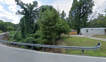
| Description | : | Lat.36.5506. lon.84.9678 This cemetery may also be known as Laurel Grove congregational Methodist Church cemetery. This Cemetery may no longer be able to be reached by motor vehicle as this Cemetery is located in a wooded area and the dirt road leading to the Cemetery is almost no longer visible from the main road.This Cemetery is located in the community of Pall Mall in Fentress county, Tennessee. |
frequently asked questions (FAQ):
-
Where is Laurel Grove United Methodist Church Cemetery?
Laurel Grove United Methodist Church Cemetery is located at Upaved [Dirt] Forest service Road. Pall Mall, Fentress County ,Tennessee , 38577USA.
-
Laurel Grove United Methodist Church Cemetery cemetery's updated grave count on graveviews.com?
1 memorials
-
Where are the coordinates of the Laurel Grove United Methodist Church Cemetery?
Latitude: 36.5505981
Longitude: -84.9677963
Nearby Cemetories:
1. Frogge Chapel Cemetery
Fentress County, USA
Coordinate: 36.5461006, -84.9764023
2. Huff Family Cemetery
Pall Mall, Fentress County, USA
Coordinate: 36.5575520, -84.9769800
3. Upchurch Cemetery
Pall Mall, Fentress County, USA
Coordinate: 36.5574989, -84.9783020
4. Wolf River Cemetery
Pall Mall, Fentress County, USA
Coordinate: 36.5471992, -84.9542007
5. John C. Wright Cemetery
Fentress County, USA
Coordinate: 36.5302900, -84.9540000
6. Greer Chapel Cemetery
Fentress County, USA
Coordinate: 36.5560989, -84.9981003
7. Reed Creek Cemetery
Fentress County, USA
Coordinate: 36.5280991, -84.9875031
8. Delk Cemetery
Fentress County, USA
Coordinate: 36.5553017, -85.0049973
9. Evans Cemetery
Fentress County, USA
Coordinate: 36.5523810, -85.0119680
10. Moody Cemetery
Travisville, Pickett County, USA
Coordinate: 36.5813300, -84.9971500
11. Travisville Cemetery
Travisville, Pickett County, USA
Coordinate: 36.5813250, -84.9972180
12. Davidson Cemetery
Travisville, Pickett County, USA
Coordinate: 36.5780200, -85.0026930
13. Upchurch Cemetery
Red Hill, Fentress County, USA
Coordinate: 36.5419710, -85.0164520
14. Davidson Cemetery
Davidson, Pickett County, USA
Coordinate: 36.5673970, -85.0146165
15. Crouch Cemetery
Travisville, Pickett County, USA
Coordinate: 36.5831640, -84.9325350
16. Buck Cemetery
Fentress County, USA
Coordinate: 36.5449980, -85.0273770
17. Poor Cemetery
Red Hill, Fentress County, USA
Coordinate: 36.5452995, -85.0274963
18. Gilreath Cemetery
Fentress County, USA
Coordinate: 36.5549000, -85.0290000
19. Stephens Family Cemetery
Fentress County, USA
Coordinate: 36.5339012, -85.0357971
20. Shatter Cemetery
Fentress County, USA
Coordinate: 36.5348550, -85.0364750
21. Fairview Cemetery
Fentress County, USA
Coordinate: 36.5003014, -85.0066986
22. Pulse Cemetery
Fentress County, USA
Coordinate: 36.5331001, -85.0421982
23. John Wright Cemetery
Moodyville, Pickett County, USA
Coordinate: 36.5418360, -85.0483400
24. Crockett Cemetery
Cedar Grove, Pickett County, USA
Coordinate: 36.5489150, -85.0519470