
| Memorials | : | 0 |
| Location | : | Abbeville County, USA |
| Phone | : | 8644462247 |
| Website | : | lebanonpca-abbeville.com/cemeteries/ |
| Coordinate | : | 34.1151470, -82.4192810 |
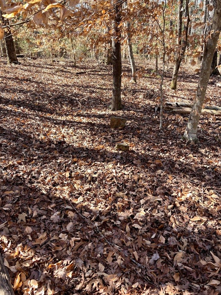
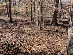
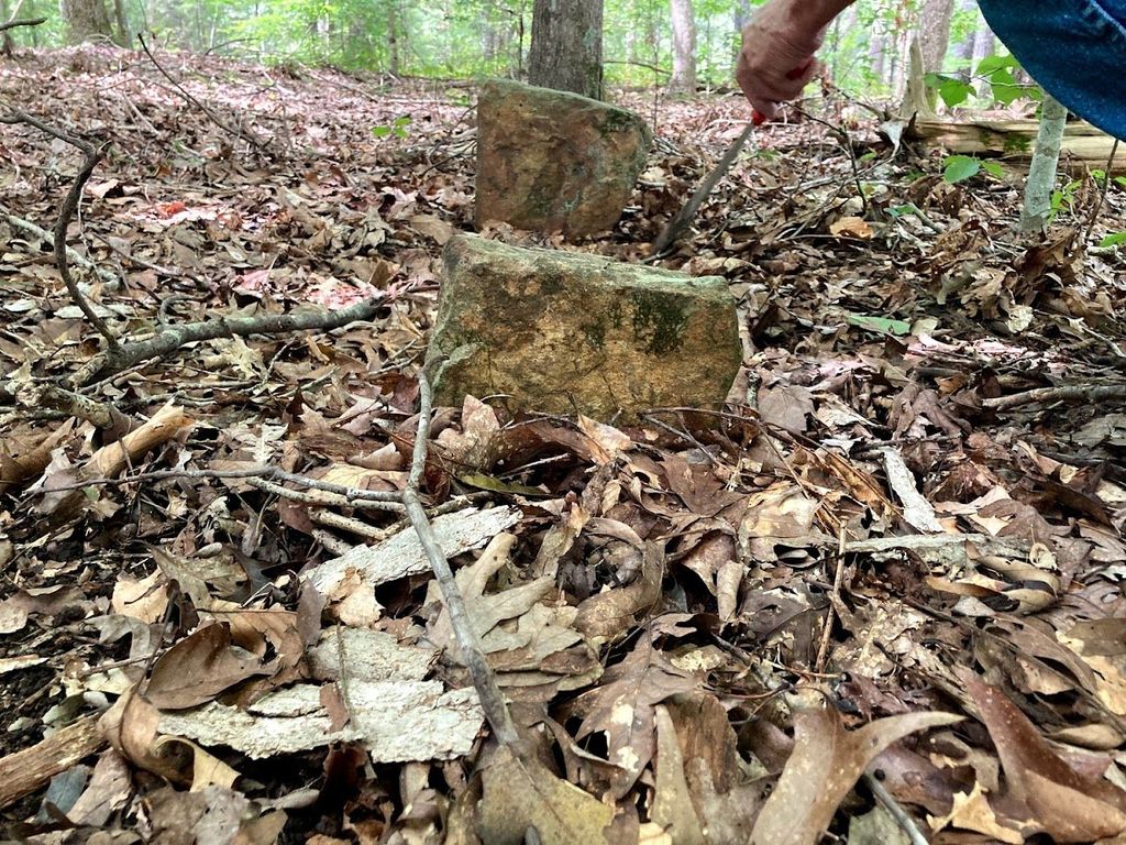
| Description | : | Lebanon Presbyterian Church Enslaved Persons Burial Site is the resting place for an estimated 150-200 individuals who are believed to have been enslaved on properties along Vienna Road (Now SC-823 / Mount Carmel Rd.). The site is in woods in back of the Church's main cemetery. The site was owned by Patrick Mullin, who donated the land for the church and cemetery to the church when it was organized in 1821. Burials are believed to have begun around that time, and most likely ceased in the mid-1870s, when predominately African American congregations were begun in the area. No record of burials... Read More |
frequently asked questions (FAQ):
-
Where is Lebanon Church Enslaved Persons Burial Site?
Lebanon Church Enslaved Persons Burial Site is located at 698 Mount Carmel Road Abbeville County ,South Carolina ,USA.
-
Lebanon Church Enslaved Persons Burial Site cemetery's updated grave count on graveviews.com?
0 memorials
-
Where are the coordinates of the Lebanon Church Enslaved Persons Burial Site?
Latitude: 34.1151470
Longitude: -82.4192810


Nearby Cemetories:
1. Lebanon Presbyterian Church Cemetery
Abbeville County, USA
Coordinate: 34.1149930, -82.4181590
2. Saint Peter AME Church Cemetery
Abbeville, Abbeville County, USA
Coordinate: 34.1313130, -82.4150360
3. Walnut Grove Baptist Church
Abbeville County, USA
Coordinate: 34.0996990, -82.4272550
4. Sharon United Methodist Church Cemetery
Abbeville County, USA
Coordinate: 34.1307983, -82.4475021
5. Rock Buffalo Baptist Church Cemetery
Abbeville, Abbeville County, USA
Coordinate: 34.1223770, -82.3793010
6. Forest Lawn Memory Gardens
Abbeville, Abbeville County, USA
Coordinate: 34.1162700, -82.4629100
7. Guffin - Spence - Williams
Abbeville, Abbeville County, USA
Coordinate: 34.1533840, -82.4316000
8. Ritchie Cemetery
Abbeville County, USA
Coordinate: 34.0758800, -82.4301200
9. Little Mountain African Methodist Episcopal Church
Abbeville, Abbeville County, USA
Coordinate: 34.0842820, -82.3758020
10. Neel Cemetery
Abbeville County, USA
Coordinate: 34.0686300, -82.4337200
11. Reid Cemetery
Calhoun Falls, Abbeville County, USA
Coordinate: 34.0653333, -82.4236167
12. Adams-Vann Family Cemetery
Abbeville, Abbeville County, USA
Coordinate: 34.1445140, -82.3683540
13. McGaw Family Cemetery
Abbeville, Abbeville County, USA
Coordinate: 34.0838410, -82.4759490
14. Mulberry African Methodist Episcopal Church Cemete
Abbeville, Abbeville County, USA
Coordinate: 34.0633640, -82.4477310
15. Calhoun Cemetery
Abbeville County, USA
Coordinate: 34.0619011, -82.4458008
16. Warrenton Cemetery
Abbeville, Abbeville County, USA
Coordinate: 34.1516991, -82.4800034
17. Bethia Cemetery
Clatworthy Crossroads, Abbeville County, USA
Coordinate: 34.0617810, -82.3759150
18. John Thompson Family Cemetery
Abbeville, Abbeville County, USA
Coordinate: 34.1725769, -82.3817139
19. Lakeview Cemetery
Abbeville, Abbeville County, USA
Coordinate: 34.1725769, -82.3817139
20. Shady Grove AME Church Cemetery
Abbeville, Abbeville County, USA
Coordinate: 34.1406780, -82.4925670
21. Saint Paul AME Church Cemetery
McCormick County, USA
Coordinate: 34.0744720, -82.4838330
22. Trinity Cemetery
Abbeville, Abbeville County, USA
Coordinate: 34.1753006, -82.3818970
23. Trinity Episcopal Church Cemetery
Abbeville, Abbeville County, USA
Coordinate: 34.1769100, -82.3808100
24. Secession Hill Cemetery
Abbeville, Abbeville County, USA
Coordinate: 34.1789560, -82.3750630