
| Memorials | : | 0 |
| Location | : | Cedar Grove Township, Orange County, USA |
| Coordinate | : | 36.1800000, -79.1769000 |
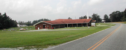
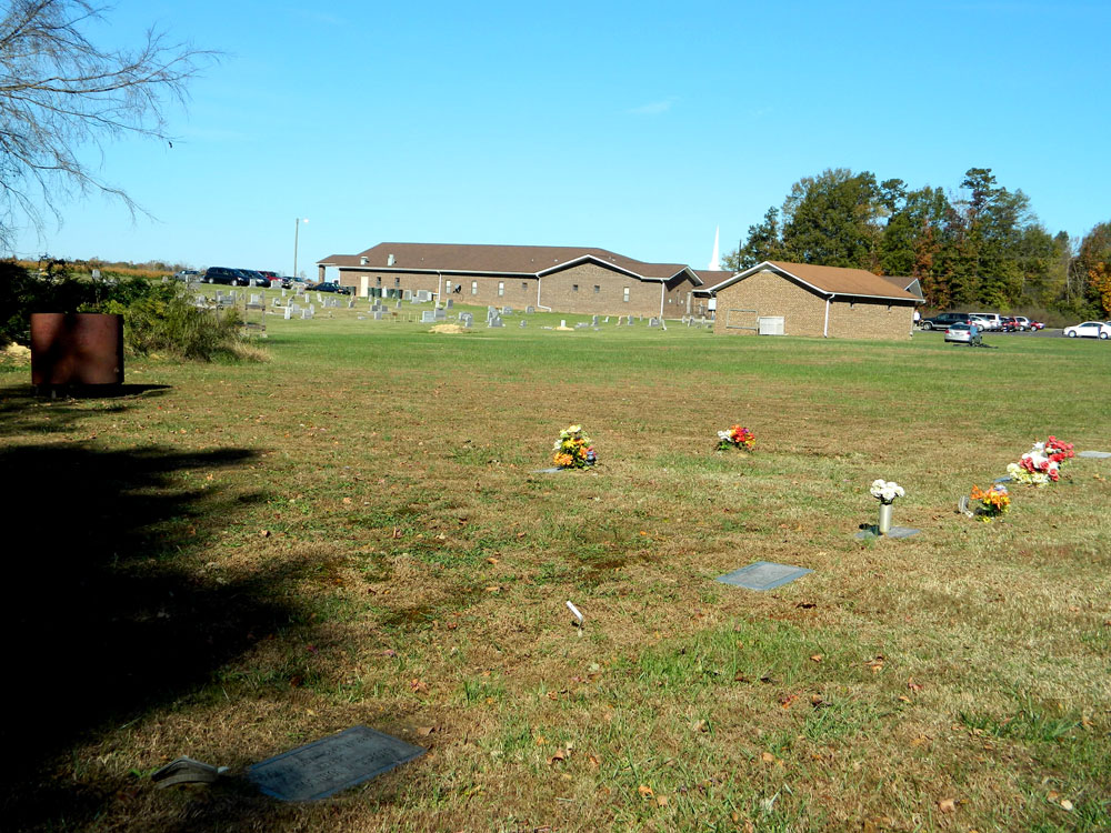
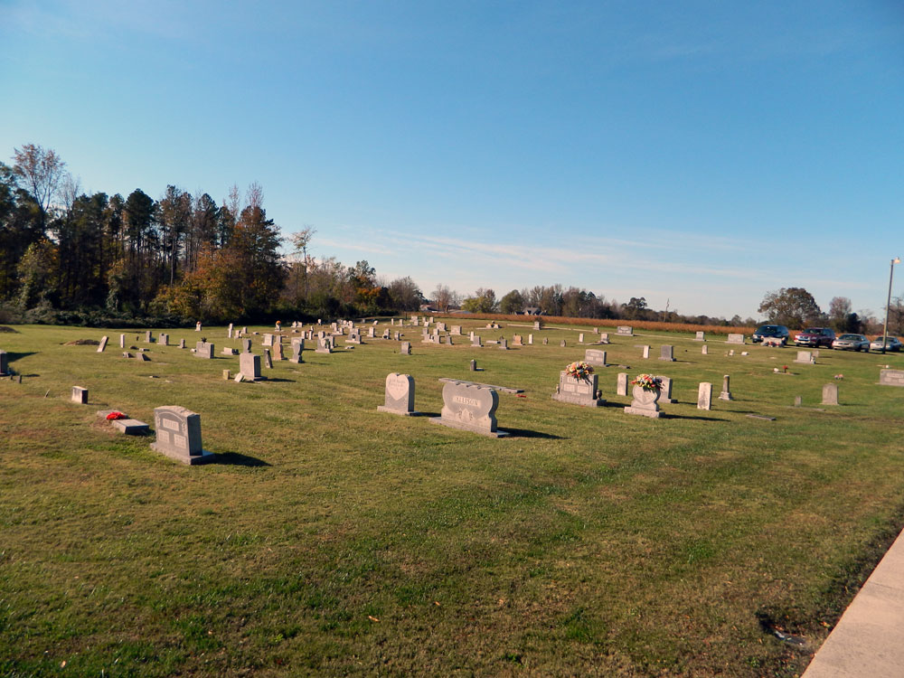
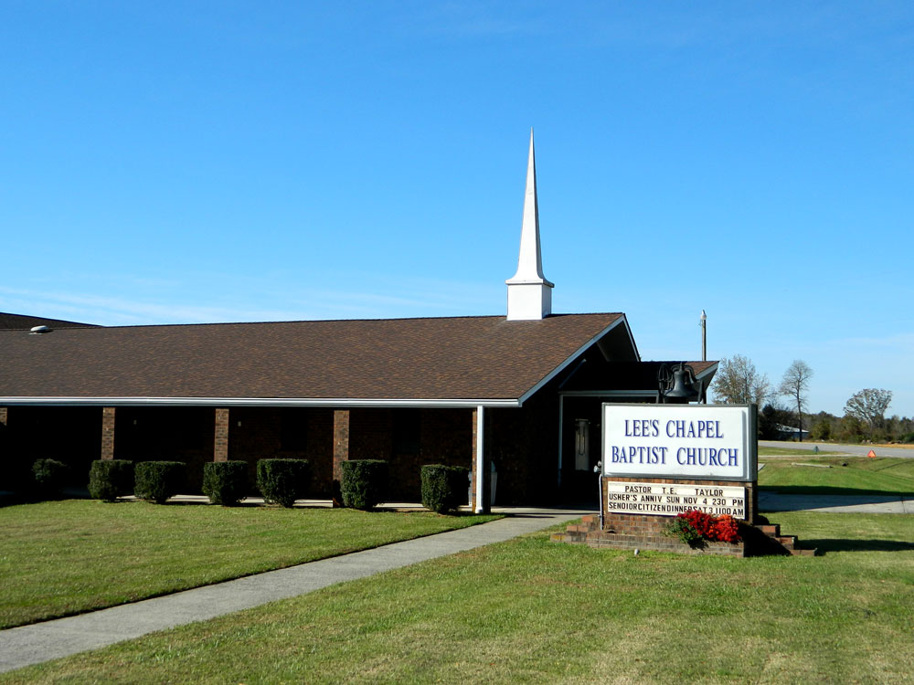
| Description | : | Location: In Cedar Grove Township, NW of Cedar Grove on Lee's Chapel Road (SR-1360) at its intersection with Jakley Road (SR-1359). The church is on the south side of the road, with the cemetery located at the rear of the Church. Additional information: This cemetery was originally established in 1893 as an African-American descent cemetery. When it was surveyed in 1973, there were 81 marked graves and 84 unmarked graves. |
frequently asked questions (FAQ):
-
Where is Lees Chapel Baptist Church Cemetery?
Lees Chapel Baptist Church Cemetery is located at Cedar Grove Township, Orange County ,North Carolina ,USA.
-
Lees Chapel Baptist Church Cemetery cemetery's updated grave count on graveviews.com?
0 memorials
-
Where are the coordinates of the Lees Chapel Baptist Church Cemetery?
Latitude: 36.1800000
Longitude: -79.1769000
Nearby Cemetories:
1. McDade Family Cemetery
Cedar Grove Township, Orange County, USA
Coordinate: 36.1823000, -79.1692000
2. Eno Presbyterian Cemetery New
Cedar Grove, Orange County, USA
Coordinate: 36.1714000, -79.1661000
3. Cedar Grove United Methodist Church
Cedar Grove, Orange County, USA
Coordinate: 36.1692000, -79.1681000
4. James B Daniel Family Cemetery
Cedar Grove Township, Orange County, USA
Coordinate: 36.2039000, -79.1578000
5. White Oak Grove Baptist Church Cemetery
Cedar Grove Township, Orange County, USA
Coordinate: 36.1903000, -79.2117000
6. Five Forks Baptist Church Cemetery
Cedar Grove Township, Orange County, USA
Coordinate: 36.2033000, -79.1500000
7. Old Eno Presbyterian Cemetery
Cedar Grove Township, Orange County, USA
Coordinate: 36.1575012, -79.1446991
8. Harmony Primitive Baptist Church Cemetery
Cedar Grove Township, Orange County, USA
Coordinate: 36.1631012, -79.2241974
9. Julius Davis Family Cemetery
Cedar Grove Township, Orange County, USA
Coordinate: 36.1400000, -79.1608000
10. Tinnin Slave Cemetery
Cedar Grove Township, Orange County, USA
Coordinate: 36.1386000, -79.1650000
11. Campbell Family Cemetery
Cedar Grove Township, Orange County, USA
Coordinate: 36.1708000, -79.2300000
12. Mount Zion AME Church Cemetery
Cedar Grove Township, Orange County, USA
Coordinate: 36.1583000, -79.1281000
13. Carr United Methodist Church Cemetery
Carr, Orange County, USA
Coordinate: 36.2139000, -79.2194000
14. Christopher Family Cemetery
Cheeks Township, Orange County, USA
Coordinate: 36.2068000, -79.2287000
15. Mary Jane Strayhorn Tate Garvesite
Cedar Grove Township, Orange County, USA
Coordinate: 36.1737000, -79.2393000
16. Mount Adar Baptist Church Cemetery
Cedar Grove Township, Orange County, USA
Coordinate: 36.2047000, -79.2319000
17. Fairfield Presbyterian Church Cemetery
Cheeks Township, Orange County, USA
Coordinate: 36.1233000, -79.1742000
18. Spivey Hensley Family Cemetery
Cedar Grove Township, Orange County, USA
Coordinate: 36.2389000, -79.1672000
19. Pope Family Cemetery
Cedar Grove Township, Orange County, USA
Coordinate: 36.2308000, -79.1381000
20. Mount Zion Christian Church Cemetery
Cedar Grove Township, Orange County, USA
Coordinate: 36.1822929, -79.2518387
21. Stadlers - Statlers Slave Cemetery
Cedar Grove Township, Orange County, USA
Coordinate: 36.2401000, -79.1895000
22. Crossett Family Cemetery
Cedar Grove Township, Orange County, USA
Coordinate: 36.2386000, -79.1539000
23. Victor Carl Walters Family Cemetery
Cedar Grove Township, Orange County, USA
Coordinate: 36.1385000, -79.2341000
24. Grace Independent Baptist Church Cemetery
Cedar Grove Township, Orange County, USA
Coordinate: 36.2422350, -79.1914190