
| Memorials | : | 3 |
| Location | : | Boomer, Cocke County, USA |
| Coordinate | : | 35.8305000, -82.9436600 |
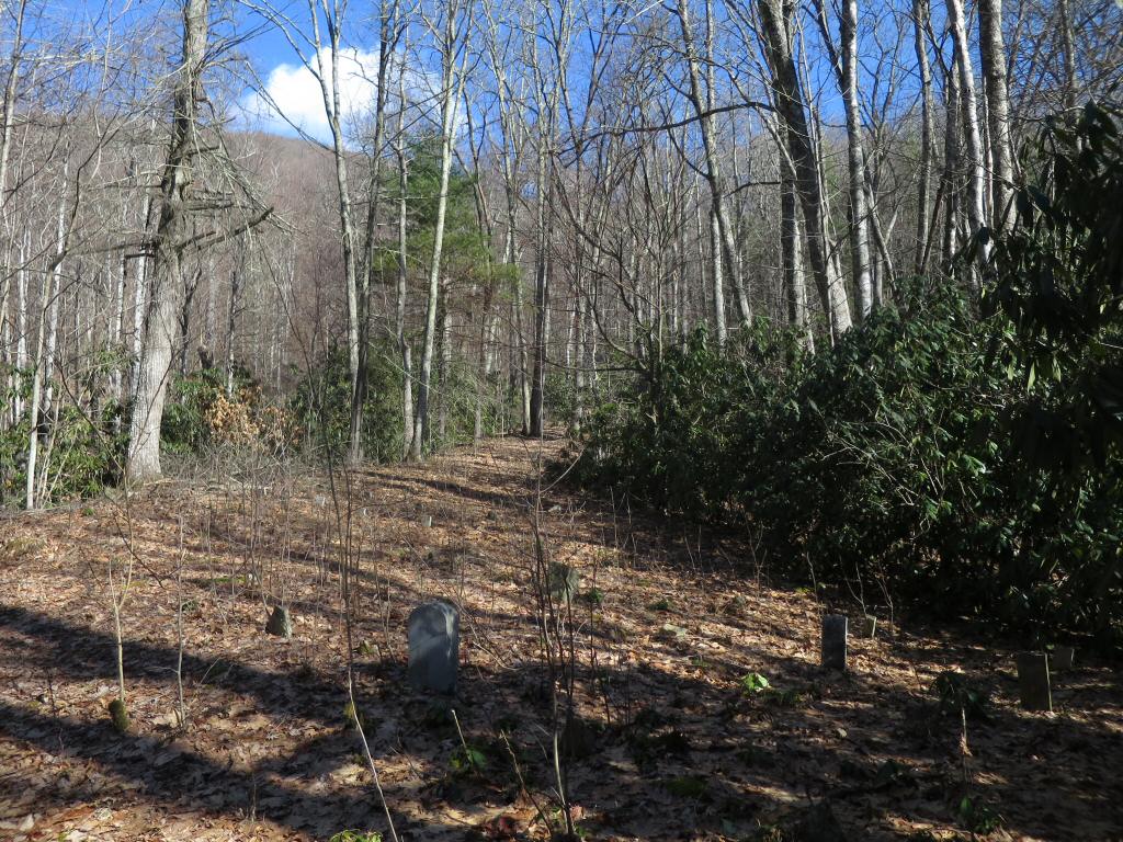
| Description | : | From US Hwy 25/70 at Del Rio, turn onto TN 107 West and follow signs for Lemon Gap. At about 6 miles, you'll be turning left on Round Mountain Road. Follow gravel road to within a half-mile of the North Carolina / Tennessee state line. Cemetery will be on your right about 100-feet from the road. According to Mary K. McCoy, the granddaughter of William P. McCoy, a diphtheria epidemic wiped out entire families that lived in the area, which accounts for some of the unmarked graves in the cemetery.[1] Note: There are only 4 engraved stones in this small... Read More |
frequently asked questions (FAQ):
-
Where is Lemon Gap Cemetery?
Lemon Gap Cemetery is located at Round Mountain Road Boomer, Cocke County ,Tennessee ,USA.
-
Lemon Gap Cemetery cemetery's updated grave count on graveviews.com?
3 memorials
-
Where are the coordinates of the Lemon Gap Cemetery?
Latitude: 35.8305000
Longitude: -82.9436600
Nearby Cemetories:
1. Sexton Cemetery
Hot Springs, Madison County, USA
Coordinate: 35.8332700, -82.9251200
2. Presnell-Mooneyham Cemetery
Hot Springs, Madison County, USA
Coordinate: 35.8118900, -82.9518200
3. Huff Cemetery
Cocke County, USA
Coordinate: 35.8553009, -82.9293976
4. Roaring Fork Cemetery
Hot Springs, Madison County, USA
Coordinate: 35.8211400, -82.9039200
5. Norwood Family Cemetery
Del Rio, Cocke County, USA
Coordinate: 35.8399800, -82.9874600
6. Waddell Cemetery
Madison County, USA
Coordinate: 35.7938995, -82.9216995
7. Poplar Gap Cemetery
Hot Springs, Madison County, USA
Coordinate: 35.7870000, -82.9413800
8. Bonnie Hill Cemetery
Hot Springs, Madison County, USA
Coordinate: 35.8624600, -82.9021900
9. Reynolds Cemetery
Madison County, USA
Coordinate: 35.8232994, -82.8855972
10. Mulberry Gap United Methodist Church Cemetery
Del Rio, Cocke County, USA
Coordinate: 35.8575020, -82.9922120
11. Meadow Fork Cemetery
Hot Springs, Madison County, USA
Coordinate: 35.7923100, -82.9035300
12. Riddle Family Cemetery
Del Rio, Cocke County, USA
Coordinate: 35.8588500, -82.9971400
13. Crowder Family Cemetery
Del Rio, Cocke County, USA
Coordinate: 35.8677700, -82.9898400
14. Smith Cemetery
Del Rio, Cocke County, USA
Coordinate: 35.8622400, -82.9990100
15. Hickam Cove-Kent Family Cemetery
Ebbs Mill, Madison County, USA
Coordinate: 35.8164210, -82.8781130
16. Morrow Family Cemetery
Del Rio, Cocke County, USA
Coordinate: 35.8676600, -82.9953800
17. Grigby Cemetery
Del Rio, Cocke County, USA
Coordinate: 35.8642006, -82.9989014
18. Franklin Cemetery
Del Rio, Cocke County, USA
Coordinate: 35.8634600, -82.9998500
19. Burgin Cemetery
Del Rio, Cocke County, USA
Coordinate: 35.8853000, -82.9634700
20. Reuben Reece Family Cemetery
Del Rio, Cocke County, USA
Coordinate: 35.8460980, -83.0119690
21. Fox Cemetery
Del Rio, Cocke County, USA
Coordinate: 35.8454130, -83.0128960
22. Brooks Family Cemetery
Bluff, Madison County, USA
Coordinate: 35.8424800, -82.8731500
23. Jonestown Cemetery
Del Rio, Cocke County, USA
Coordinate: 35.8830020, -82.9819430
24. Davis-Trantham Cemetery
Hot Springs, Madison County, USA
Coordinate: 35.7709900, -82.9133000