
| Memorials | : | 1 |
| Location | : | Douglas County, USA |
| Coordinate | : | 43.7009970, -123.2789290 |
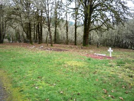
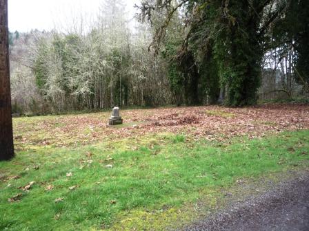
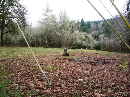
| Description | : | Located off Sand Creek Road (Hwy 178) between Drain and I-5 on Hwy 99. Located next to property owned by the Pentacostal Church of God. When you turn on Sand Creek Road off Hwy 99, go about 100 feet and turn right on Leona Lane behind the church. Bear to the left and go up towards the buildings at the top of the hill. The cemetery will be on your left. |
frequently asked questions (FAQ):
-
Where is Leona Cemetery?
Leona Cemetery is located at 100 Leona Lane Douglas County ,Oregon ,USA.
-
Leona Cemetery cemetery's updated grave count on graveviews.com?
1 memorials
-
Where are the coordinates of the Leona Cemetery?
Latitude: 43.7009970
Longitude: -123.2789290
Nearby Cemetories:
1. Drain Cemetery
Drain, Douglas County, USA
Coordinate: 43.6706300, -123.3125300
2. East Drain Cemetery
Drain, Douglas County, USA
Coordinate: 43.6542015, -123.2944031
3. Colvin Cemetery
Drain, Douglas County, USA
Coordinate: 43.6928500, -123.3460300
4. Comstock Cemetery
Curtin, Douglas County, USA
Coordinate: 43.7340190, -123.1936530
5. Anlauf Cemetery
Douglas County, USA
Coordinate: 43.7341995, -123.1919022
6. Ensley Cemetery
Douglas County, USA
Coordinate: 43.6935997, -123.3778000
7. Rural Drain Grave Site
Drain, Douglas County, USA
Coordinate: 43.6932182, -123.3791275
8. Applegate Family Cemetery
Yoncalla, Douglas County, USA
Coordinate: 43.6273390, -123.3060960
9. Shoestring Cemetery
Elkhead, Douglas County, USA
Coordinate: 43.6513900, -123.1833300
10. Indian Burial Ground
Douglas County, USA
Coordinate: 43.6514015, -123.1832962
11. Putnam Valley Cemetery
Drain, Douglas County, USA
Coordinate: 43.6596985, -123.4124985
12. Drain-Yoncalla Masonic Cemetery
Yoncalla, Douglas County, USA
Coordinate: 43.5949120, -123.2877620
13. Applegate Pioneer Cemetery
Yoncalla, Douglas County, USA
Coordinate: 43.5943985, -123.2889023
14. Cowan Family Cemetery
Yoncalla, Douglas County, USA
Coordinate: 43.5929160, -123.2587980
15. IOOF Cemetery
Lorane, Lane County, USA
Coordinate: 43.8219000, -123.2361000
16. Crowe Family Cemetery
Lane County, USA
Coordinate: 43.8314018, -123.2268982
17. Hawley Cemetery
Cottage Grove, Lane County, USA
Coordinate: 43.7588997, -123.1069031
18. Lone Pine Cemetery
Lane County, USA
Coordinate: 43.6528015, -123.0805969
19. Taylor-Lane Cemetery
Cottage Grove, Lane County, USA
Coordinate: 43.7472000, -123.0639038
20. Lorane Grange Cemetery
Lorane, Lane County, USA
Coordinate: 43.8638992, -123.2491989
21. Silk Creek Cemetery
Cottage Grove, Lane County, USA
Coordinate: 43.8241997, -123.1256027
22. Bemis Cemetery
Cottage Grove, Lane County, USA
Coordinate: 43.6152992, -123.0777969
23. Fir Grove Cemetery
Cottage Grove, Lane County, USA
Coordinate: 43.7985992, -123.0819016
24. Saint Andrews Episcopal Church Memorial Garden
Cottage Grove, Lane County, USA
Coordinate: 43.7975000, -123.0706000