
| Memorials | : | 0 |
| Location | : | Zafra, Le Flore County, USA |
| Coordinate | : | 34.5084803, -94.4793354 |
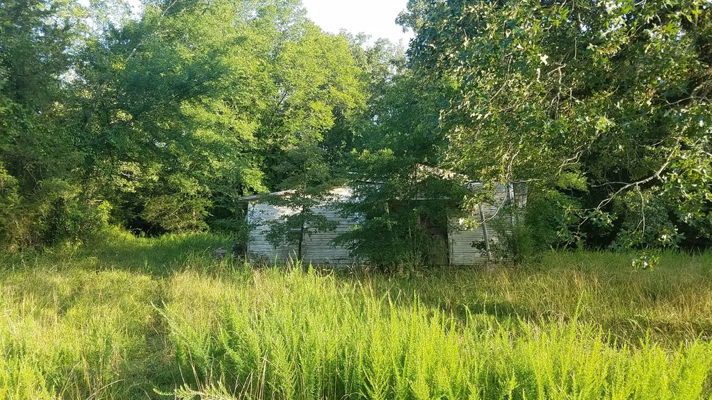
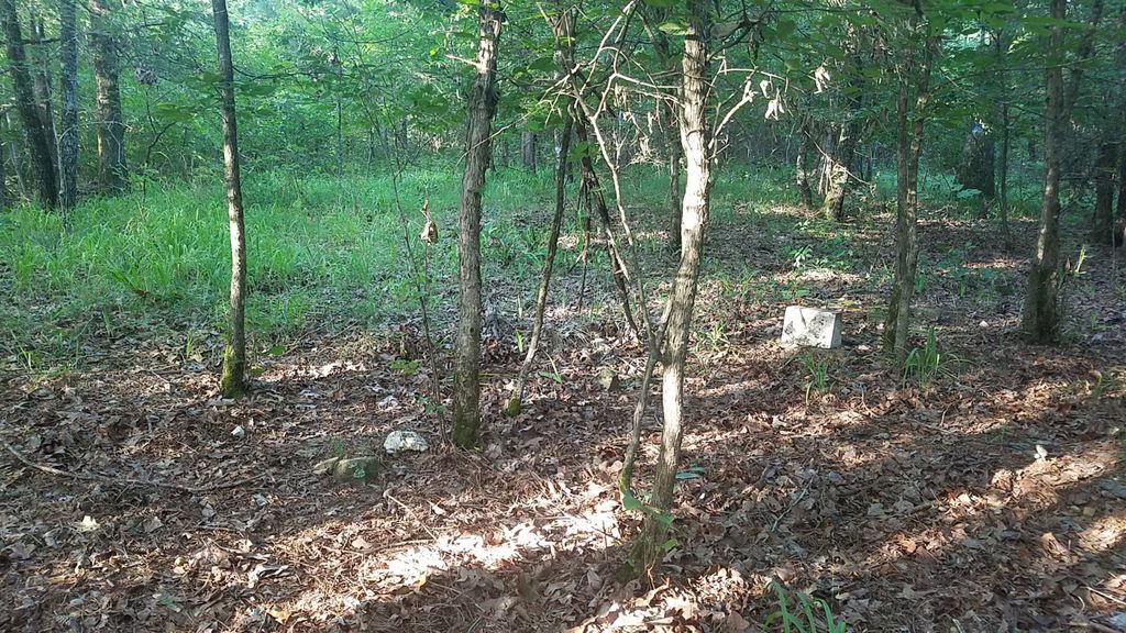
| Description | : | Just inside the woods to the south and east of the old Liberty Baptist Church building which has now fallen in, but is still standing (July of 2019). Three visible graves present, two of which are only marked with small rocks, one at the head and one at the foot. Only one grave has a concrete marker which has been painted white and sits on a sandstone foundation. |
frequently asked questions (FAQ):
-
Where is Liberty Baptist Church Cemetery?
Liberty Baptist Church Cemetery is located at Zafra, Le Flore County ,Oklahoma ,USA.
-
Liberty Baptist Church Cemetery cemetery's updated grave count on graveviews.com?
0 memorials
-
Where are the coordinates of the Liberty Baptist Church Cemetery?
Latitude: 34.5084803
Longitude: -94.4793354
Nearby Cemetories:
1. Nichols Cemetery
Hatfield, Polk County, USA
Coordinate: 34.5141500, -94.4394300
2. Pleasant Hill Cemetery
Hatfield, Polk County, USA
Coordinate: 34.4810982, -94.4178009
3. Beachton Cemetery
Smithville, McCurtain County, USA
Coordinate: 34.4943373, -94.5664877
4. Beechtree Cemetery
McCurtain County, USA
Coordinate: 34.4947014, -94.5667038
5. Bulger Cemetery
Potter, Polk County, USA
Coordinate: 34.5428900, -94.3997500
6. Mollie Gann Cemetery
Hatfield, Polk County, USA
Coordinate: 34.5293500, -94.3930700
7. Panther Creek Cemetery
Watson, McCurtain County, USA
Coordinate: 34.4336080, -94.4901830
8. Buffalo Cemetery
Cove, Polk County, USA
Coordinate: 34.4241982, -94.4447021
9. Six Mile Cemetery
Hatfield, Polk County, USA
Coordinate: 34.4777985, -94.3752975
10. Watson Cemetery
Watson, McCurtain County, USA
Coordinate: 34.4264412, -94.5452499
11. Antioch Cemetery
Hatfield, Polk County, USA
Coordinate: 34.5038986, -94.3589020
12. Pleasant Grove Cemetery
Cove, Polk County, USA
Coordinate: 34.4230900, -94.4075800
13. Westview Cemetery
Cove, Polk County, USA
Coordinate: 34.3953018, -94.4377975
14. Gann Cemetery
Potter, Polk County, USA
Coordinate: 34.5471992, -94.3431015
15. Rocky Cemetery
Rocky, Polk County, USA
Coordinate: 34.5908012, -94.3685989
16. Foote Cemetery
Vandervoort, Polk County, USA
Coordinate: 34.4118996, -94.3683014
17. Mount Gilead Cemetery
Rocky, Polk County, USA
Coordinate: 34.5916000, -94.3529000
18. Watson-McGee Family Cemetery
McCurtain County, USA
Coordinate: 34.3960978, -94.5663808
19. Lone Valley Cemetery
Hatfield, Polk County, USA
Coordinate: 34.4650002, -94.3246994
20. Foster Cemetery
Polk County, USA
Coordinate: 34.5766983, -94.3343964
21. Smithville Cemetery
Smithville, McCurtain County, USA
Coordinate: 34.4651500, -94.6387500
22. Mount Fork Cemetery
Mountain Fork, Polk County, USA
Coordinate: 34.6408100, -94.4280200
23. Old Smithville Cemetery
Smithville, McCurtain County, USA
Coordinate: 34.4654320, -94.6410390
24. Cecil Chapel Cemetery
Vandervoort, Polk County, USA
Coordinate: 34.3807983, -94.4068985