
| Memorials | : | 12 |
| Location | : | Johns, Scotland County, USA |
| Coordinate | : | 34.6818761, -79.4581009 |
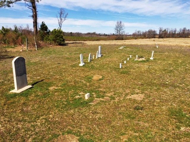
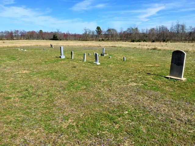
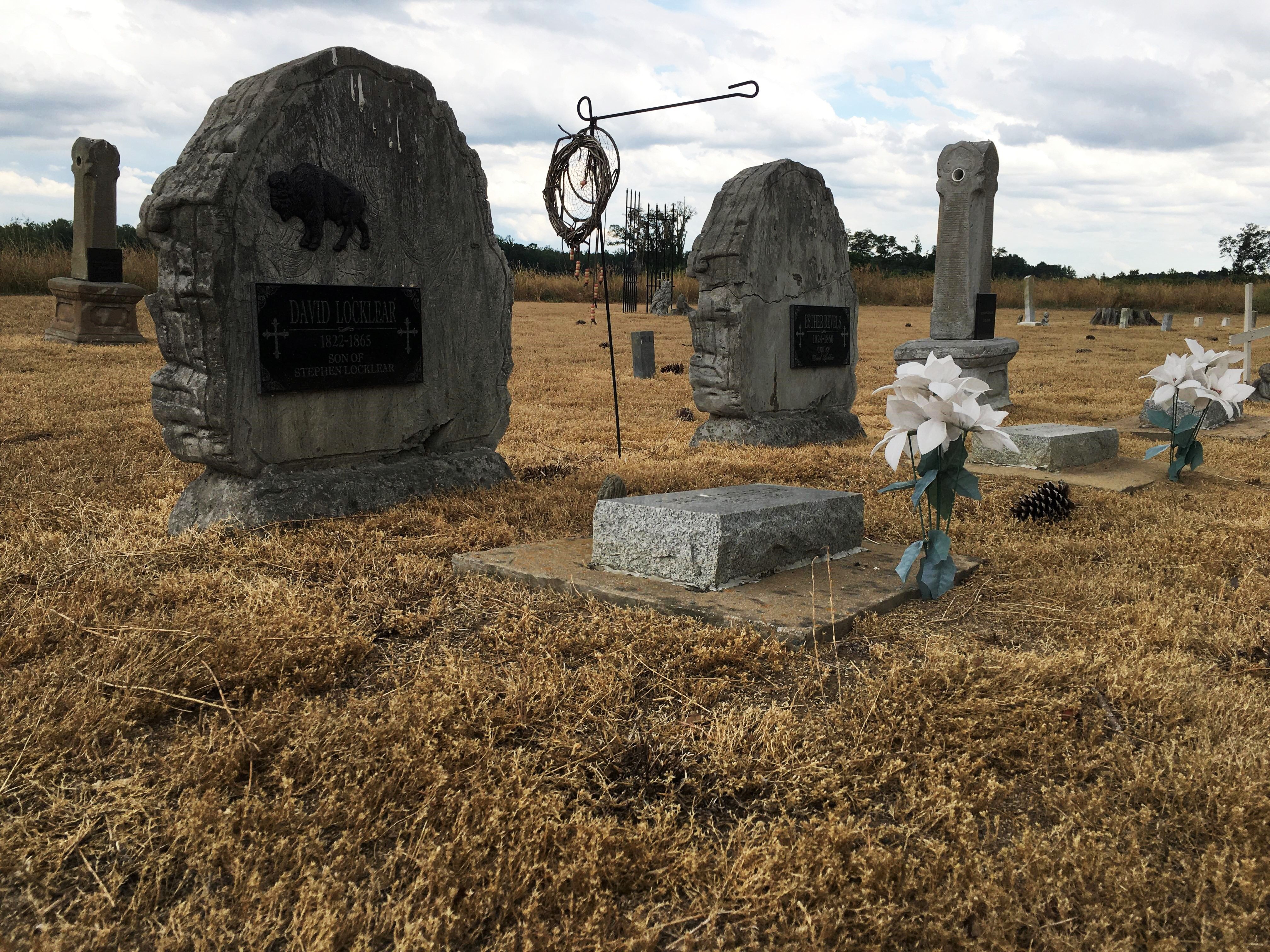
| Description | : | This Native American Cemetery is utilized by the descendants of Stephen Locklear and Mollie Cheirin. It is located in Johns on Pea Bridge Rd. before the intersection of Pea Bridge Rd. and Hasty Rd. It is located within a half mile from the remains of The Native American "Indian" Day School which was also called Oak Grove School. |
frequently asked questions (FAQ):
-
Where is Locklear Native Cemetery?
Locklear Native Cemetery is located at Pea Bridge Rd Johns, Scotland County ,North Carolina , 28352USA.
-
Locklear Native Cemetery cemetery's updated grave count on graveviews.com?
12 memorials
-
Where are the coordinates of the Locklear Native Cemetery?
Latitude: 34.6818761
Longitude: -79.4581009
Nearby Cemetories:
1. Oak Grove Cemetery
Scotland County, USA
Coordinate: 34.6685000, -79.4691200
2. Smyrna Presbyterian Church Cemetery
Johns, Scotland County, USA
Coordinate: 34.6588554, -79.4526520
3. Good News Chapel Church Cemetery
Laurinburg, Scotland County, USA
Coordinate: 34.6671200, -79.4822700
4. Bowen Family Cemetery
Laurinburg, Scotland County, USA
Coordinate: 34.6527500, -79.4887100
5. Smiling Family Cemetery
Laurinburg, Scotland County, USA
Coordinate: 34.6649550, -79.5036320
6. Priest Cemetery
McColl, Marlboro County, USA
Coordinate: 34.6447100, -79.4885200
7. Harris Family Cemetery
Laurinburg, Scotland County, USA
Coordinate: 34.7160960, -79.4189630
8. Caledonia United Methodist Church Cemetery
Laurinburg, Scotland County, USA
Coordinate: 34.7290916, -79.4603958
9. Seales Family Cemetery
Laurinburg, Scotland County, USA
Coordinate: 34.7008290, -79.5199050
10. Carmichael-McIntyre Cemetery
Stewartsville Township, Scotland County, USA
Coordinate: 34.7352370, -79.4414480
11. Reedy Branch Baptist Church
Marlboro County, USA
Coordinate: 34.6254900, -79.4757300
12. Brown Cemetery #2
McColl, Marlboro County, USA
Coordinate: 34.6415140, -79.5130430
13. Bethel Bible Believing Church Cemetery
McColl, Marlboro County, USA
Coordinate: 34.6389610, -79.5123580
14. McKinnon Cemetery
Laurinburg, Scotland County, USA
Coordinate: 34.7349600, -79.4994700
15. Greater Fair Plains AME Zion Church Cemetery
McColl, Marlboro County, USA
Coordinate: 34.6650590, -79.5321980
16. Laurinburg Memorial Park
Laurinburg, Scotland County, USA
Coordinate: 34.7114700, -79.5264800
17. Stewartsville Cemetery
Laurinburg, Scotland County, USA
Coordinate: 34.7380981, -79.4135971
18. Mount Misery Cemetery
McColl, Marlboro County, USA
Coordinate: 34.6725520, -79.5395280
19. Graham Plantation Cemetery
Laurinburg, Scotland County, USA
Coordinate: 34.6997300, -79.5389800
20. Old Reedy Branch Cemetery
Clio, Marlboro County, USA
Coordinate: 34.6160300, -79.4836400
21. McLaurin Cemetery
McColl, Marlboro County, USA
Coordinate: 34.6688995, -79.5417023
22. Daniels Chapel Cemetery
Marlboro County, USA
Coordinate: 34.6192000, -79.4993600
23. McCormick Cemetery
Laurinburg, Scotland County, USA
Coordinate: 34.7454000, -79.5029700
24. Pee Dee Chapel Baptist Church Cemetery
Carolina, Dillon County, USA
Coordinate: 34.6074638, -79.4516678