
| Memorials | : | 0 |
| Location | : | Tyner, Chowan County, USA |
| Coordinate | : | 36.0603490, -76.4721290 |
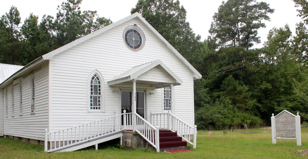
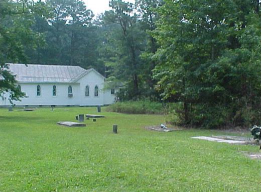
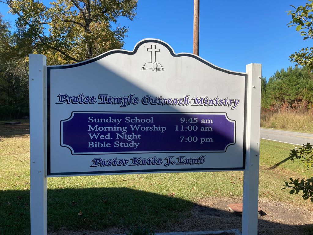
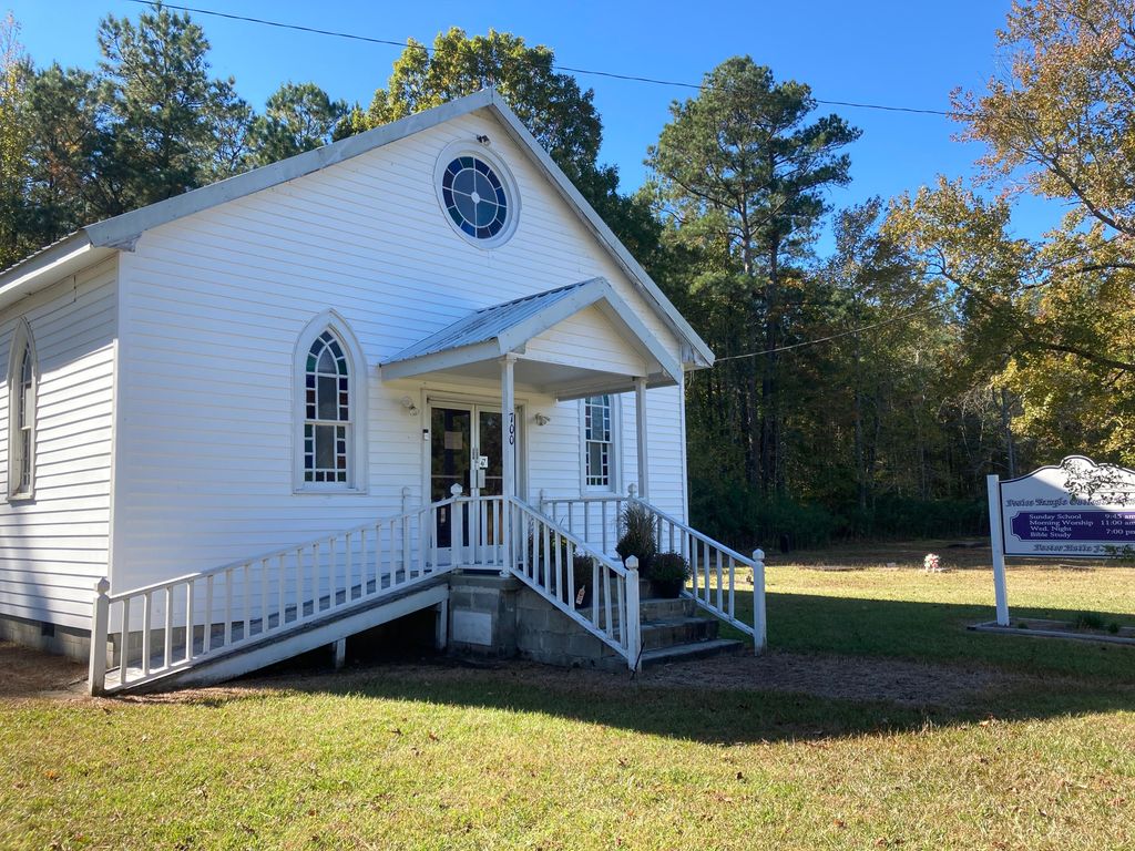
| Description | : | A small, historical, African American Cemetery in eastern Chowan County, off Drummond Point Road. The cemetery lies to the north of the church and is very small, with several unmarked graves (old and new) and several headstones being swallowed up by the surrounding woods. The church was originally called Locust Grove AME Zion Methodist Church, but a current visit to the site shows the sign has been changed to Praise Temple Outreach Ministry. The original church has not changed " When Edenton was incorporated in 1772, a group of slaves from a farm named Haughton Point began holding church services under a grove of locust... Read More |
frequently asked questions (FAQ):
-
Where is Locust Grove AME Zion Methodist Church Cemetery?
Locust Grove AME Zion Methodist Church Cemetery is located at Drummonds Point Road Tyner, Chowan County ,North Carolina ,USA.
-
Locust Grove AME Zion Methodist Church Cemetery cemetery's updated grave count on graveviews.com?
0 memorials
-
Where are the coordinates of the Locust Grove AME Zion Methodist Church Cemetery?
Latitude: 36.0603490
Longitude: -76.4721290
Nearby Cemetories:
1. Saint Johns Baptist Church Cemetery
Tyner, Chowan County, USA
Coordinate: 36.0313060, -76.5094170
2. Canaan Temple AME Zion Church Cemetery
Edenton, Chowan County, USA
Coordinate: 36.0657959, -76.5261459
3. New Bethel Cemetery
Hertford, Perquimans County, USA
Coordinate: 36.1110400, -76.4772900
4. Bethel Baptist Church Cemetery
Bethel, Perquimans County, USA
Coordinate: 36.1105100, -76.4895200
5. Bethel Baptist Churchyard Cemetery
Bethel, Perquimans County, USA
Coordinate: 36.1119194, -76.4841461
6. Gatling-Smith Cemetery
Perquimans County, USA
Coordinate: 36.1151700, -76.4691760
7. Mulberry Hill-Blount Family Cemetery
Edenton, Chowan County, USA
Coordinate: 36.0105100, -76.5369960
8. Bethlehem Church of Christ Cemetery
Hertford, Perquimans County, USA
Coordinate: 36.1347542, -76.4535980
9. James J. Smith Family Cemetery
Perquimans County, USA
Coordinate: 36.1383400, -76.4520250
10. Paxton Cemetery
Edenton, Chowan County, USA
Coordinate: 36.0441940, -76.5733890
11. Benbury Family Cemetery
Edenton, Chowan County, USA
Coordinate: 36.0572222, -76.5900000
12. Joseph B. Wynn Cemetery
Skinnersville, Washington County, USA
Coordinate: 35.9632480, -76.4627440
13. New Haven Missionary Baptist Church Cemetery
Hertford, Perquimans County, USA
Coordinate: 36.1052704, -76.3582230
14. General William Skinner Family Cemetery
Perquimans County, USA
Coordinate: 36.1603300, -76.4308100
15. Johnston Family Cemetery
Edenton, Chowan County, USA
Coordinate: 36.0527992, -76.6022034
16. Biggs-Hassell Cemetery
Pea Ridge, Washington County, USA
Coordinate: 35.9548810, -76.4712580
17. Edenton United Methodist Cemetery
Edenton, Chowan County, USA
Coordinate: 36.0605500, -76.6044000
18. Piney Grove Church Cemetery
Washington County, USA
Coordinate: 35.9532430, -76.4689550
19. Hertford Colored Cemetery
Hertford, Perquimans County, USA
Coordinate: 36.1676060, -76.4763450
20. William Lawrence Tarkington Family Cemetery
Pea Ridge, Washington County, USA
Coordinate: 35.9520416, -76.4795990
21. Sahara Cemetery
Pea Ridge, Washington County, USA
Coordinate: 35.9520750, -76.4812450
22. Saint Anne Catholic Church Cemetery
Edenton, Chowan County, USA
Coordinate: 36.0626984, -76.6080017
23. Saint Pauls Episcopal Churchyard
Edenton, Chowan County, USA
Coordinate: 36.0614014, -76.6082993
24. Vine Oak Cemetery
Edenton, Chowan County, USA
Coordinate: 36.0671997, -76.6102982