
| Memorials | : | 156 |
| Location | : | Soles, Mathews County, USA |
| Phone | : | (804) 725-3504 |
| Coordinate | : | 37.4897570, -76.4385580 |
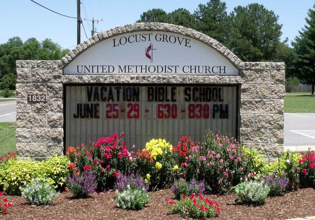
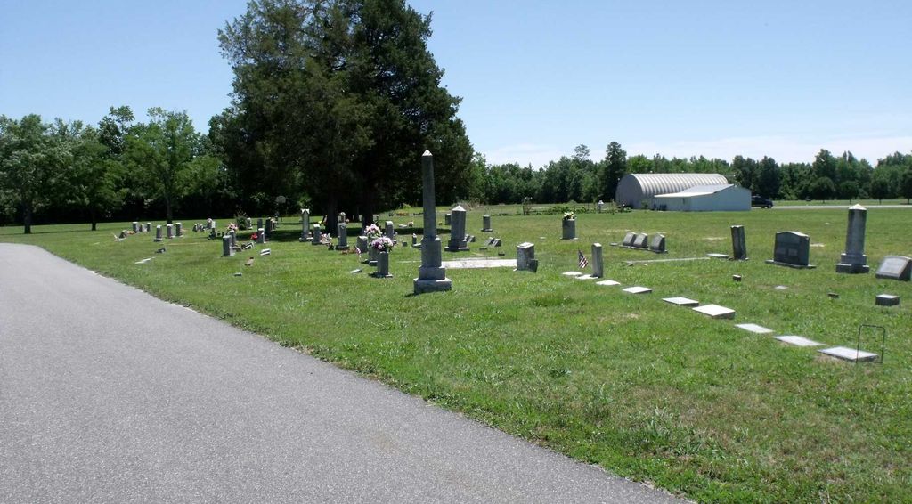
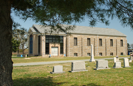
| Description | : | The William F. Lewis Cemetery is located in a strip on the southwest edge of the Locust Grove UMC Cemetery. The graves are in one long row. Mathews County, VA GIS Parcel ID: 8-A-20 Owner: TRUSTEES OF LOCUST GROVE Acres 6.8691 And Mathews County, VA GIS Parcel ID: 8-A-20A Owner: WILLIAM F. LEWIS CEMETERY Acres 0.041 |
frequently asked questions (FAQ):
-
Where is Locust Grove United Methodist Church Cemetery?
Locust Grove United Methodist Church Cemetery is located at 1832 Windsor Rd Soles, Mathews County ,Virginia , 23050USA.
-
Locust Grove United Methodist Church Cemetery cemetery's updated grave count on graveviews.com?
0 memorials
-
Where are the coordinates of the Locust Grove United Methodist Church Cemetery?
Latitude: 37.4897570
Longitude: -76.4385580
Nearby Cemetories:
1. Windsor Road Family Cemetery
Dutton, Gloucester County, USA
Coordinate: 37.4837990, -76.4406860
2. Windsor Gardens Cemetery
Mathews, Mathews County, USA
Coordinate: 37.4808390, -76.4458140
3. Spring Hill Baptist Church Cemetery
Cobbs Creek, Mathews County, USA
Coordinate: 37.4936730, -76.4160275
4. Holland Point Cemetery
Mathews, Mathews County, USA
Coordinate: 37.5094400, -76.4338900
5. Rising Valley Baptist Church Cemetery
Gloucester County, USA
Coordinate: 37.4663940, -76.4589210
6. Callis-Sommers Cemetery
Cobbs Creek, Mathews County, USA
Coordinate: 37.5142626, -76.4066125
7. Bassett Cemetery
Cobbs Creek, Mathews County, USA
Coordinate: 37.4873294, -76.3836965
8. Ebenezer Baptist Church Cemetery
Cobbs Creek, Mathews County, USA
Coordinate: 37.5062469, -76.3874452
9. Shipley Cemetery
Cobbs Creek, Mathews County, USA
Coordinate: 37.5163356, -76.3918610
10. Mount Zion United Methodist Church Cemetery
Gloucester, Gloucester County, USA
Coordinate: 37.4506600, -76.4724080
11. Mount Olive Church Cemetery
Harfield, Middlesex County, USA
Coordinate: 37.5410570, -76.4327490
12. Haynes Cemetery
Mathews, Mathews County, USA
Coordinate: 37.5065244, -76.3757781
13. Gleaning Baptist Church Cemetery
Harcum, Gloucester County, USA
Coordinate: 37.5151120, -76.4972470
14. Emmaus Baptist Church Cemetery
Mathews County, USA
Coordinate: 37.4437486, -76.4052237
15. Yeatman Plantation Cemetery
Foster, Mathews County, USA
Coordinate: 37.4360966, -76.4426093
16. Carter Burials
Cobbs Creek, Mathews County, USA
Coordinate: 37.4945036, -76.3701273
17. Trinity Church Kingston Parish Cemetery
Foster, Mathews County, USA
Coordinate: 37.4573589, -76.3821672
18. Barn Elms Plantation Cemetery
Middlesex County, USA
Coordinate: 37.5435146, -76.4572527
19. Cobbs Creek Cemetery
Cobbs Creek, Mathews County, USA
Coordinate: 37.5231030, -76.3815670
20. Roane's Point Cemetery
Cobbs Creek, Mathews County, USA
Coordinate: 37.5212450, -76.3792710
21. Blakes Cemetery
Blakes, Mathews County, USA
Coordinate: 37.4987945, -76.3670831
22. Gayle-Hudgins Cemetery
Mathews County, USA
Coordinate: 37.4313801, -76.4413433
23. Morse Cemetery
Cobbs Creek, Mathews County, USA
Coordinate: 37.5231141, -76.3770167
24. Matthews Cemetery
Cobbs Creek, Mathews County, USA
Coordinate: 37.5192586, -76.3723047