
| Memorials | : | 16 |
| Location | : | Bath Springs, Decatur County, USA |
| Coordinate | : | 35.4051340, -87.9987160 |
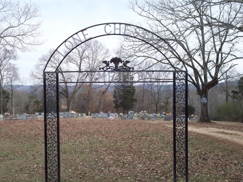
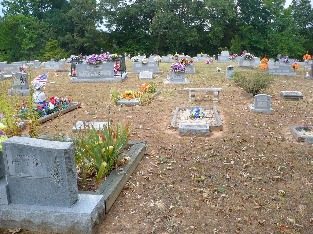
| Description | : | Lone Chestnut is located on Clifton Bend in southeastern Decatur County on the road to the old Clifton ferry ramp. It is indicated on the U.S.G.S. Clifton quadrangle (1972). The cemetery is maintained but is nearly full within its present borders. Some space has been re-used. David Donahue recorded Lone Chestnut Cemetery in 1996; updated it in 2001; and checked and updated it in 2003. Alexander and Tuten on recorded the cemetery in 1976 and they note "about 90 unmarked graves." |
frequently asked questions (FAQ):
-
Where is Lone Chestnut Cemetery?
Lone Chestnut Cemetery is located at 3581 Old Ferry Road Bath Springs, Decatur County ,Tennessee ,USA.
-
Lone Chestnut Cemetery cemetery's updated grave count on graveviews.com?
16 memorials
-
Where are the coordinates of the Lone Chestnut Cemetery?
Latitude: 35.4051340
Longitude: -87.9987160
Nearby Cemetories:
1. Tucker Cemetery
Decatur County, USA
Coordinate: 35.4053001, -87.9882965
2. Hardin Cemetery
Bath Springs, Decatur County, USA
Coordinate: 35.4057720, -87.9845970
3. Clifton Cemetery
Clifton, Wayne County, USA
Coordinate: 35.3802986, -88.0010986
4. Richardson Cemetery
Clifton, Wayne County, USA
Coordinate: 35.4319000, -87.9938965
5. Shannon Cemetery
Decatur County, USA
Coordinate: 35.4077988, -88.0333023
6. Helton Cemetery
Clifton, Wayne County, USA
Coordinate: 35.3835983, -87.9749985
7. Lizard Glade Cemetery
Clifton, Wayne County, USA
Coordinate: 35.3739014, -87.9950027
8. Old Shannon Cemetery
Bath Springs, Decatur County, USA
Coordinate: 35.4118520, -88.0367720
9. Nunnley Ford Cemetery
Clifton, Wayne County, USA
Coordinate: 35.4225006, -87.9653015
10. Haggard Cemetery
Clifton, Wayne County, USA
Coordinate: 35.3732986, -87.9907990
11. Baker Cemetery
Clifton, Wayne County, USA
Coordinate: 35.3782997, -88.0224991
12. Praters Chapel Cemetery
Clifton, Wayne County, USA
Coordinate: 35.3982600, -87.9502000
13. Warrington Cemetery
Clifton, Wayne County, USA
Coordinate: 35.3986015, -87.9494019
14. Albert Floyd Cemetery
Wayne County, USA
Coordinate: 35.3820778, -87.9566229
15. Riverside Methodist Church Cemetery
Clifton, Wayne County, USA
Coordinate: 35.4368170, -87.9658930
16. Culp’s Chapel Cemetery
Perry County, USA
Coordinate: 35.4467010, -87.9993973
17. Benham-Hughes-Speer Cemetery
Clifton, Wayne County, USA
Coordinate: 35.3819008, -87.9563980
18. Carroll Cemetery
Clifton, Wayne County, USA
Coordinate: 35.4294014, -87.9511032
19. Montague Cemetery
Hardin County, USA
Coordinate: 35.4021988, -88.0560989
20. Lafferty Cemetery
Perry County, USA
Coordinate: 35.4500008, -88.0158005
21. Backbone Ridge Cemetery
Hardin County, USA
Coordinate: 35.3772011, -88.0464020
22. Culp Cemetery
Perry County, USA
Coordinate: 35.4561005, -88.0149994
23. Powells Hill Cemetery
Perry County, USA
Coordinate: 35.4565870, -88.0142350
24. Roberts Cemetery
Clifton, Wayne County, USA
Coordinate: 35.3532982, -87.9700012