
| Memorials | : | 0 |
| Location | : | Farrell, Coahoma County, USA |
| Coordinate | : | 34.2650030, -90.6631310 |
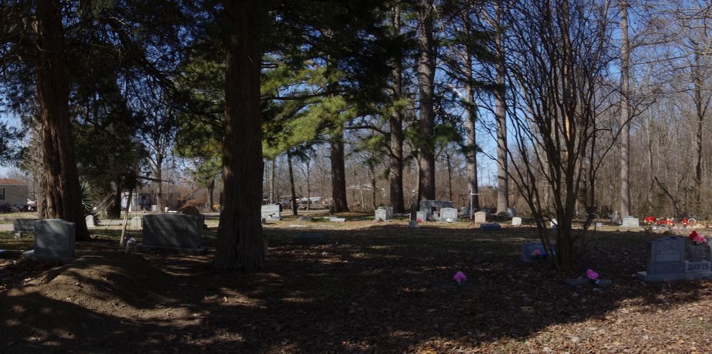
| Description | : | This cemetery is known alternately as Lonesome Pine Cemetery, Farrell Cemetery, and Kirkland Cemetery, the latter referring to John W. Kirkland, the eldest patriarch buried here. The cemetery is populated primarily by Maupin family members, by marriage of John W. Kirkland's daughter Alice Lela to Edward Eugene Maupin, and their ancestors, descendants, and relatives by marriage. The tiny disused church at the site was Farrell Baptist Church. Many of the people buried in the cemetery made their homes and lived their lives on the very same road, within walking distance of the church. Alice Lela (Kirkland)... Read More |
frequently asked questions (FAQ):
-
Where is Lonesome Pine Cemetery?
Lonesome Pine Cemetery is located at Farrell, Coahoma County ,Mississippi ,USA.
-
Lonesome Pine Cemetery cemetery's updated grave count on graveviews.com?
0 memorials
-
Where are the coordinates of the Lonesome Pine Cemetery?
Latitude: 34.2650030
Longitude: -90.6631310

Nearby Cemetories:
1. Pleasant Valley Cemetery
Farrell, Coahoma County, USA
Coordinate: 34.2649994, -90.6714020
2. Lone Oak Cemetery
Coahoma County, USA
Coordinate: 34.2668991, -90.6718979
3. Pee Dee Cemetery
Coahoma County, USA
Coordinate: 34.2552986, -90.6489029
4. Oak Ridge Cemetery
Stovall, Coahoma County, USA
Coordinate: 34.2710000, -90.6357700
5. Carson Cemetery
Coahoma County, USA
Coordinate: 34.2935982, -90.6588974
6. Stovall Family Cemetery
Clarksdale, Coahoma County, USA
Coordinate: 34.2546300, -90.6290950
7. Humber Cemetery
Coahoma County, USA
Coordinate: 34.2731018, -90.7043991
8. Violet Williams Home Cemetery
Stovall, Coahoma County, USA
Coordinate: 34.2953700, -90.6861900
9. Mount Olive Church Cemetery
Farrell, Coahoma County, USA
Coordinate: 34.2273600, -90.6505800
10. Sycamore Grove Cemetery
Coahoma County, USA
Coordinate: 34.3092003, -90.6496964
11. Zion Traveler Cemetery
Coahoma County, USA
Coordinate: 34.2658005, -90.7189026
12. Dickerson Cemetery
Coahoma County, USA
Coordinate: 34.2663994, -90.5971985
13. Moten Cemetery
Coahoma County, USA
Coordinate: 34.3208008, -90.6358032
14. Old Dickerson Cemetery
Coahoma County, USA
Coordinate: 34.3142014, -90.6157990
15. Mount Ary Cemetery
Dickerson, Coahoma County, USA
Coordinate: 34.3213997, -90.6260986
16. Mount Aaron Church Cemetery
Coahoma County, USA
Coordinate: 34.3216300, -90.6264200
17. Saint James Cemetery
Lyon, Coahoma County, USA
Coordinate: 34.2317009, -90.5886002
18. Oakridge Cemetery
Clarksdale, Coahoma County, USA
Coordinate: 34.2125015, -90.6046982
19. Saint John MB Church Cemetery
Clarksdale, Coahoma County, USA
Coordinate: 34.2503000, -90.5720100
20. Robson Cemetery
Rescue Landing, Coahoma County, USA
Coordinate: 34.2680800, -90.7569200
21. Dogwood Cemetery
Coahoma County, USA
Coordinate: 34.1925011, -90.6971970
22. Morning Glory Church Cemetery
Clarksdale, Coahoma County, USA
Coordinate: 34.1920400, -90.6256600
23. Springfield Perpetual Cemetery
Sherard, Coahoma County, USA
Coordinate: 34.1996469, -90.7301582
24. Nathan Cemetery
Coahoma County, USA
Coordinate: 34.1994019, -90.7303009