
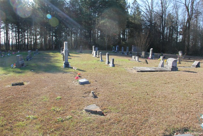
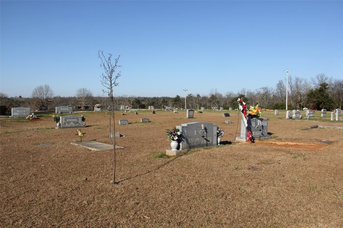
| Memorials | : | 0 |
| Location | : | DeKalb County, USA |
| Coordinate | : | 34.2796090, -85.7608570 |
| Description | : | From Portersville travel East on county road 83 to stop sign at Mount Vernon, Hwy 176. Continue straight across on county road 83 for 1 mile. Turn left at stop sign on county road 101, travel 1.5 miles. Cemetery will be on the right. Dirt road into the cemetery separates Longshore and New Holiness cemeteries. Longshore cemetery will be on your left. |
frequently asked questions (FAQ):
-
Where is Longshore Cemetery?
Longshore Cemetery is located at COUNTY ROAD 101 DeKalb County ,Alabama ,USA.
-
Longshore Cemetery cemetery's updated grave count on graveviews.com?
0 memorials
-
Where are the coordinates of the Longshore Cemetery?
Latitude: 34.2796090
Longitude: -85.7608570


Nearby Cemetories:
1. New Testament Holiness Cemetery
Collinsville, DeKalb County, USA
Coordinate: 34.2799750, -85.7616790
2. Pleasant Hill Baptist Church Cemetery
Cedar Bluff, Cherokee County, USA
Coordinate: 34.2589500, -85.7477300
3. Welcome Hill Baptist Church Cemetery
Sand Rock, Cherokee County, USA
Coordinate: 34.2813988, -85.7307968
4. Mount Vernon Baptist Church Cemetery
Collinsville, DeKalb County, USA
Coordinate: 34.2922000, -85.7894000
5. Big Rock Cemetery
Collinsville, DeKalb County, USA
Coordinate: 34.2758000, -85.7931000
6. Sand Rock Cemetery
Sand Rock, Cherokee County, USA
Coordinate: 34.2449989, -85.7683029
7. McNutt Memorial Methodist Church Cemetery
DeKalb County, USA
Coordinate: 34.3102000, -85.7836000
8. Bobo Cemetery
Portersville, DeKalb County, USA
Coordinate: 34.3062770, -85.7937950
9. Mount Lookout Cemetery
Sand Rock, Cherokee County, USA
Coordinate: 34.2444000, -85.7919006
10. Smith Chapel Cemetery
Mount Vernon, DeKalb County, USA
Coordinate: 34.2661000, -85.8128000
11. Plunket Cemetery
Collinsville, DeKalb County, USA
Coordinate: 34.2686005, -85.8153000
12. Starling Cemetery
Cherokee County, USA
Coordinate: 34.2644005, -85.6928024
13. Walkers Chapel Cemetery
Dog Town, DeKalb County, USA
Coordinate: 34.3356000, -85.7336000
14. West Cemetery
Blue Pond, Cherokee County, USA
Coordinate: 34.2266400, -85.7254600
15. Hall Cemetery
Collinsville, DeKalb County, USA
Coordinate: 34.2855988, -85.8371964
16. Black Oak Cemetery
Cherokee County, USA
Coordinate: 34.3102989, -85.6928024
17. Coffey Cemetery
Cherokee County, USA
Coordinate: 34.2710991, -85.6808014
18. Hunts Chapel Cemetery
Cherokee County, USA
Coordinate: 34.2247009, -85.8135986
19. Jack Cemetery
Collinsville, DeKalb County, USA
Coordinate: 34.3402100, -85.8051800
20. New Bethel Baptist Church Cemetery
Cherokee County, USA
Coordinate: 34.2374992, -85.8311005
21. Daniel Cemetery
Cherokee County, USA
Coordinate: 34.2700005, -85.6746979
22. Killian Cemetery
DeKalb County, USA
Coordinate: 34.3469009, -85.7996979
23. Hopewell Advent Cemetery
Leesburg, Cherokee County, USA
Coordinate: 34.2015500, -85.7288900
24. Collins Cemetery
Collinsville, DeKalb County, USA
Coordinate: 34.2663994, -85.8630981