| Memorials | : | 0 |
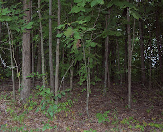
| Location | : | Sedgewickville, Bollinger County, USA |
| Coordinate | : | 37.4719810, -89.8708267 |
| Description | : | Also called Ates Cemetery. East of Sedgewickville. 72 Hwy, .7 Mile east of CR 226; take gravel road to right 1/2 mile. |
frequently asked questions (FAQ):
-
Where is Looney Family Cemetery?
Looney Family Cemetery is located at Sedgewickville, Bollinger County ,Missouri ,USA.
-
Looney Family Cemetery cemetery's updated grave count on graveviews.com?
0 memorials
-
Where are the coordinates of the Looney Family Cemetery?
Latitude: 37.4719810
Longitude: -89.8708267
Nearby Cemetories:
1. Edinger Cemetery
Scopus, Bollinger County, USA
Coordinate: 37.4814360, -89.8807630
2. Estes Cemetery
Cape Girardeau County, USA
Coordinate: 37.4693985, -89.8544006
3. Ates Cemetery
Bollinger County, USA
Coordinate: 37.4569016, -89.8700027
4. Limbaugh Cemetery
Sedgewickville, Bollinger County, USA
Coordinate: 37.4656200, -89.9008100
5. Riehn Cemetery
Cape Girardeau County, USA
Coordinate: 37.4805984, -89.8414001
6. Niswonger Cemetery
Fruitland, Cape Girardeau County, USA
Coordinate: 37.4494900, -89.8501700
7. Kinder Cemetery
Scopus, Bollinger County, USA
Coordinate: 37.4440900, -89.8744500
8. Schmidt Cemetery
Cape Girardeau County, USA
Coordinate: 37.4914017, -89.8450012
9. Wise Cemetery
Cape Girardeau County, USA
Coordinate: 37.4752998, -89.8308029
10. Seabaugh Cemetery
Sedgewickville, Bollinger County, USA
Coordinate: 37.4822006, -89.9100037
11. Hiram Hartle Cemetery
Sedgewickville, Bollinger County, USA
Coordinate: 37.4975800, -89.9029500
12. Old Niswonger Cemetery
Cape Girardeau County, USA
Coordinate: 37.4477997, -89.8360977
13. Hartle Cemetery
Scopus, Bollinger County, USA
Coordinate: 37.4347000, -89.8632965
14. Kurre Cemetery
Cape Girardeau County, USA
Coordinate: 37.4819100, -89.8209500
15. Kurreville Cemetery
Millersville, Cape Girardeau County, USA
Coordinate: 37.4767700, -89.8182600
16. Baker Cemetery
Cape Girardeau County, USA
Coordinate: 37.4500008, -89.8217010
17. Caney Fork Cemetery
Oak Ridge, Cape Girardeau County, USA
Coordinate: 37.4951800, -89.8214100
18. Garden of Memories
Sedgewickville, Bollinger County, USA
Coordinate: 37.5070400, -89.9113700
19. Holt Cemetery
Scopus, Bollinger County, USA
Coordinate: 37.4258003, -89.8996964
20. Pulliam Cemetery
Mayfield, Bollinger County, USA
Coordinate: 37.4397011, -89.9225006
21. Old Salem Cemetery
Millersville, Cape Girardeau County, USA
Coordinate: 37.4619400, -89.8061300
22. Old Caney Fork Cemetery
Oak Ridge, Cape Girardeau County, USA
Coordinate: 37.4914017, -89.8063965
23. Seabaugh Cemetery
Mayfield, Bollinger County, USA
Coordinate: 37.4710999, -89.9452972
24. Mayfield Cemetery
Cape Girardeau County, USA
Coordinate: 37.4714012, -89.7960968

