
| Memorials | : | 0 |
| Location | : | Galion, Crawford County, USA |
| Coordinate | : | 40.8445280, -82.8164860 |
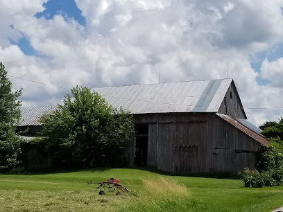
| Description | : | Sandusky Township. East of Biddle Road (Township Highway 44) and north of Loss Creek Road (Township Highway 178). This small cemetery was bulldozed off about 1945 to remove it as an obstacle to farming. It contained the grave of a veteran whose name is preserved in the Veterans' Decoration list in the Recorder's office in the county courthouse. The cemetery is located in Sandusky Township, Crawford County, Ohio, and is # 2500 (Knisley Cemetery / Loss Creek Cemetery) in “Ohio Cemeteries 1803-2003”, compiled by the Ohio Genealogical Society. |
frequently asked questions (FAQ):
-
Where is Loss Creek Cemetery?
Loss Creek Cemetery is located at Biddle Road (Township Road 44) Galion, Crawford County ,Ohio , 44887USA.
-
Loss Creek Cemetery cemetery's updated grave count on graveviews.com?
0 memorials
-
Where are the coordinates of the Loss Creek Cemetery?
Latitude: 40.8445280
Longitude: -82.8164860
Nearby Cemetories:
1. Biddle Cemetery
Crestline, Crawford County, USA
Coordinate: 40.8272018, -82.8088989
2. Sandusky Cemetery
Bucyrus, Crawford County, USA
Coordinate: 40.8654728, -82.8175378
3. Dapper Cemetery
Crawford County, USA
Coordinate: 40.8278008, -82.7891998
4. Liberty Cemetery
North Robinson, Crawford County, USA
Coordinate: 40.8577995, -82.7821594
5. Luke Cemetery
Crawford County, USA
Coordinate: 40.8363991, -82.8553009
6. Saint Paul Reformed Cemetery
Crawford County, USA
Coordinate: 40.8207880, -82.7859740
7. Tustison Cemetery
Dekalb, Crawford County, USA
Coordinate: 40.8787130, -82.8220330
8. Crawford County Memory Gardens
Crestline, Crawford County, USA
Coordinate: 40.8081128, -82.8037923
9. Kruse Cemetery
Sulphur Springs, Crawford County, USA
Coordinate: 40.8561540, -82.8815730
10. Union Cemetery
Sulphur Springs, Crawford County, USA
Coordinate: 40.8857994, -82.8561020
11. Leesville Cemetery
Crawford County, USA
Coordinate: 40.7942940, -82.7914940
12. Dickson Cemetery
Crawford County, USA
Coordinate: 40.8863983, -82.7641983
13. Liberty Chapel Cemetery
Crawford County, USA
Coordinate: 40.8422794, -82.8935178
14. Conley Cemetery
Crawford County, USA
Coordinate: 40.8592880, -82.8950910
15. Blowers Cemetery
Bucyrus, Crawford County, USA
Coordinate: 40.8282040, -82.8964160
16. Oakland Cemetery
Auburn Township, Crawford County, USA
Coordinate: 40.9104802, -82.7819932
17. Sacred Heart Cemetery
Shelby, Richland County, USA
Coordinate: 40.8384552, -82.7230606
18. Gledhill Cemetery
Middletown, Crawford County, USA
Coordinate: 40.7751350, -82.7940420
19. Roop Cemetery
Crawford County, USA
Coordinate: 40.8499414, -82.9139471
20. Saint Paul Lutheran Cemetery
Sulphur Springs, Crawford County, USA
Coordinate: 40.8950000, -82.8880000
21. Windfall Cemetery
North Robinson, Crawford County, USA
Coordinate: 40.7696991, -82.8199997
22. Middletown Cemetery
Middletown, Crawford County, USA
Coordinate: 40.7701090, -82.7915850
23. Salem Cemetery
North Robinson, Crawford County, USA
Coordinate: 40.7985992, -82.8977966
24. Yider Cemetery
Crawford County, USA
Coordinate: 40.8929900, -82.9020070