| Memorials | : | 0 |
| Location | : | Huntersville, Clinton County, USA |
| Coordinate | : | 36.6252710, -85.1452220 |
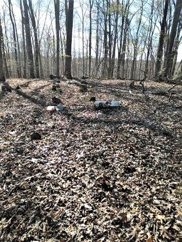
| Description | : | From the intersection of Greenbrier Rd, & KY-1576, south of Albany, KY, travel south on Greenbrier Rd. for 0.4 mi., entering TN ; turning west (right) onto Hunter Barn Ridge Rd., going 0.5 mi., (re-entering KY); turning north (right) to the cemetery adjacent to the roadway, approximately 500' north of the TN/KY state-line. |
frequently asked questions (FAQ):
-
Where is Lowhorn and Ferrill Cemetery?
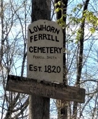
Lowhorn and Ferrill Cemetery is located at Hunters Barn Ridge Road Huntersville, Clinton County ,Kentucky ,USA.
-
Lowhorn and Ferrill Cemetery cemetery's updated grave count on graveviews.com?
0 memorials
-
Where are the coordinates of the Lowhorn and Ferrill Cemetery?
Latitude: 36.6252710
Longitude: -85.1452220
Nearby Cemetories:
1. Locust Grove Cemetery
Clinton County, USA
Coordinate: 36.6319560, -85.1409300
2. Cope Cemetery
Green Brier, Pickett County, USA
Coordinate: 36.6065050, -85.1223570
3. Mullins Cemetery
Pickett County, USA
Coordinate: 36.6035995, -85.1250000
4. Gibson Cemetery
Clinton County, USA
Coordinate: 36.6530991, -85.1318970
5. Shipley Cemetery
Clinton County, USA
Coordinate: 36.6557999, -85.1367035
6. Love Lady Sims Cemetery
Byrdstown, Pickett County, USA
Coordinate: 36.5980435, -85.1646892
7. Butler Cemetery
Clinton County, USA
Coordinate: 36.6444016, -85.1791992
8. Rector Cemetery
Static, Pickett County, USA
Coordinate: 36.6225960, -85.1028840
9. Flowers Cemetery
Byrdstown, Pickett County, USA
Coordinate: 36.5952988, -85.1211014
10. Anderson-Jones Cemetery
Pickett County, USA
Coordinate: 36.6050110, -85.1845550
11. Brock-Zachary Cemetery
Red Hill, Pickett County, USA
Coordinate: 36.6098000, -85.1019000
12. Garrett Cemetery
Red Hill, Pickett County, USA
Coordinate: 36.6034820, -85.1050040
13. Griffin-Lee Cemetery
Static, Pickett County, USA
Coordinate: 36.6253800, -85.1943020
14. Red Hill Church Cemetery
Red Hill, Pickett County, USA
Coordinate: 36.6113330, -85.0981670
15. Chancey Hole
Byrdstown, Pickett County, USA
Coordinate: 36.5822500, -85.1387830
16. Edgefield Cemetery
Byrdstown, Pickett County, USA
Coordinate: 36.6031670, -85.0978330
17. Lowhorn-Riley Cemetery
Byrdstown, Pickett County, USA
Coordinate: 36.5903015, -85.1791992
18. Story Cemetery
Byrdstown, Pickett County, USA
Coordinate: 36.5821991, -85.1294022
19. Garrett Cemetery
Bloomington, Pickett County, USA
Coordinate: 36.5963000, -85.1882000
20. Mullins Cemetery
Byrdstown, Pickett County, USA
Coordinate: 36.6013985, -85.0975037
21. Jones-Smith Cemetery
Bloomington, Pickett County, USA
Coordinate: 36.5941500, -85.1872600
22. Nicholas Cemetery
Static, Pickett County, USA
Coordinate: 36.6106860, -85.0898510
23. Phillips-Bow Cemetery
Byrdstown, Pickett County, USA
Coordinate: 36.6066320, -85.1987930
24. Harris Cemetery
Red Hill, Pickett County, USA
Coordinate: 36.6031100, -85.0935380


