
| Memorials | : | 325 |
| Location | : | Griswold, Cass County, USA |
| Coordinate | : | 41.1594009, -95.0886002 |
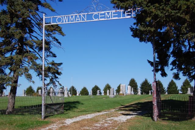
| Description | : | The Loman Cemetery Is located five miles south of Griswold, and two and one half miles east of highway 48 in the south-west corner of the S. W. ¼ of the S. E. ¼ of section 34 on the north side of the county line. The land was given by J. A. Lowman in 1870, and contains 5 acres. It is maintained by taxes. The first burial was a two-year old girl, Ida Guess, daughter of Eli A. and Sarah Guess, in January, 1871. In the 1880s a church was built here which was destroyed by a cyclone in September,... Read More |
frequently asked questions (FAQ):
-
Where is Lowman Cemetery?
Lowman Cemetery is located at Griswold, Cass County ,Iowa ,USA.
-
Lowman Cemetery cemetery's updated grave count on graveviews.com?
325 memorials
-
Where are the coordinates of the Lowman Cemetery?
Latitude: 41.1594009
Longitude: -95.0886002
Nearby Cemetories:
1. Pilot Grove Center Cemetery
Elliott, Montgomery County, USA
Coordinate: 41.1190600, -95.0993700
2. Hillside Cemetery
Elliott, Montgomery County, USA
Coordinate: 41.1408005, -95.1544037
3. Pleasant Township Cemetery
Griswold, Cass County, USA
Coordinate: 41.2056000, -95.1370000
4. Mercer Cemetery
Pottawattamie County, USA
Coordinate: 41.1753006, -95.1650009
5. Grant Cemetery
Grant, Montgomery County, USA
Coordinate: 41.1405983, -94.9906006
6. Waveland Cemetery
Pottawattamie County, USA
Coordinate: 41.1738700, -95.1881500
7. Pilot Grove Presbyterian Cemetery
Wallin, Montgomery County, USA
Coordinate: 41.0793991, -95.0699997
8. Old East Cemetery
Grant, Montgomery County, USA
Coordinate: 41.1444016, -94.9792023
9. Noble Center Cemetery
Cass County, USA
Coordinate: 41.2014008, -94.9858017
10. Douglas Township Cemetery
Grant, Montgomery County, USA
Coordinate: 41.1360933, -94.9752558
11. Indian Graveyard
Sherman Township, Montgomery County, USA
Coordinate: 41.0955730, -95.1837580
12. Saint Johns UCC Cemetery
Lyman, Cass County, USA
Coordinate: 41.2160988, -94.9839020
13. Griswold Cemetery
Waveland Township, Pottawattamie County, USA
Coordinate: 41.2360992, -95.1735992
14. Flint Cemetery
Pottawattamie County, USA
Coordinate: 41.2289009, -95.1841965
15. Mortons Mill Cemetery
Morton Mills, Montgomery County, USA
Coordinate: 41.0793991, -95.0085983
16. Haefflick Burial Site
Red Oak, Montgomery County, USA
Coordinate: 41.0726300, -95.1561700
17. Indian Burial Ground
Douglas Township, Montgomery County, USA
Coordinate: 41.0972116, -94.9752628
18. Tabor Cemetery
Wallin, Montgomery County, USA
Coordinate: 41.0543700, -95.0619900
19. Weirich Cemetery
Cass County, USA
Coordinate: 41.2146988, -94.9655991
20. Smith Cemetery
Griswold, Cass County, USA
Coordinate: 41.2606010, -95.1453018
21. L Laire Property Cemetery (Defunct)
Sherman Township, Montgomery County, USA
Coordinate: 41.0958257, -95.2224927
22. Saint Clair Cemetery
Red Oak Township, Montgomery County, USA
Coordinate: 41.0598400, -95.2049810
23. Frankfort Cemetery
Montgomery County, USA
Coordinate: 41.0271988, -95.1327972
24. Newlons Grove Cemetery
Cass County, USA
Coordinate: 41.2397003, -94.9372025