
| Memorials | : | 2 |
| Location | : | Biehle, Perry County, USA |
| Coordinate | : | 37.6330986, -89.8075027 |
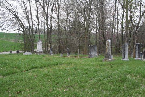
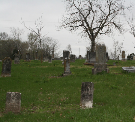
| Description | : | Located between Longtown and Biehle in Perry County. Also called "Hart's Cemetery" because of it's proximity to the Hart residence. One of the organizers (Elizabeth Ann Welker Knox) of the American Lutheran Congregation at Harts, was said to have been the only living member of the original group to retain any authority over the affairs of the church property. The church itself (in 1937) had not been used as a place of worship for more than a generation and the cemetery had been used as a burial ground only at rare intervals. The cemetery was often described as being in the... Read More |
frequently asked questions (FAQ):
-
Where is Luther's Chapel Cemetery?
Luther's Chapel Cemetery is located at Biehle, Perry County ,Missouri ,USA.
-
Luther's Chapel Cemetery cemetery's updated grave count on graveviews.com?
2 memorials
-
Where are the coordinates of the Luther's Chapel Cemetery?
Latitude: 37.6330986
Longitude: -89.8075027
Nearby Cemetories:
1. Saint Maurus Catholic Cemetery
Biehle, Perry County, USA
Coordinate: 37.6031400, -89.8433910
2. Zion Lutheran Cemetery
Longtown, Perry County, USA
Coordinate: 37.6716995, -89.7767029
3. York Chapel Cemetery
Perry County, USA
Coordinate: 37.6775600, -89.7933200
4. York Chapel Cemetery
Longtown, Perry County, USA
Coordinate: 37.6785400, -89.7927900
5. Saint Joseph Cemetery
Apple Creek, Perry County, USA
Coordinate: 37.6096992, -89.7536011
6. Dickman Cemetery
Cape Girardeau County, USA
Coordinate: 37.5786018, -89.7780991
7. Trinity Lutheran Church Cemetery
Friedheim, Cape Girardeau County, USA
Coordinate: 37.5705986, -89.8191986
8. Hilderbrand Cemetery
Cape Girardeau County, USA
Coordinate: 37.5756089, -89.8539929
9. Arnsberg Cemetery
Arnsberg, Cape Girardeau County, USA
Coordinate: 37.5678400, -89.7788700
10. Lang Cemetery
Appleton, Cape Girardeau County, USA
Coordinate: 37.5955238, -89.7319717
11. Grace Lutheran Upper Cemetery
Uniontown, Perry County, USA
Coordinate: 37.6262980, -89.7184500
12. Grace Lutheran Middle Cemetery
Uniontown, Perry County, USA
Coordinate: 37.6224480, -89.7187930
13. Grace Lutheran Cemetery
Uniontown, Perry County, USA
Coordinate: 37.6202420, -89.7175680
14. Saint Joseph Cemetery
Highland, Perry County, USA
Coordinate: 37.6598050, -89.8947720
15. Zion United Methodist Cemetery
Apple Creek, Cape Girardeau County, USA
Coordinate: 37.5819420, -89.7368000
16. Friedenberg Peace Lutheran Cemetery
Friedenberg, Perry County, USA
Coordinate: 37.7092018, -89.8292007
17. Campground Cemetery
Frohna, Perry County, USA
Coordinate: 37.6055984, -89.9056015
18. Erley-Dumbach Cemetery
Oak Ridge, Cape Girardeau County, USA
Coordinate: 37.5665500, -89.7460400
19. Baptist Shed Cemetery
Perry County, USA
Coordinate: 37.7085991, -89.7574997
20. African Methodist Church Cemetery
Appleton, Cape Girardeau County, USA
Coordinate: 37.5882200, -89.7143500
21. Sides Cemetery
Cape Girardeau County, USA
Coordinate: 37.5588989, -89.7510986
22. Holy Cross Lutheran Cemetery
Perry County, USA
Coordinate: 37.7224998, -89.7660980
23. Pleasant Grove Cemetery
Crosstown, Perry County, USA
Coordinate: 37.7132300, -89.7382400
24. Horn Cemetery
Perry County, USA
Coordinate: 37.7285995, -89.7780991