
| Memorials | : | 58 |
| Location | : | Lyona, Dickinson County, USA |
| Coordinate | : | 38.8630400, -96.9266500 |
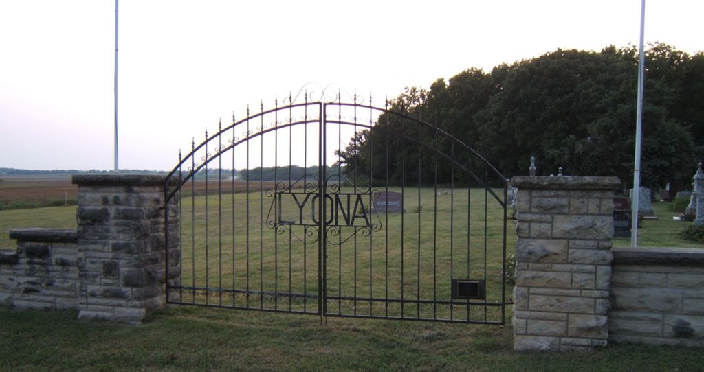
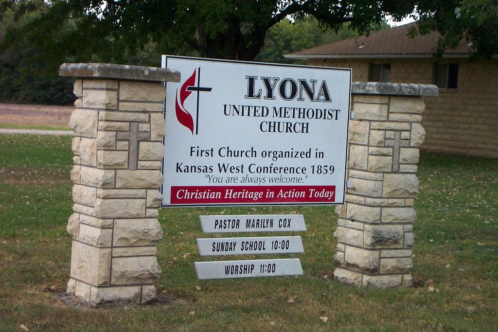
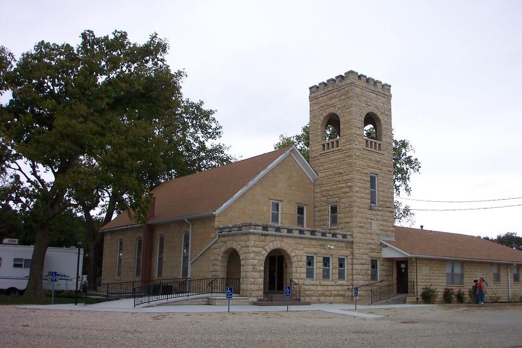
| Description | : | The cemetery is on the west side of the road and the Methodist Church is on the east side, right across from each other. |
frequently asked questions (FAQ):
-
Where is Lyona Methodist Church Cemetery?
Lyona Methodist Church Cemetery is located at 1850 Wolf Road, Junction City Lyona, Dickinson County ,Kansas , 66441USA.
-
Lyona Methodist Church Cemetery cemetery's updated grave count on graveviews.com?
58 memorials
-
Where are the coordinates of the Lyona Methodist Church Cemetery?
Latitude: 38.8630400
Longitude: -96.9266500
Nearby Cemetories:
1. Mount Zion Cemetery
Junction City, Geary County, USA
Coordinate: 38.8762000, -96.9267080
2. Rinehart Cemetery
Enterprise, Dickinson County, USA
Coordinate: 38.9021988, -96.9638977
3. Woodbine Cemetery
Woodbine, Dickinson County, USA
Coordinate: 38.7924995, -96.9636002
4. Saint Johns Cemetery
White City, Morris County, USA
Coordinate: 38.8093987, -96.8531036
5. Langhofer Cemetery
Woodbine, Dickinson County, USA
Coordinate: 38.7905530, -96.9921110
6. Langhofer-Riffel Cemetery
Woodbine, Dickinson County, USA
Coordinate: 38.7835530, -96.9874660
7. Clarks Creek Cemetery
Latimer, Morris County, USA
Coordinate: 38.7821999, -96.8664017
8. Skiddy Cemetery
Geary County, USA
Coordinate: 38.8852997, -96.8078003
9. Riffel Cemetery (Defunct)
Woodbine, Dickinson County, USA
Coordinate: 38.8177986, -97.0342026
10. Lyons Creek German Baptist Cemetery
Woodbine, Dickinson County, USA
Coordinate: 38.7672680, -96.9645600
11. Pleasant Hill Cemetery
Enterprise, Dickinson County, USA
Coordinate: 38.8885150, -97.0749560
12. Wreford Cemetery
Junction City, Geary County, USA
Coordinate: 38.9620300, -96.8423500
13. Lutheran Cemetery #17
Enterprise, Dickinson County, USA
Coordinate: 38.9009209, -97.0734787
14. Zion Lutheran Cemetery
Latimer, Morris County, USA
Coordinate: 38.7542000, -96.8578033
15. Immanuel Lutheran Cemetery
Shady Brook, Dickinson County, USA
Coordinate: 38.7392890, -96.9842260
16. Saint Patricks Cemetery
Chapman, Dickinson County, USA
Coordinate: 38.9803330, -97.0062850
17. Fall Cemetery
Herington, Dickinson County, USA
Coordinate: 38.7324440, -96.9642810
18. Saint Paul Cemetery
Shady Brook, Dickinson County, USA
Coordinate: 38.7358017, -96.9816971
19. Indian Hill Cemetery
Chapman, Dickinson County, USA
Coordinate: 38.9714012, -97.0327988
20. Salchow Cemetery
Geary County, USA
Coordinate: 38.9352989, -96.7731018
21. Scheiller Cemetery
Enterprise, Dickinson County, USA
Coordinate: 38.8669014, -97.1106033
22. Mount Hope Cemetery
Enterprise, Dickinson County, USA
Coordinate: 38.8869019, -97.1121979
23. Geary County Poor Farm Cemetery
Junction City, Geary County, USA
Coordinate: 39.0064500, -96.8727100
24. Wetzel Cemetery
Geary County, USA
Coordinate: 38.9449997, -96.7649994