
| Memorials | : | 15 |
| Location | : | Rosedale, Baltimore County, USA |
| Coordinate | : | 39.3507510, -76.4842470 |
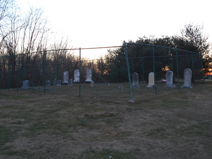
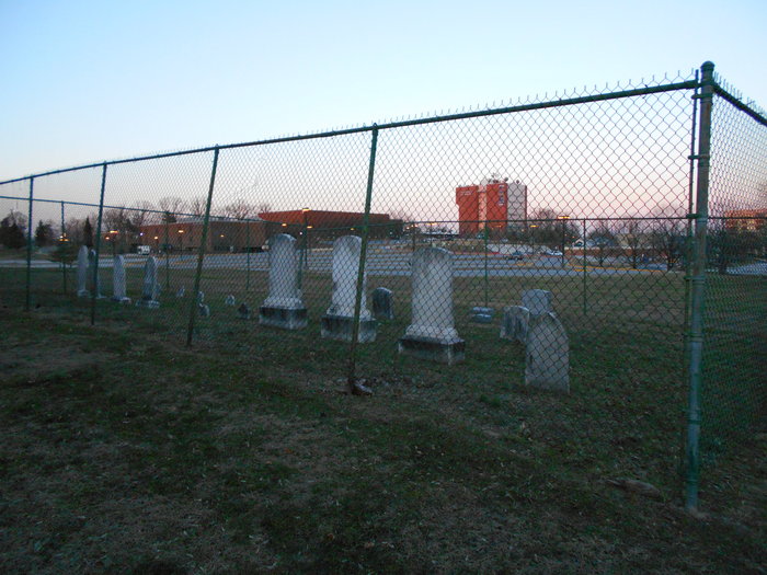
| Description | : | © 2013 Bigg Jim Jones All Rights Reserved. The Mace Family Farm was a staple in Rosedale (Baltimore County) Maryland for generations. One of the founding families of the area, the Mace Plantation was one of the largest in eastern part of the county. After the last of the Mace family donated the former plantation to Baltimore County for a school project, only the small family cemetery remains. The cemetery sits on a hillside, just behind the Mass Transit Administration shelter on Franklin Square Drive, across from Lions Head Court. The cemetery is maintained by CCBC Essex, and is surrounded by a 10... Read More |
frequently asked questions (FAQ):
-
Where is Mace Family Cemetery?
Mace Family Cemetery is located at 7201 Rossville Boulevard Rosedale, Baltimore County ,Maryland , 21237USA.
-
Mace Family Cemetery cemetery's updated grave count on graveviews.com?
0 memorials
-
Where are the coordinates of the Mace Family Cemetery?
Latitude: 39.3507510
Longitude: -76.4842470
Nearby Cemetories:
1. Gardens of Faith Cemetery
Rosedale, Baltimore County, USA
Coordinate: 39.3530700, -76.5084200
2. Fitch Family Cemetery
Fullerton, Baltimore County, USA
Coordinate: 39.3625166, -76.5091333
3. Holt Center For The Arts
Overlea, Baltimore County, USA
Coordinate: 39.3525900, -76.5162400
4. Dowden Chapel Cemetery
Nottingham, Baltimore County, USA
Coordinate: 39.3752915, -76.5038555
5. Orems United Methodist Church Cemetery
Middle River, Baltimore County, USA
Coordinate: 39.3293800, -76.4563000
6. Saint Peters Lutheran Church Cemetery
Nottingham, Baltimore County, USA
Coordinate: 39.3728600, -76.5113100
7. Saint Joseph Church, Fullerton Cemetery
Nottingham, Baltimore County, USA
Coordinate: 39.3868700, -76.4971300
8. Morford - Fowler Family Cemetery
Baltimore County, USA
Coordinate: 39.3840200, -76.5091500
9. Lazer-Rissa-Sklar Family Circle Cemetery
Rosedale, Baltimore County, USA
Coordinate: 39.3210380, -76.5195900
10. Petach Tikvah Cemetery New
Rosedale, Baltimore County, USA
Coordinate: 39.3209700, -76.5197100
11. Agudas Achim Anshe Sfard Congregation Cemetery
Rosedale, Baltimore County, USA
Coordinate: 39.3199770, -76.5182810
12. Beth Jacob Congregation Cemetery
Rosedale, Baltimore County, USA
Coordinate: 39.3202500, -76.5187450
13. Anshe Neisen Cemetery
Rosedale, Baltimore County, USA
Coordinate: 39.3196900, -76.5181600
14. Agudath Israel Congregation Cemetery
Rosedale, Baltimore County, USA
Coordinate: 39.3204000, -76.5193090
15. Shomrei Mishmeres Schares Haplata Cemetery
Rosedale, Baltimore County, USA
Coordinate: 39.3207000, -76.5197500
16. Progressive Radomer Verein Lodge Cemetery
Rosedale, Baltimore County, USA
Coordinate: 39.3205360, -76.5195610
17. Bobroisker Beneficial Circle New Cemetery
Rosedale, Baltimore County, USA
Coordinate: 39.3194120, -76.5178920
18. Forband Cemetery
Rosedale, Baltimore County, USA
Coordinate: 39.3209200, -76.5201400
19. Petach Tikvah Cemetery Old
Rosedale, Baltimore County, USA
Coordinate: 39.3198690, -76.5186270
20. Radomer Verein Cemetery
Rosedale, Baltimore County, USA
Coordinate: 39.3223700, -76.5222000
21. Har Sinai Benevolent Society Cemetery
Rosedale, Baltimore County, USA
Coordinate: 39.3197840, -76.5187800
22. Ohr Knesseth Israel Anshe Sphard Cong. Cemetery
Rosedale, Baltimore County, USA
Coordinate: 39.3192770, -76.5181960
23. Progressive Sick Benefit and Relief Assoc Cemetery
Rosedale, Baltimore County, USA
Coordinate: 39.3199200, -76.5194600
24. Radomer Verein Oldest Cemetery
Rosedale, Baltimore County, USA
Coordinate: 39.3197800, -76.5193200