
| Memorials | : | 0 |
| Location | : | Church Hill, Jefferson County, USA |
| Coordinate | : | 31.6807300, -91.2555200 |
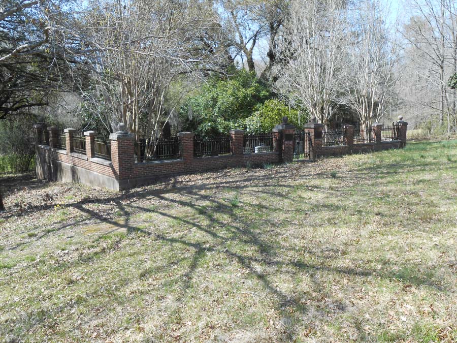
| Description | : | The Magruder-Drake Cemetery was located at the family home, Mt. Ararat Plantation, Church Hill, Jefferson County, Mississippi. The original home was destroyed but the property is still retained by the descendants of Captain James Truman Magruder, the Drake family. Information for the burials at this cemetery was taken from the Year Book, American Clan Gregor Society, 1962, p. 62. The information was compiled by Winbourne E. Magruder Drake and his sisters, Jane Howard Drake Cooper and Claribel Drake. |
frequently asked questions (FAQ):
-
Where is Magruder-Drake Family Cemetery?
Magruder-Drake Family Cemetery is located at Church Hill, Jefferson County ,Mississippi ,USA.
-
Magruder-Drake Family Cemetery cemetery's updated grave count on graveviews.com?
0 memorials
-
Where are the coordinates of the Magruder-Drake Family Cemetery?
Latitude: 31.6807300
Longitude: -91.2555200

Nearby Cemetories:
1. Linwood Baptist Church Cemetery
Church Hill, Jefferson County, USA
Coordinate: 31.6834200, -91.2670800
2. Adams Cemetery
Jefferson County, USA
Coordinate: 31.6907997, -91.2703018
3. Jefferson Chapel A.M.E. Church Cemetery
Jefferson County, USA
Coordinate: 31.6789900, -91.2348000
4. Krize Family Cemetery
Church Hill, Jefferson County, USA
Coordinate: 31.6877400, -91.2332100
5. Smith Cemetery
Jefferson County, USA
Coordinate: 31.6653004, -91.2378006
6. Shields Cemetery
Jefferson County, USA
Coordinate: 31.6714001, -91.2842026
7. Milford Missionary Baptist Church Cemetery
Natchez, Adams County, USA
Coordinate: 31.6580200, -91.2816800
8. John Jones Cemetery
Church Hill, Jefferson County, USA
Coordinate: 31.6804400, -91.2179800
9. Christ Episcopal Church Cemetery
Church Hill, Jefferson County, USA
Coordinate: 31.7152996, -91.2386169
10. Kibbe Cemetery
Adams County, USA
Coordinate: 31.6632900, -91.3025400
11. Greater Saint Mark Missionary Baptist Church Cemet
Natchez, Adams County, USA
Coordinate: 31.6371200, -91.2654100
12. Mercy Seat Baptist Church Cemetery
Church Hill, Jefferson County, USA
Coordinate: 31.7269400, -91.2307100
13. Brooks Cemetery
Jefferson County, USA
Coordinate: 31.7208004, -91.2182999
14. Bethlehem Cemetery
Jefferson County, USA
Coordinate: 31.6632996, -91.1988983
15. Chamberlain Cemetery
Cannonsburg, Jefferson County, USA
Coordinate: 31.6858006, -91.1913986
16. Mount Locust Slave Cemetery
Cannonsburg, Jefferson County, USA
Coordinate: 31.6871200, -91.1914400
17. August Boyd Gravesite
Adams County, USA
Coordinate: 31.6276000, -91.2363200
18. Davenport Family Cemetery
Cannonsburg, Jefferson County, USA
Coordinate: 31.6422400, -91.2081600
19. Bethlehem Baptist Church Cemetery
Cannonsburg, Jefferson County, USA
Coordinate: 31.6685800, -91.1899700
20. Tyler-Frisby Cemetery
Cannonsburg, Jefferson County, USA
Coordinate: 31.6691600, -91.1887900
21. Cole Family Cemetery
Cannonsburg, Jefferson County, USA
Coordinate: 31.6682900, -91.1890000
22. Bullen Cemetery
Jefferson County, USA
Coordinate: 31.6686001, -91.1883011
23. McKnight Family Cemetery
Cannonsburg, Jefferson County, USA
Coordinate: 31.6742200, -91.1851500
24. Tenner Family Cemetery
Church Hill, Jefferson County, USA
Coordinate: 31.7007400, -91.1884500