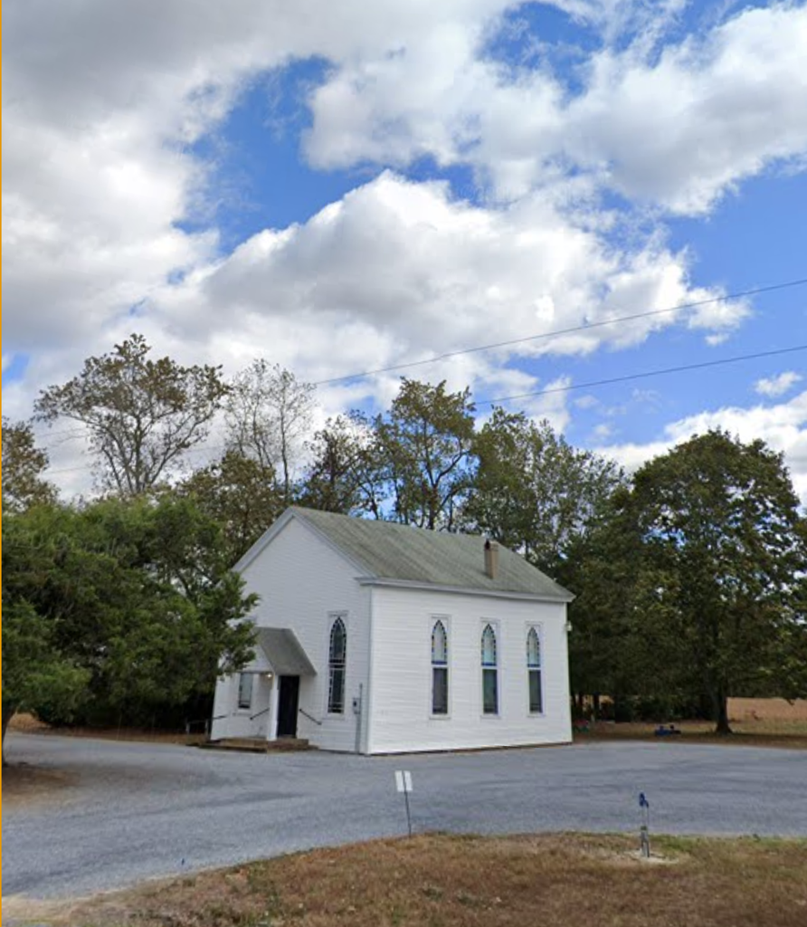
| Memorials | : | 1 |
| Location | : | Hollandsville, Kent County, USA |
| Coordinate | : | 38.9901660, -75.6581840 |
| Description | : | Manship Chapel is located. At Hollandsville, West of Felton, Delaware. It is on the South side of Burnite Mill Rd. (Rt 12) 1500 feet east of rd 58. It was recorded April 20, 1984 by Raymond Dill for his "Souls in Heaven, Names in Stone Kent County, Delaware Cemetery Records. There is 1 tombstone on the east side of the Church. |
frequently asked questions (FAQ):
-
Where is Manship Church Cemetery?
Manship Church Cemetery is located at 4912 Burnite Mill Rd Hollandsville, Kent County ,Delaware , 19943USA.
-
Manship Church Cemetery cemetery's updated grave count on graveviews.com?
0 memorials
-
Where are the coordinates of the Manship Church Cemetery?
Latitude: 38.9901660
Longitude: -75.6581840
Nearby Cemetories:
1. Hopkins Cemetery
Felton, Kent County, USA
Coordinate: 39.0005989, -75.6211014
2. Hughes Family Plot
Whiteleysburg, Kent County, USA
Coordinate: 38.9725900, -75.6963300
3. Edwards Family Cemetery
Edwardsville, Kent County, USA
Coordinate: 38.9953500, -75.7097500
4. John Clark Family Graveyard
Whiteleysburg, Kent County, USA
Coordinate: 39.0228510, -75.6931830
5. Longfellow Family Plot
Sandtown, Kent County, USA
Coordinate: 39.0280000, -75.6957000
6. Peter Dill Family Plot
Edwardsville, Kent County, USA
Coordinate: 38.9803960, -75.7223590
7. Philemon Dill Family Plot
Felton, Kent County, USA
Coordinate: 38.9778410, -75.7230090
8. Cedar Grove Cemetery
Felton, Kent County, USA
Coordinate: 38.9806000, -75.7248000
9. Saint James Church Cemetery
Berrytown, Kent County, USA
Coordinate: 39.0187000, -75.6008000
10. Mount Olive Cemetery
Sandtown, Kent County, USA
Coordinate: 39.0374985, -75.6977997
11. Whites Methodist Church Cemetery
Harrington, Kent County, USA
Coordinate: 38.9320000, -75.6549000
12. Cow Marsh Baptist Church Cemetery
Petersburg, Kent County, USA
Coordinate: 39.0423203, -75.6943817
13. Abbott Family Burying Ground
Felton, Kent County, USA
Coordinate: 38.9731704, -75.5796893
14. Benston Family Plot
Harrington, Kent County, USA
Coordinate: 38.9284470, -75.6303590
15. Whiteley Family Cemetery
Whiteleysburg, Kent County, USA
Coordinate: 38.9483060, -75.7310200
16. Downham Cemetery
Viola, Kent County, USA
Coordinate: 39.0399000, -75.5863000
17. Clements Family Plot
Sandtown, Kent County, USA
Coordinate: 39.0540930, -75.7106920
18. Coopers Farm Cemetery
Petersburg, Kent County, USA
Coordinate: 39.0698776, -75.6614227
19. Mount Plymouth Cemetery
Viola, Kent County, USA
Coordinate: 39.0343819, -75.5705566
20. Betsy Baynard Farm Cemetery
Goldsboro, Caroline County, USA
Coordinate: 39.0159200, -75.7596900
21. Browns Farm Burial Ground
Brownsville, Kent County, USA
Coordinate: 38.9083000, -75.6797000
22. Slaughter Family Plot
Sandtown, Kent County, USA
Coordinate: 39.0592900, -75.7243900
23. Charlie Miller Farm Graveyard
Greensboro, Caroline County, USA
Coordinate: 38.9886200, -75.7705300
24. Baynard Cemetery
Layton Corners, Kent County, USA
Coordinate: 38.9125100, -75.7146400


