| Memorials | : | 14 |
| Location | : | Helena, Phillips County, USA |
| Coordinate | : | 34.5429190, -90.5893060 |
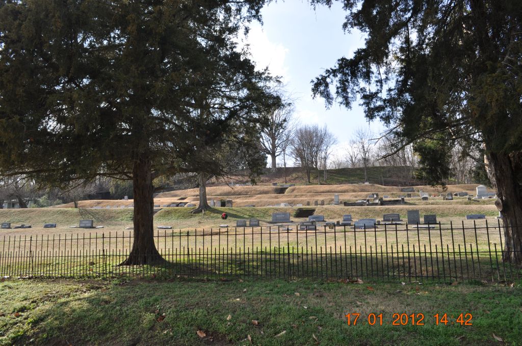
| Description | : | Maple Hill Cemetery is a nonprofit cemetery which is owned by its Lot Owners and which is administered by a Board of Trustees. It was started about 1865 as a direct result of the destruction of Helena's existing cemetery (called Graveyard Hill) by the shells and gunfire of the Battle of Helena, July 4, 1863. In the first years of the cemetery's existence and when its newly drawn lots were being purchased, the remains of many were removed from the shattered cemetery and from places of burial in private yards and reinterred in the new cemetery. The earliest death date... Read More |
frequently asked questions (FAQ):
-
Where is Maple Hill Cemetery?
Maple Hill Cemetery is located at Helena, Phillips County ,Arkansas ,USA.
-
Maple Hill Cemetery cemetery's updated grave count on graveviews.com?
13 memorials
-
Where are the coordinates of the Maple Hill Cemetery?
Latitude: 34.5429190
Longitude: -90.5893060
Nearby Cemetories:
1. Confederate Cemetery
Helena, Phillips County, USA
Coordinate: 34.5418080, -90.5908070
2. Saint Mary's Catholic Cemetery
Helena, Phillips County, USA
Coordinate: 34.5453060, -90.5892440
3. Beth El Cemetery
Phillips County, USA
Coordinate: 34.5463830, -90.5892470
4. Magnolia Cemetery
Helena, Phillips County, USA
Coordinate: 34.5438995, -90.5950012
5. Cedar Grove Cemetery
Helena, Phillips County, USA
Coordinate: 34.5572014, -90.5907974
6. Graveyard Hill
Helena, Phillips County, USA
Coordinate: 34.5250000, -90.5959000
7. Saint Mary's Churchyard Cemetery
Phillips County, USA
Coordinate: 34.5229520, -90.5921610
8. Stephens Cemetery
Phillips County, USA
Coordinate: 34.5125008, -90.6342010
9. Polly Dots Cemetery
Phillips County, USA
Coordinate: 34.5275002, -90.6464005
10. Dunn-Baker-Horner Cemetery
West Helena, Phillips County, USA
Coordinate: 34.5958061, -90.6065674
11. Saint Marks Cemetery
Phillips County, USA
Coordinate: 34.5760994, -90.6449966
12. Oak Grove Garden Cemetery
Phillips County, USA
Coordinate: 34.5400009, -90.6613998
13. Oak Grove Cemetery #3
Phillips County, USA
Coordinate: 34.5424030, -90.6618680
14. Odd Fellows Cemetery
West Helena, Phillips County, USA
Coordinate: 34.5410995, -90.6619034
15. Mount Nebo Cemetery
Coahoma County, USA
Coordinate: 34.4933014, -90.5449982
16. Davidson-Hart Cemetery
West Helena, Phillips County, USA
Coordinate: 34.5693033, -90.6615133
17. OShield Cemetery
Phillips County, USA
Coordinate: 34.5699997, -90.6616974
18. Crouse Cemetery
Tunica County, USA
Coordinate: 34.5388985, -90.5083008
19. New Zion Cemetery
Phillips County, USA
Coordinate: 34.5442009, -90.6753006
20. Flower Lake Cemetery
Dundee, Tunica County, USA
Coordinate: 34.5860600, -90.5201200
21. Thompson Cemetery
Coahoma County, USA
Coordinate: 34.4805984, -90.5425034
22. Calvary Cemetery
Trotter Landing, Tunica County, USA
Coordinate: 34.5798400, -90.5030000
23. Brown Cemetery
Phillips County, USA
Coordinate: 34.4636002, -90.6296997
24. Cooper Cemetery
Phillips County, USA
Coordinate: 34.4589005, -90.6275024


