
| Memorials | : | 0 |
| Location | : | Hartville, Stark County, USA |
| Coordinate | : | 40.9414464, -81.3384425 |
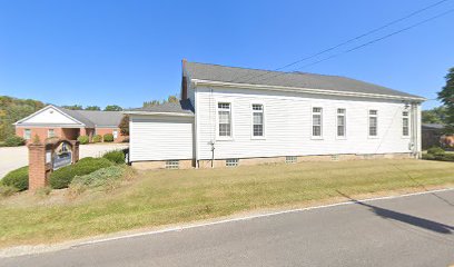
| Description | : | Maplegrove Cemetery no longer exists. The church, per a parishioner I talked with, said that the cemetery was removed, at least 20 years ago, when an addition and parking lot were added to the church. The headstones were given to the former pastor. |
frequently asked questions (FAQ):
-
Where is Maplegrove Mennonite Cemetery?
Maplegrove Mennonite Cemetery is located at Hartville, Stark County ,Ohio ,USA.
-
Maplegrove Mennonite Cemetery cemetery's updated grave count on graveviews.com?
0 memorials
-
Where are the coordinates of the Maplegrove Mennonite Cemetery?
Latitude: 40.9414464
Longitude: -81.3384425
Nearby Cemetories:
1. Machamer Cemetery
Stark County, USA
Coordinate: 40.9458008, -81.3475037
2. Hartville Mennonite Church Cemetery
Hartville, Stark County, USA
Coordinate: 40.9405067, -81.3510943
3. East Nimishillen Church of the Brethren Cemetery
Hartville, Stark County, USA
Coordinate: 40.9253250, -81.3290150
4. Oak Grove Cemetery
Lake Township, Stark County, USA
Coordinate: 40.9530983, -81.3597031
5. Pleasant View Amish Mennonite Church Cemetery
Hartville, Stark County, USA
Coordinate: 40.9567780, -81.3578580
6. Hartville Lutheran Cemetery
Hartville, Stark County, USA
Coordinate: 40.9622910, -81.3286180
7. Union Cemetery
Hartville, Stark County, USA
Coordinate: 40.9631004, -81.3281021
8. Mount Peace Cemetery
Hartville, Stark County, USA
Coordinate: 40.9688988, -81.3405991
9. Saint Jacobs Lutheran Cemetery
Lake Township, Stark County, USA
Coordinate: 40.9153366, -81.3531647
10. Walnut Grove Cemetery
Uniontown, Stark County, USA
Coordinate: 40.9682000, -81.3648100
11. Brumbaugh Cemetery
Hartville, Stark County, USA
Coordinate: 40.9752998, -81.3107986
12. Greentown Cemetery
Greentown, Stark County, USA
Coordinate: 40.9295000, -81.3970600
13. Thomas Cemetery
Stark County, USA
Coordinate: 40.8953018, -81.3116989
14. Werner Chapel Cemetery
Middlebranch, Stark County, USA
Coordinate: 40.8959999, -81.3010025
15. Woods Cemetery
Uniontown, Stark County, USA
Coordinate: 40.9757996, -81.4008026
16. Mount Pleasant Cemetery
Canton, Stark County, USA
Coordinate: 40.9078400, -81.4020600
17. Saint Peters Cemetery
Stark County, USA
Coordinate: 40.9225000, -81.2630600
18. Old Lutheran Cemetery
Uniontown, Stark County, USA
Coordinate: 40.9772290, -81.4081710
19. Greenlawn Cemetery
Uniontown, Stark County, USA
Coordinate: 40.9782982, -81.4103012
20. Tison Road Cemetery
Akron, Summit County, USA
Coordinate: 40.9995003, -81.3936996
21. Pleasant Valley Cemetery
North Canton, Stark County, USA
Coordinate: 40.9061990, -81.4218240
22. North Canton Cemetery
North Canton, Stark County, USA
Coordinate: 40.8969002, -81.4206009
23. Faith United Methodist Church Columbarium
North Canton, Stark County, USA
Coordinate: 40.8843520, -81.4076290
24. French Baptist Church Cemetery
Harrisburg, Stark County, USA
Coordinate: 40.9082790, -81.2406660