| Memorials | : | 1 |
| Location | : | Dutton, Madison County, USA |
| Coordinate | : | 35.8353700, -93.7157400 |
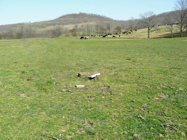
| Description | : | There is a single grave at this location, which is in Section 35, Township 14 North, Range 26 West, in a field located just a little east of Gene Ogden's home. This is located about 1 1/2 miles northwest of Dutton, Arkansas, and the grave is located just off of Highway 16. This grave used to be located underneath a large tree, which died and is now gone. Now the tombstone is in the middle of a pasture. Some information shows that 2 or 3 other Coleman family members were also buried here, but no other... Read More |
frequently asked questions (FAQ):
-
Where is Mary Frances Coleman Gravesite?
Mary Frances Coleman Gravesite is located at Dutton, Madison County ,Arkansas ,USA.
-
Mary Frances Coleman Gravesite cemetery's updated grave count on graveviews.com?
1 memorials
-
Where are the coordinates of the Mary Frances Coleman Gravesite?
Latitude: 35.8353700
Longitude: -93.7157400
Nearby Cemetories:
1. Wages Farm Gravesite
Dutton, Madison County, USA
Coordinate: 35.8170370, -93.6995590
2. Dutton Cemetery
Madison County, USA
Coordinate: 35.8147011, -93.6958008
3. Atkins Cemetery
Saint Paul, Madison County, USA
Coordinate: 35.8619003, -93.7155991
4. Riverside Cemetery
Saint Paul, Madison County, USA
Coordinate: 35.8297005, -93.7521973
5. Jones - Old Dave Jones Homeplace Graves
Saint Paul, Madison County, USA
Coordinate: 35.7989100, -93.7206200
6. Prater - Bivens Cemetery
Saint Paul, Madison County, USA
Coordinate: 35.8236500, -93.7733350
7. Horn Cemetery
Pettigrew, Madison County, USA
Coordinate: 35.8596992, -93.6635971
8. Kilgore Cemetery
Madison County, USA
Coordinate: 35.7821999, -93.7071991
9. Jones Cemetery
Madison County, USA
Coordinate: 35.7827988, -93.6782990
10. Bivens-John Bivens Homeplace Crypts
Brashears, Madison County, USA
Coordinate: 35.8148000, -93.7866000
11. Watson Cemetery
Madison County, USA
Coordinate: 35.8100014, -93.6468964
12. Cragar Cemetery
Madison County, USA
Coordinate: 35.7844009, -93.7608032
13. Ogden Cemetery
Madison County, USA
Coordinate: 35.8974100, -93.6961700
14. Ogden Roadside Graves
Witter, Madison County, USA
Coordinate: 35.8986000, -93.6971000
15. Greasy Creek Cemetery
Saint Paul, Madison County, USA
Coordinate: 35.8549995, -93.7921982
16. Lo Fleming Creek Cemetery
Saint Paul, Madison County, USA
Coordinate: 35.8090120, -93.7906240
17. Brashears Cemetery
Saint Paul, Madison County, USA
Coordinate: 35.8133011, -93.7983017
18. Cove Cemetery
Madison County, USA
Coordinate: 35.8866997, -93.6508026
19. Liberty Cemetery
Dutton, Madison County, USA
Coordinate: 35.7792200, -93.6571700
20. M. F. P. Prater Gravesite
Pettigrew, Madison County, USA
Coordinate: 35.7700200, -93.6679300
21. Granville Williams Cemetery
Pettigrew, Madison County, USA
Coordinate: 35.7964800, -93.6318600
22. Locust Ridge Cemetery
Witter, Madison County, USA
Coordinate: 35.9140400, -93.7312400
23. Cook Family Cemetery
Combs, Madison County, USA
Coordinate: 35.8455420, -93.8181600
24. Hall Cemetery
Combs, Madison County, USA
Coordinate: 35.8344900, -93.8203000

