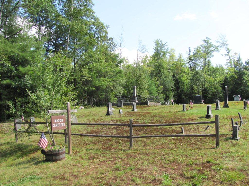
| Memorials | : | 90 |
| Location | : | Mason Township, Oxford County, USA |
| Coordinate | : | 44.3579270, -70.8525530 |
| Description | : | Take the Flat Road to right onto Grover Hill Road. Cemetery is on left. From what I understand, this area was once called Mason Township. GPS location 44.357927,-70.852553 |
frequently asked questions (FAQ):
-
Where is Mason Cemetery?
Mason Cemetery is located at Grover Hill Road Mason Township, Oxford County ,Maine , 04217USA.
-
Mason Cemetery cemetery's updated grave count on graveviews.com?
90 memorials
-
Where are the coordinates of the Mason Cemetery?
Latitude: 44.3579270
Longitude: -70.8525530
Nearby Cemetories:
1. Flat Cemetery
West Bethel, Oxford County, USA
Coordinate: 44.3731003, -70.8497009
2. Songo Cemetery
Albany, Oxford County, USA
Coordinate: 44.3464012, -70.7908020
3. Pine Grove Cemetery
West Bethel, Oxford County, USA
Coordinate: 44.4055600, -70.8563100
4. Scribner Hill Cemetery Upper Yard
Otisfield, Oxford County, USA
Coordinate: 44.3903181, -70.7978794
5. Woodland Cemetery
Bethel, Oxford County, USA
Coordinate: 44.3902283, -70.7967911
6. Skillingston Cemetery
Bethel, Oxford County, USA
Coordinate: 44.4085999, -70.8197021
7. Chapman Cemetery
Gilead, Oxford County, USA
Coordinate: 44.4114100, -70.9024900
8. Riverside Cemetery
Bethel, Oxford County, USA
Coordinate: 44.4202995, -70.8058014
9. Peabody Cemetery
Gilead, Oxford County, USA
Coordinate: 44.3987885, -70.9400635
10. Hunts Corner Cemetery
Albany, Oxford County, USA
Coordinate: 44.2958333, -70.7606667
11. Capen Family Cemetery
Bethel, Oxford County, USA
Coordinate: 44.4382283, -70.7925117
12. West Stoneham Cemetery
Stoneham, Oxford County, USA
Coordinate: 44.2665600, -70.8984100
13. South Bethel Cemetery
Bethel, Oxford County, USA
Coordinate: 44.4160995, -70.7363968
14. Howe Hill Cemetery
Greenwood, Oxford County, USA
Coordinate: 44.3856010, -70.7142029
15. Mount Will Cemetery
North Bethel, Oxford County, USA
Coordinate: 44.4636002, -70.8028030
16. Mount Abram Cemetery
Greenwood, Oxford County, USA
Coordinate: 44.4025002, -70.7078018
17. Hillside Cemetery
East Stoneham, Oxford County, USA
Coordinate: 44.2489840, -70.8062260
18. Chandler Hill Cemetery
Bethel, Oxford County, USA
Coordinate: 44.4392014, -70.7394028
19. Middle Intervale Cemetery
Bethel, Oxford County, USA
Coordinate: 44.4638600, -70.7866200
20. Gammon Cemetery
Stoneham, Oxford County, USA
Coordinate: 44.2514659, -70.9256119
21. Tallyrand G. Lary Cemetery
Gilead, Oxford County, USA
Coordinate: 44.3960800, -71.0117670
22. Hicks Cemetery
Greenwood, Oxford County, USA
Coordinate: 44.3451390, -70.6823830
23. North Lovell Cemetery
North Lovell, Oxford County, USA
Coordinate: 44.2368300, -70.8808000
24. Cole Cemetery
Greenwood, Oxford County, USA
Coordinate: 44.3638400, -70.6729000

