
| Memorials | : | 0 |
| Location | : | Carroll County, USA |
| Coordinate | : | 36.3654500, -93.3958150 |
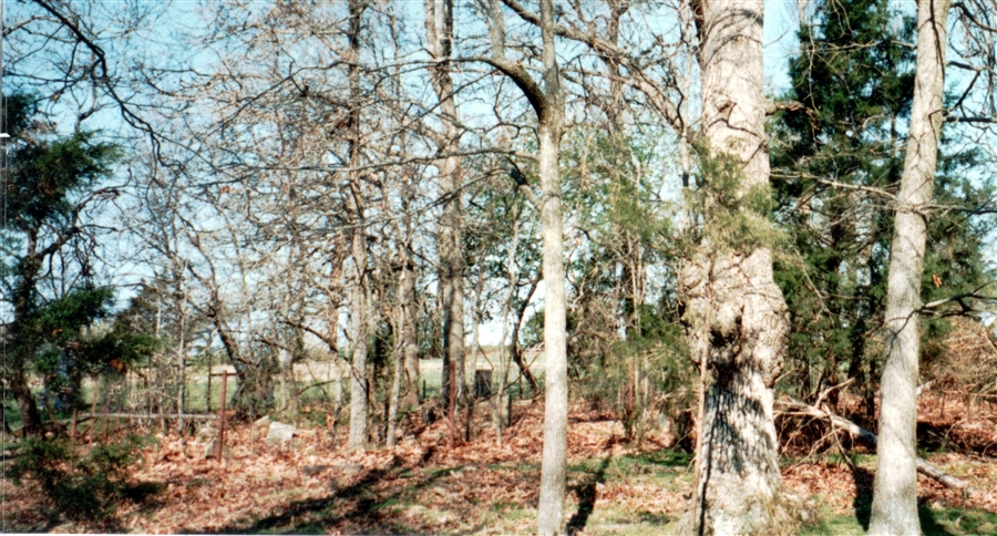
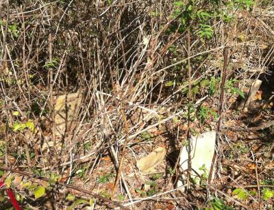
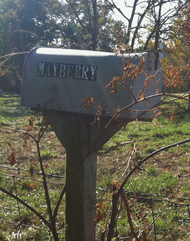
| Description | : | Mayberry Cemetery is known to have been used as a burying ground by the Ham family as far back as the 1870s but it was not until after the death and burial here of Martha Mary Ann (Ham) Lawrence that her widowed husband, William Henry Lawrence, purchased this land to be formally designated as a cemetery. Lawrence paid $1 to the heirs of Barton Kamon Witt Bradley for the property on January 3, 1899. The legal location of the cemetery was described at the time as being "the West part of the Southwest 1/4 of the Northeast 1/4 of Section... Read More |
frequently asked questions (FAQ):
-
Where is Mayberry Cemetery?
Mayberry Cemetery is located at Carroll County ,Arkansas ,USA.
-
Mayberry Cemetery cemetery's updated grave count on graveviews.com?
0 memorials
-
Where are the coordinates of the Mayberry Cemetery?
Latitude: 36.3654500
Longitude: -93.3958150

Nearby Cemetories:
1. Parker Cemetery
Carroll County, USA
Coordinate: 36.3863983, -93.4139023
2. Callens Branch Cemetery
Green Forest, Carroll County, USA
Coordinate: 36.3560000, -93.3646000
3. Glenwood Cemetery
Green Forest, Carroll County, USA
Coordinate: 36.3417015, -93.4255981
4. Norris Cemetery
Green Forest, Carroll County, USA
Coordinate: 36.3321991, -93.4139023
5. Farewell Cemetery
Farewell, Carroll County, USA
Coordinate: 36.3959100, -93.3702100
6. Pickens Cemetery
Green Forest, Carroll County, USA
Coordinate: 36.3424988, -93.4356003
7. Black Oak Cemetery
Green Forest, Carroll County, USA
Coordinate: 36.3474450, -93.3520100
8. Riddle Cemetery
Green Forest, Carroll County, USA
Coordinate: 36.3480988, -93.3507996
9. New Home Cemetery
Green Forest, Carroll County, USA
Coordinate: 36.3753014, -93.4471970
10. Zion Hill Cemetery
Green Forest, Carroll County, USA
Coordinate: 36.3157000, -93.3957000
11. Yocum Cemetery
Yocum, Carroll County, USA
Coordinate: 36.4164009, -93.3921967
12. Fair Grove Cemetery
Green Forest, Carroll County, USA
Coordinate: 36.3433000, -93.4619000
13. Denver Cemetery
Denver, Carroll County, USA
Coordinate: 36.3911018, -93.3261032
14. McCracken Cemetery
Denver, Carroll County, USA
Coordinate: 36.3418999, -93.3218994
15. Burris Cemetery
Cisco, Carroll County, USA
Coordinate: 36.3652992, -93.4807968
16. Mountain View Cemetery
Carroll County, USA
Coordinate: 36.2771988, -93.3981018
17. Roscoe Cemetery
Alpena, Boone County, USA
Coordinate: 36.3278390, -93.2918890
18. Brumead Cemetery
Boone County, USA
Coordinate: 36.3950300, -93.2871500
19. Youngblood Cemetery
Alpena, Boone County, USA
Coordinate: 36.3624992, -93.2782974
20. Ward Cemetery
Green Forest, Carroll County, USA
Coordinate: 36.2593150, -93.4041430
21. Rule Cemetery
Green Forest, Carroll County, USA
Coordinate: 36.2727200, -93.4604600
22. Snow Cemetery
Green Forest, Carroll County, USA
Coordinate: 36.3288002, -93.5220032
23. Hale Cemetery
Berryville, Carroll County, USA
Coordinate: 36.4580730, -93.4667500
24. Snow Homestead Cemetery
Carroll County, USA
Coordinate: 36.3111900, -93.5181600