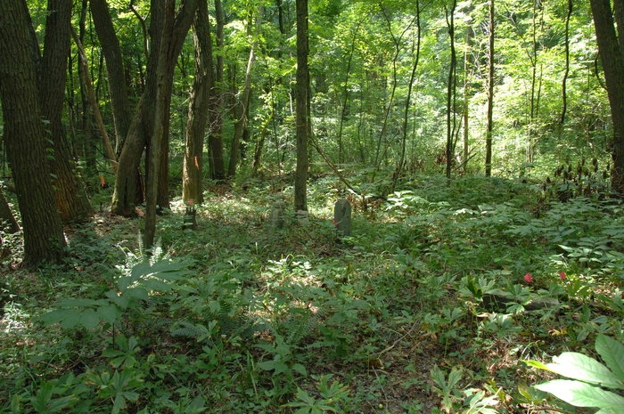
| Memorials | : | 0 |
| Location | : | Butlerville, Jennings County, USA |
| Description | : | The cemetery is located in Campbell Township (Section 16 Township 7N Range 9E) on the grounds of the Muscatatuck Urban Training Center on the west side of Indiana State Route 3 west of N County Road 475 E. Indiana Cemetery Locations, Volume 3, published by the Indiana Genealogical Society (April 2007), lists the cemetery as McCaulou Cemetery. The cemetery is listed in the Cemetery and Burial Grounds Registry of the Indiana Department of Natural Resources (DNR) and in the State Historical Architectural and Archaeological Research Database (SHAARD) with Cemetery Record Number CR-40-17 (McCaulon). |
frequently asked questions (FAQ):
-
Where is McCaulou Cemetery?
McCaulou Cemetery is located at No GPS information available Add GPSN County Road 475 E Butlerville, Jennings County ,Indiana , 47265USA.
-
McCaulou Cemetery cemetery's updated grave count on graveviews.com?
0 memorials
Nearby Cemetories:
1. Barkman Cemetery
Jennings County, USA
Coordinate: 38.9053001, -85.7838974
2. Bear Creek Baptist Cemetery
Jennings County, USA
Coordinate: 39.0236000, -85.6474000
3. Bear Creek Cemetery
Jennings County, USA
Coordinate: 39.0251350, -85.6991740
4. Hughes Cemetery
Bigger Township, Jennings County, USA
Coordinate: 38.9858017, -85.5569000
5. Corbin-Green Cemetery
Jennings County, USA
Coordinate: 38.9483109, -85.5756226
6. Day Cemetery
Jennings County, USA
Coordinate: 38.9378014, -85.6635971
7. Edwards Cemetery
Jennings County, USA
Coordinate: 39.0139084, -85.6249237
8. Cave Springs Cemetery
Geneva Township, Jennings County, USA
Coordinate: 39.0386900, -85.6923120
9. Marsh Cemetery
Jennings County, USA
Coordinate: 39.0709000, -85.6083000
10. Meek Cemetery
Jennings County, USA
Coordinate: 38.9233000, -85.5715000
11. Montgomery Family Cemetery
Jennings County, USA
12. Muscatatuck Cemetery
Jennings County, USA
Coordinate: 39.0517349, -85.5830154
13. Myers Cemetery
Jennings County, USA
Coordinate: 38.9053001, -85.7838974
14. Couchman Cemetery
North Vernon, Jennings County, USA
Coordinate: 39.0236000, -85.6474000
15. Eastman Cemetery
North Vernon, Jennings County, USA
Coordinate: 39.0251350, -85.6991740
16. Ebenezer Methodist Church Cemetery
North Vernon, Jennings County, USA
Coordinate: 38.9858017, -85.5569000
17. Freedom Baptist Church Cemetery
North Vernon, Jennings County, USA
Coordinate: 38.9483109, -85.5756226
18. Green Cemetery
North Vernon, Jennings County, USA
Coordinate: 38.9378014, -85.6635971
19. Hillcrest Cemetery
North Vernon, Jennings County, USA
Coordinate: 39.0139084, -85.6249237
20. Judd Cemetery
North Vernon, Jennings County, USA
Coordinate: 39.0386900, -85.6923120
21. Kellar Cemetery
North Vernon, Jennings County, USA
Coordinate: 39.0709000, -85.6083000
22. Poor Farm Old Folks Cemetery
North Vernon, Jennings County, USA
Coordinate: 38.9233000, -85.5715000
23. Richland Cemetery
North Vernon, Jennings County, USA
24. Saint Ann Catholic Cemetery
North Vernon, Jennings County, USA
Coordinate: 39.0517349, -85.5830154

