
| Memorials | : | 0 |
| Location | : | Van Wert County, USA |
| Coordinate | : | 40.9421997, -84.5746994 |
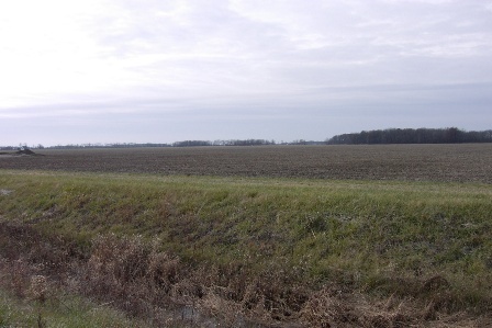
| Description | : | This cemetery was located on Liberty-Union Road in Union Twp. The cemetery was supposed to have been the size of 75' x 50'. There were at least 18 known graves with markers. At least members of two families, the McClure's and Kyle's are buried here. The cemetery was disbanded about 1914 and the stones were buried. The cemetery was on the west side of Liberty-Union Road with the stones facing east. It was enclosed with a rail fence but has vanished along with the cemetery. To find the general area of where this cemetery was take... Read More |
frequently asked questions (FAQ):
-
Where is McClure-Dowler Cemetery?
McClure-Dowler Cemetery is located at Van Wert County ,Ohio ,USA.
-
McClure-Dowler Cemetery cemetery's updated grave count on graveviews.com?
0 memorials
-
Where are the coordinates of the McClure-Dowler Cemetery?
Latitude: 40.9421997
Longitude: -84.5746994
Nearby Cemetories:
1. Taylor Cemetery
Van Wert County, USA
Coordinate: 40.9421997, -84.5746994
2. Mohr Cemetery
Van Wert, Van Wert County, USA
Coordinate: 40.9519005, -84.5614014
3. Scott Cemetery
Scott, Van Wert County, USA
Coordinate: 40.9892006, -84.5950012
4. Dunkard Cemetery
Hoaglin, Van Wert County, USA
Coordinate: 40.9463997, -84.5006027
5. Mount Pleasant Cemetery
Van Wert County, USA
Coordinate: 40.9516983, -84.4961014
6. Van Wert Mausoleum (Defunct)
Van Wert, Van Wert County, USA
Coordinate: 40.8698690, -84.6138640
7. Dix Cemetery
Van Wert County, USA
Coordinate: 40.8852997, -84.6492004
8. Woodland Union Cemetery
Van Wert, Van Wert County, USA
Coordinate: 40.8675003, -84.6156006
9. Sugar Ridge Cemetery
Convoy, Van Wert County, USA
Coordinate: 40.9382858, -84.6982346
10. IOOF Cemetery
Convoy, Van Wert County, USA
Coordinate: 40.9306330, -84.6990970
11. Blue Creek Cemetery
Haviland, Paulding County, USA
Coordinate: 41.0385200, -84.6116100
12. Ridge Cemetery
Middle Point, Van Wert County, USA
Coordinate: 40.8781013, -84.4692001
13. Abbott Cemetery
Latty, Paulding County, USA
Coordinate: 41.0480090, -84.5966750
14. Middle Creek Cemetery
Grover Hill, Paulding County, USA
Coordinate: 41.0050011, -84.4509964
15. Pleasant View Cemetery
Paulding, Paulding County, USA
Coordinate: 41.0611000, -84.5699997
16. Dague Cemetery
Latty, Paulding County, USA
Coordinate: 41.0628260, -84.5802310
17. Saint Johns Cemetery
Van Wert County, USA
Coordinate: 40.8880997, -84.7174988
18. Harrison Baptist Cemetery
Van Wert, Van Wert County, USA
Coordinate: 40.8549450, -84.6892090
19. Redeemer Lutheran Cemetery
Convoy, Van Wert County, USA
Coordinate: 40.8880000, -84.7220000
20. Dealey Cemetery
Payne, Paulding County, USA
Coordinate: 41.0038986, -84.7221985
21. King Cemetery
Middle Point, Van Wert County, USA
Coordinate: 40.8664017, -84.4377975
22. Glenn Presbyterian Cemetery
Van Wert County, USA
Coordinate: 40.8590012, -84.7070007
23. Apostolic Christian Church Cemetery
Latty, Paulding County, USA
Coordinate: 41.0760002, -84.5749969
24. Mount Zion Cemetery
Latty, Paulding County, USA
Coordinate: 41.0536003, -84.4582977