
| Memorials | : | 0 |
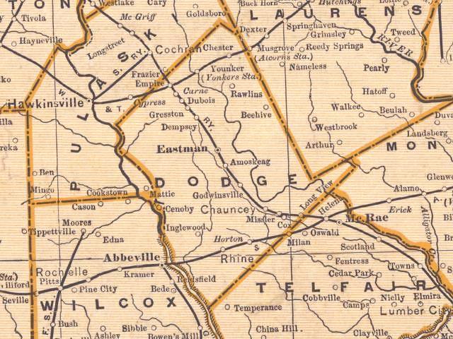
| Location | : | Dodge County, USA |
| Coordinate | : | 32.0265600, -83.1342300 |
| Description | : | The cemetery no longer exists. It was located in District 14, Lot 130 about a mile from the Horton train stop (the Sand Grove community) between Rhine and Milan. Horton Edward McCranie lost the property during the Great Depression. The cemetery was destroyed in 1941 when it was ploughed over. Some slaves owned by the Daniel L. McCranie family were also buried in the cemetery. Coordinates are an approximate location showing the land lot. |
frequently asked questions (FAQ):
-
Where is McCranie Cemetery?
McCranie Cemetery is located at Dodge County ,Georgia ,USA.
-
McCranie Cemetery cemetery's updated grave count on graveviews.com?
0 memorials
-
Where are the coordinates of the McCranie Cemetery?
Latitude: 32.0265600
Longitude: -83.1342300
Nearby Cemetories:
1. Sand Grove Baptist Church Cemetery
Dodge County, USA
Coordinate: 32.0076210, -83.1194040
2. Vilula Baptist Church Cemetery
Dodge County, USA
Coordinate: 32.0485980, -83.1604470
3. Old Mount Ararat Cemetery
Chauncey, Dodge County, USA
Coordinate: 32.0593500, -83.1403090
4. Mount Ararat Free Will Baptist Church Cemetery
Chauncey, Dodge County, USA
Coordinate: 32.0606910, -83.1268390
5. Walker Cemetery
Dodge County, USA
Coordinate: 31.9817009, -83.1468964
6. Antioch Baptist Church Cemetery #2
Dodge County, USA
Coordinate: 32.0307999, -83.0772018
7. Sweet Home Baptist Church Cemetery
Chauncey, Dodge County, USA
Coordinate: 32.0641960, -83.0898660
8. Friendship Baptist Church Cemetery
Five Points, Dodge County, USA
Coordinate: 32.0889290, -83.1422350
9. Oak Grove United Methodist Church Cemetery
Rhine, Dodge County, USA
Coordinate: 31.9692860, -83.1702990
10. Mill Creek Cemetery
Dodge County, USA
Coordinate: 31.9615880, -83.1474210
11. Rhine City Cemetery
Rhine, Dodge County, USA
Coordinate: 31.9908520, -83.2054170
12. Old Fair Haven Cemetery
Rhine, Dodge County, USA
Coordinate: 32.0200005, -83.2177963
13. Mount Olive Church Cemetery
Eastman, Dodge County, USA
Coordinate: 32.0616989, -83.2082977
14. Campbell - Cravey Cemetery
Rhine, Dodge County, USA
Coordinate: 31.9684800, -83.1857400
15. Fair Haven Cemetery
Dodge County, USA
Coordinate: 32.0415290, -83.2189520
16. Watson Cemetery
Dodge County, USA
Coordinate: 32.0489000, -83.0516600
17. Hamilton Cemetery
Dodge County, USA
Coordinate: 32.0988998, -83.1172028
18. Pleasant Grove Cemetery
Rhine, Dodge County, USA
Coordinate: 31.9545750, -83.1744590
19. Ruth Prince Cemetery
Dodge County, USA
Coordinate: 32.1049995, -83.1567001
20. Sugar Creek Cemetery
Chauncey, Dodge County, USA
Coordinate: 32.0942010, -83.0699960
21. Benevolence United Methodist Church Cemetery
Dodge County, USA
Coordinate: 32.0977690, -83.1967290
22. Barney I Cemetery
Rhine, Dodge County, USA
Coordinate: 31.9807240, -83.2308210
23. El Bethel Baptist Church Cemetery
Chauncey, Dodge County, USA
Coordinate: 32.0678000, -83.0340450
24. Hopewell Baptist Church Cemetery
Rhine, Dodge County, USA
Coordinate: 31.9615150, -83.2157810