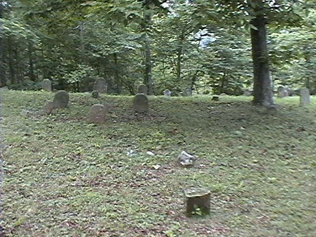
| Memorials | : | 7 |
| Location | : | Bryants Store, Knox County, USA |
| Coordinate | : | 36.7776940, -83.9295350 |
| Description | : | Just off Stoney Fork Road, Knox County, KY. Turn off of 25-E at Barbourville onto Hwy. 11. Go about 7 miles on Hwy. 11 and turn left onto 1809. Go about 1 mile and turn left on Stoney Fork Road. There is a road sign that is labeled Stoney Fork. Stoney Fork Road is a gravel road. The cemetery is about 1½ to 2 miles on the left on a little hill in the woods, up a short, narrow, steep dirt road, just past a residence and farm. Recorded October 30, 1999. There are several stones that are illegible and... Read More |
frequently asked questions (FAQ):
-
Where is McKeehan Burial Ground?
McKeehan Burial Ground is located at Stoney Fork Rd Bryants Store, Knox County ,Kentucky ,USA.
-
McKeehan Burial Ground cemetery's updated grave count on graveviews.com?
7 memorials
-
Where are the coordinates of the McKeehan Burial Ground?
Latitude: 36.7776940
Longitude: -83.9295350
Nearby Cemetories:
1. Powers Cemetery
Bryants Store, Knox County, USA
Coordinate: 36.7812770, -83.9341740
2. Ketchen Cemetery
Bryants Store, Knox County, USA
Coordinate: 36.7752991, -83.9188995
3. Fuson Cemetery
Bryants Store, Knox County, USA
Coordinate: 36.7692970, -83.9235950
4. Killion Cemetery
Bryants Store, Knox County, USA
Coordinate: 36.7830980, -83.9187240
5. Croley Cemetery
Bryants Store, Knox County, USA
Coordinate: 36.7625000, -83.9255600
6. Bryant Cemetery
King, Knox County, USA
Coordinate: 36.7942009, -83.9353027
7. Lane Cemetery
Bryants Store, Knox County, USA
Coordinate: 36.7630160, -83.9123880
8. Watkins Cemetery
King, Knox County, USA
Coordinate: 36.7908300, -83.9508000
9. Rickett Branch Cemetery
Bryants Store, Knox County, USA
Coordinate: 36.7570700, -83.9179200
10. Evans Cemetery
King, Knox County, USA
Coordinate: 36.7914009, -83.9524994
11. Peace-Tye Cemetery
Mackey Bend, Knox County, USA
Coordinate: 36.7839760, -83.9575640
12. Mays Cemetery
Bryants Store, Knox County, USA
Coordinate: 36.7710991, -83.8989029
13. Lay Cemetery
Bryants Store, Knox County, USA
Coordinate: 36.7511100, -83.9350000
14. John Lay Cemetery
Bryants Store, Knox County, USA
Coordinate: 36.7455600, -83.9322200
15. Wilson Graveyard
Barbourville, Knox County, USA
Coordinate: 36.8112250, -83.9291490
16. Mays Cemetery
Bryants Store, Knox County, USA
Coordinate: 36.7435989, -83.9293976
17. Adams Cemetery
Knox County, USA
Coordinate: 36.8163986, -83.9417038
18. Mackey Cemetery
Mackey Bend, Knox County, USA
Coordinate: 36.8022003, -83.9719009
19. Prichard Cemetery
Mackey Bend, Knox County, USA
Coordinate: 36.8153000, -83.9569016
20. Partin Cemetery
Mackey Bend, Knox County, USA
Coordinate: 36.8166700, -83.9675000
21. Elliott Cemetery
Mackey Bend, Knox County, USA
Coordinate: 36.8166330, -83.9678440
22. Hampton Cemetery
Swanpond, Knox County, USA
Coordinate: 36.8231010, -83.8964005
23. Abner Wells Cemetery
Knox County, USA
Coordinate: 36.8364060, -83.9215730
24. Miles Cemetery
Knox County, USA
Coordinate: 36.8324640, -83.8996650

