
| Memorials | : | 11 |
| Location | : | Yellow Creek Township, Columbiana County, USA |
| Coordinate | : | 40.6319008, -80.7182999 |
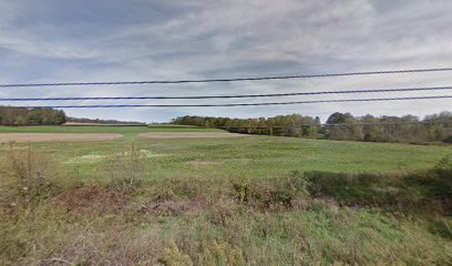
| Description | : | Cemetery appears to be in a wooded area.(Via Google Maps) Access to this location is best described as between Mc Cormick Run Road and Bill Smith Road. Roughly in the 4400 Block of Ohio State Route 39 on the Northeast Side of the Road. The cemetery is located in Yellow Creek Township, Columbiana County, Ohio, and is # 2171 (McKenzie Cemetery / MacKenzie Cemetery / John Smith Cemetery) in “Ohio Cemeteries 1803-2003”, compiled by the Ohio Genealogical Society. The U.S. Geological Survey (USGS) Geographic Names Information System (GNIS) feature ID for the cemetery is 1043120 (McKenzie Cemetery). |
frequently asked questions (FAQ):
-
Where is McKenzie Cemetery?
McKenzie Cemetery is located at Ohio State Route 39 Yellow Creek Township, Columbiana County ,Ohio , 43968USA.
-
McKenzie Cemetery cemetery's updated grave count on graveviews.com?
11 memorials
-
Where are the coordinates of the McKenzie Cemetery?
Latitude: 40.6319008
Longitude: -80.7182999
Nearby Cemetories:
1. Oak Ridge Cemetery
Wellsville, Columbiana County, USA
Coordinate: 40.6119003, -80.7078018
2. Highlandtown Cemetery
Highlandtown, Columbiana County, USA
Coordinate: 40.6320000, -80.7549973
3. Clark Family Cemetery
Wellsville, Columbiana County, USA
Coordinate: 40.6114006, -80.7478027
4. Yellow Creek Presbyterian Church Cemetery
Wellsville, Columbiana County, USA
Coordinate: 40.6479988, -80.6796036
5. Bethel Presbyterian Church Cemetery
Salineville, Columbiana County, USA
Coordinate: 40.6607860, -80.7648250
6. Cuppy Cemetery
Wellsville, Columbiana County, USA
Coordinate: 40.5943985, -80.6766968
7. Saint Elizabeth Cemetery
Wellsville, Columbiana County, USA
Coordinate: 40.6077995, -80.6580963
8. Spring Hill Cemetery
Wellsville, Columbiana County, USA
Coordinate: 40.6062700, -80.6590000
9. Ogle Cemetery
Washington Township, Columbiana County, USA
Coordinate: 40.6063995, -80.7778015
10. Irondale Cemetery
Irondale, Jefferson County, USA
Coordinate: 40.5753650, -80.7290040
11. Old Irondale Cemetery
Irondale, Jefferson County, USA
Coordinate: 40.5752670, -80.7292340
12. Scotch Settlement Cemetery
Wellsville, Columbiana County, USA
Coordinate: 40.6399994, -80.6393967
13. Morning View Cemetery
Irondale, Jefferson County, USA
Coordinate: 40.5682983, -80.7382965
14. West Beaver Church Cemetery
Lisbon, Columbiana County, USA
Coordinate: 40.6958008, -80.7371979
15. Chestnut Grove Cemetery
Irondale, Jefferson County, USA
Coordinate: 40.5733000, -80.7569600
16. Davis Cemetery
Lisbon, Columbiana County, USA
Coordinate: 40.7019005, -80.7624969
17. Hammondsville Cemetery
Hammondsville, Jefferson County, USA
Coordinate: 40.5530014, -80.7099991
18. Madison Township Cemetery
Lisbon, Columbiana County, USA
Coordinate: 40.7094002, -80.6802979
19. Bnai Jacob Cemetery
East Liverpool, Columbiana County, USA
Coordinate: 40.6321983, -80.6091995
20. Saint Patricks Cemetery
Salineville, Columbiana County, USA
Coordinate: 40.6281013, -80.8311005
21. Township Line Cemetery
East Liverpool, Columbiana County, USA
Coordinate: 40.6906013, -80.6333008
22. Shadow Lawn Memory Garden
Newell, Hancock County, USA
Coordinate: 40.6091750, -80.5990870
23. Russell Cemetery
Irondale, Jefferson County, USA
Coordinate: 40.5541992, -80.7869034
24. Saint Aloysius Cemetery
East Liverpool, Columbiana County, USA
Coordinate: 40.6315994, -80.5944977