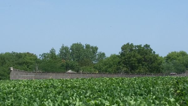
| Memorials | : | 0 |
| Location | : | Gower, Clinton County, USA |
| Phone | : | 816-809-2469 |
| Description | : | There are 3 generations of McKissick buried here (including three Daniel McKissicks). The McKissick family occupied the home and farm at this address from 1832/33 to 1947 when the last McKissick on this farm passed away, with no direct heirs. The first generation McKissick (Daniel 1787-1854) married Mary Polly Kent, born 1788-1867 from North Carolina, married May 15, 1808. They are buried here, along with several of their descendants. This is private property, no trespassing. (Daniel's brother John married Mary's sister, Martha Kent, in North Carolina - the families had been neighbors. John... Read More |
frequently asked questions (FAQ):
-
Where is McKissick Cemetery?
McKissick Cemetery is located at No GPS information available Add GPS268th St and County Line Rd Gower, Clinton County ,Missouri , 64454USA.
-
McKissick Cemetery cemetery's updated grave count on graveviews.com?
0 memorials
Nearby Cemetories:
1. Barnesville Cemetery
Barnesville, Clinton County, USA
2. Perkins Cemetery
Barnesville, Clinton County, USA
Coordinate: 39.6816711, -94.4936066
3. Newman Henderson Family Cemetery
Haynesville, Clinton County, USA
Coordinate: 39.6381493, -94.5121231
4. Oakland Cemetery
Haynesville, Clinton County, USA
Coordinate: 39.4805984, -94.4452972
5. Bethel Cemetery
Clinton County, USA
Coordinate: 39.4692001, -94.4356003
6. Evergreen Cemetery
Cameron, Clinton County, USA
Coordinate: 39.6227989, -94.5994034
7. Graceland Cemetery
Cameron, Clinton County, USA
Coordinate: 39.5917000, -94.5741000
8. Graceland Memorial Cemetery
Cameron, Clinton County, USA
Coordinate: 39.5877991, -94.5667038
9. Packard Cemetery
Cameron, Clinton County, USA
Coordinate: 39.5836710, -94.5996160
10. Saint Munchin Cemetery
Cameron, Clinton County, USA
Coordinate: 39.5829770, -94.5873680
11. Round Prairie Cemetery
Clinton County, USA
Coordinate: 39.6010017, -94.4135971
12. Smith Fork Church Cemetery
Clinton County, USA
Coordinate: 39.6590805, -94.4028168
13. Attebury Cemetery
Starfield, Clinton County, USA
14. Lebanon Church Cemetery
Starfield, Clinton County, USA
Coordinate: 39.6816711, -94.4936066
15. Mount Zion Baptist Cemetery
Starfield, Clinton County, USA
Coordinate: 39.6381493, -94.5121231
16. Cook Cemetery
Clinton County, USA
Coordinate: 39.4805984, -94.4452972
17. Eberts Cemetery
Clinton County, USA
Coordinate: 39.4692001, -94.4356003
18. Antioch Cemetery
Gower, Clinton County, USA
Coordinate: 39.6227989, -94.5994034
19. McMahan Cemetery
Gower, Clinton County, USA
Coordinate: 39.5917000, -94.5741000
20. Mount Carmel Cemetery
Gower, Clinton County, USA
Coordinate: 39.5877991, -94.5667038
21. Old Gower Cemetery #2
Gower, Clinton County, USA
Coordinate: 39.5836710, -94.5996160
22. Old Gower Town Cemetery
Gower, Clinton County, USA
Coordinate: 39.5829770, -94.5873680
23. Log Church Cemetery
Perrin, Clinton County, USA
Coordinate: 39.6010017, -94.4135971
24. Perrin Cemetery
Perrin, Clinton County, USA
Coordinate: 39.6590805, -94.4028168


