
| Memorials | : | 33 |
| Location | : | Neal, Greenwood County, USA |
| Coordinate | : | 37.8088989, -96.0516968 |
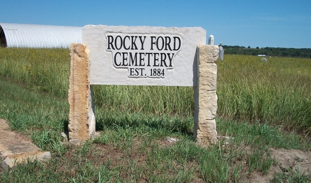
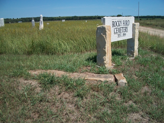
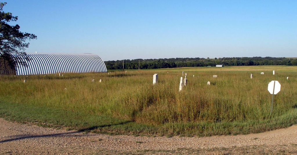
| Description | : | This cemetery is actually where Pleasant Grove Township was located, which was nearest to Neal, and also to Quincy, both in Greenwood County. Pleasant Grove Township was at first a community of people who had come on wagon train to eastern Greenwood County to farm. My great-great grandparents Key migrated there from New York State, and several generations continued to live there as others moved on and they acquired or rented their property. Some of my Boone cousins were next door neighbors, and many more first families. The local cemetery was always called the Means Cemetery after the Reverend William... Read More |
frequently asked questions (FAQ):
-
Where is Means Cemetery?
Means Cemetery is located at Neal, Greenwood County ,Kansas ,USA.
-
Means Cemetery cemetery's updated grave count on graveviews.com?
33 memorials
-
Where are the coordinates of the Means Cemetery?
Latitude: 37.8088989
Longitude: -96.0516968
Nearby Cemetories:
1. Neal Cemetery
Neal, Greenwood County, USA
Coordinate: 37.8224983, -96.0631027
2. Bedigrew Family Cemetery
Neal, Greenwood County, USA
Coordinate: 37.8197300, -95.9740300
3. End of the Trail Cemetery
Eureka, Greenwood County, USA
Coordinate: 37.7802410, -96.1484626
4. Quincy Cemetery
Quincy, Greenwood County, USA
Coordinate: 37.8833008, -95.9777985
5. Pleasant Valley Cemetery
Greenwood County, USA
Coordinate: 37.9028015, -96.0207977
6. Watts Haven Cemetery
Quincy, Greenwood County, USA
Coordinate: 37.9077200, -95.9823100
7. Wickersham Cemetery
Fall River, Greenwood County, USA
Coordinate: 37.6935000, -96.0756000
8. Whitehall Cemetery
Fall River, Greenwood County, USA
Coordinate: 37.6775700, -96.0711800
9. Emma's Hill Cemetery
Fall River, Greenwood County, USA
Coordinate: 37.6766400, -96.0790900
10. Worford Cemetery
Hamilton, Greenwood County, USA
Coordinate: 37.9414700, -96.0900400
11. Pike Cemetery (Defunct)
Fall River, Greenwood County, USA
Coordinate: 37.6650009, -96.0681000
12. Stewart Cemetery
Greenwood County, USA
Coordinate: 37.7885100, -96.2347700
13. Virgil Cemetery
Virgil, Greenwood County, USA
Coordinate: 37.9592018, -96.0033035
14. Browns Chapel Cemetery
Fall River, Greenwood County, USA
Coordinate: 37.6498300, -96.0927100
15. Homer Creek Cemetery
Greenwood County, USA
Coordinate: 37.9261017, -96.2097015
16. Charleston Cemetery
Fall River, Greenwood County, USA
Coordinate: 37.6371994, -96.0338974
17. Greenwood Cemetery
Eureka, Greenwood County, USA
Coordinate: 37.8231010, -96.2724991
18. Ott Cemetery
Hamilton, Greenwood County, USA
Coordinate: 37.9686012, -96.1502991
19. Belle Grove Cemetery
Fall River Township, Greenwood County, USA
Coordinate: 37.7133900, -96.2532200
20. Janesville Cemetery
Hamilton, Greenwood County, USA
Coordinate: 37.9853000, -96.1767000
21. Gage Cemetery
Fall River, Greenwood County, USA
Coordinate: 37.6208400, -96.1466100
22. Old Tailor Cemetery
Elk County, USA
Coordinate: 37.5885700, -95.9988700
23. Pleasant View Cemetery
Otter Creek, Greenwood County, USA
Coordinate: 37.6941986, -96.2977982
24. Mount Zion Cemetery
Cave Springs, Elk County, USA
Coordinate: 37.5844002, -96.0980988