
| Memorials | : | 0 |
| Location | : | Westfield, Clark County, USA |
| Coordinate | : | 39.4557304, -88.0004883 |
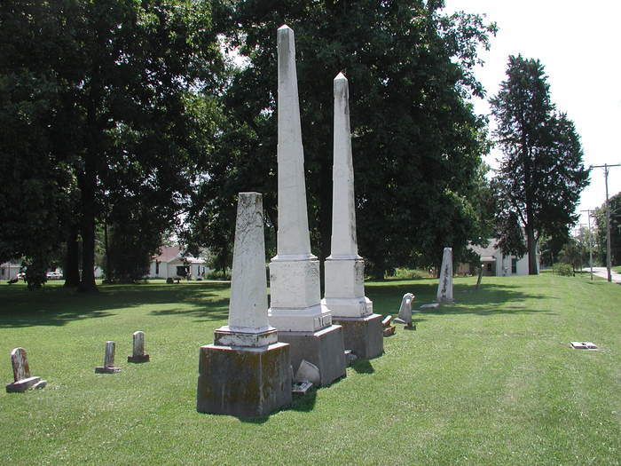
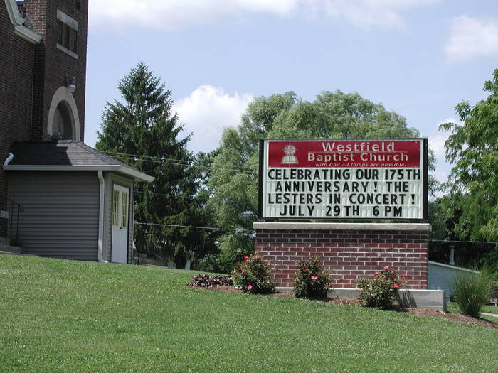
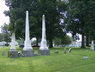
| Description | : | The Methodist Church in Westfield closed many years ago. The property, located on the corner of South Division and West Cherry, now belongs to the Baptist Church, but the cemetery is officially listed as "abandoned." The Baptist congregation mows the yard, but does nothing to keep up the cemetery. In one corner of the property is a pile of headstones that have been removed from their respective graves. In 1973, Freda Stipp of the Clark Cnty Genealogical Society did a census of the cemetery, listing 34 graves and commenting that there are "probably a lot more... Read More |
frequently asked questions (FAQ):
-
Where is Methodist Church Cemetery?
Methodist Church Cemetery is located at Westfield, Clark County ,Illinois ,USA.
-
Methodist Church Cemetery cemetery's updated grave count on graveviews.com?
0 memorials
-
Where are the coordinates of the Methodist Church Cemetery?
Latitude: 39.4557304
Longitude: -88.0004883
Nearby Cemetories:
1. Maple Hill Cemetery
Westfield, Clark County, USA
Coordinate: 39.4591990, -87.9925120
2. Good Hope Cemetery
Westfield, Clark County, USA
Coordinate: 39.4443710, -88.0058100
3. Otterbein Cemetery
Hutton Township, Coles County, USA
Coordinate: 39.4655418, -88.0186462
4. Broome Cemetery
Montgomery County, USA
Coordinate: 39.4596297, -87.9724841
5. Briscoe Family Burying Ground
Clark County, USA
Coordinate: 39.4628100, -87.9719690
6. Parker Cemetery #2
Hutton Township, Coles County, USA
Coordinate: 39.4320500, -88.0192200
7. Stewart Cemetery
Hutton Township, Coles County, USA
Coordinate: 39.4413872, -88.0547256
8. Wiley Brick Cemetery
Hutton Township, Coles County, USA
Coordinate: 39.4281616, -88.0453873
9. Wells Cemetery
Ashmore Township, Coles County, USA
Coordinate: 39.4995540, -88.0224370
10. Richwoods Cemetery
Westfield, Clark County, USA
Coordinate: 39.4658510, -87.9410510
11. Olmstead Cemetery
Ashmore Township, Coles County, USA
Coordinate: 39.4891750, -88.0447940
12. Connelly Cemetery
Clark County, USA
Coordinate: 39.4289000, -87.9376000
13. Enon-Ashmore Cemetery
Ashmore Township, Coles County, USA
Coordinate: 39.5034610, -88.0406840
14. Liberty Cemetery
Hutton Township, Coles County, USA
Coordinate: 39.4440613, -88.0775986
15. Reed Cemetery
Ashmore Township, Coles County, USA
Coordinate: 39.5141983, -88.0227966
16. Shoots Cemetery
Ashmore Township, Coles County, USA
Coordinate: 39.4824905, -88.0719070
17. Sargent Family Cemetery
Hutton Township, Coles County, USA
Coordinate: 39.4133153, -88.0612008
18. Poulter Cemetery
Kansas, Edgar County, USA
Coordinate: 39.5033500, -87.9447000
19. Waite Cemetery
Kansas, Edgar County, USA
Coordinate: 39.5139008, -87.9511032
20. Brandenburg Cemetery
Hutton Township, Coles County, USA
Coordinate: 39.4019203, -88.0614319
21. Ashmore Cemetery
Ashmore, Coles County, USA
Coordinate: 39.5269318, -88.0189972
22. Welsh Family Cemetery
Hutton Township, Coles County, USA
Coordinate: 39.4238890, -88.0852780
23. Freeman Cemetery
Hutton Township, Coles County, USA
Coordinate: 39.4700619, -88.0955331
24. Whetstone Cemetery
Hutton Township, Coles County, USA
Coordinate: 39.4429398, -88.0966263