| Memorials | : | 0 |
| Location | : | Pleasant Valley, Dutchess County, USA |
| Coordinate | : | 41.7505656, -73.8100419 |
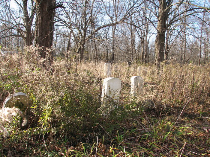
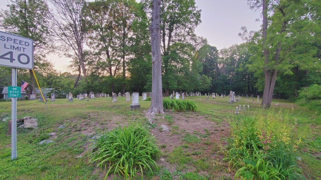
| Description | : | Pleasant Valley Methodist Episcopal Cemetery is owned by the Methodist Episcopal Society. The Methodist Episcopal Circuit of Dutchess County was formed approximately 1788. The former Methodist church was located at this site, as a schoolhouse. In 1845, the church was removed and relocated to the village of Pleasant Valley, during the pastorate of Rev. Jeremiah Ham. Another church existed in Washington Hollow (also known as Salt Point.) The grounds are now cleared and manicured, fairly flat, and well visible from Route 44 (situated beside an Automotive shop.) Parking is on street. There are well over 250 stones at this Cemetery.... Read More |
frequently asked questions (FAQ):
-
Where is Methodist Episcopal Church Cemetery?
Methodist Episcopal Church Cemetery is located at 1773 Route 44 Pleasant Valley, Dutchess County ,New York ,USA.
-
Methodist Episcopal Church Cemetery cemetery's updated grave count on graveviews.com?
0 memorials
-
Where are the coordinates of the Methodist Episcopal Church Cemetery?
Latitude: 41.7505656
Longitude: -73.8100419
Nearby Cemetories:
1. Saint Pauls Church Cemetery
Pleasant Valley, Dutchess County, USA
Coordinate: 41.7468900, -73.8155800
2. Pleasant Valley Friends Ground
Pleasant Valley, Dutchess County, USA
Coordinate: 41.7462748, -73.8235184
3. Pleasant Valley Cemetery
Pleasant Valley, Dutchess County, USA
Coordinate: 41.7420006, -73.8259964
4. Hebrew Fraternal Benevolent Society Cemetery
Lagrangeville, Dutchess County, USA
Coordinate: 41.7243900, -73.8467180
5. Temple Beth-El Cemetery
Poughkeepsie, Dutchess County, USA
Coordinate: 41.7246600, -73.8473700
6. Netherwood Baptist Church Cemetery
Salt Point, Dutchess County, USA
Coordinate: 41.7986832, -73.8183975
7. Kerk Hof Cemetery
Dutchess County, USA
Coordinate: 41.7644539, -73.7471542
8. Pittsbury Presbyterian Churchyard
Washington Hollow, Dutchess County, USA
Coordinate: 41.7822100, -73.7576400
9. Salt Point Cemetery
Salt Point, Dutchess County, USA
Coordinate: 41.8044300, -73.7948700
10. Mariapolis Luminosa Cemetery
Hyde Park, Dutchess County, USA
Coordinate: 41.7932360, -73.8780150
11. Crum Elbow Rural Cemetery
Hyde Park, Dutchess County, USA
Coordinate: 41.8046989, -73.8666992
12. LaGrange Rural Cemetery
Poughkeepsie, Dutchess County, USA
Coordinate: 41.6913986, -73.8632965
13. Saint Peters Cemetery
Poughkeepsie, Dutchess County, USA
Coordinate: 41.7214012, -73.8989029
14. Verbank Cemetery
Verbank, Dutchess County, USA
Coordinate: 41.7271700, -73.7148900
15. Oswego Friends Burial Ground
Moores Mill, Dutchess County, USA
Coordinate: 41.7020840, -73.7289720
16. Presbyterian Ground
Freedom Plains, Dutchess County, USA
Coordinate: 41.6691740, -73.7960560
17. Freedom Plains Cemetery
Lagrangeville, Dutchess County, USA
Coordinate: 41.6690200, -73.7960000
18. Union Cemetery
Hyde Park, Dutchess County, USA
Coordinate: 41.7855988, -73.9119034
19. Vassar Temple Cemetery
Arlington, Dutchess County, USA
Coordinate: 41.6919790, -73.8951620
20. Hebrew Fraternal Benevolent Society Cemetery
Arlington, Dutchess County, USA
Coordinate: 41.6920540, -73.8957040
21. Schomre Israel Cemetery
Arlington, Dutchess County, USA
Coordinate: 41.6920000, -73.8957000
22. Calvary Cemetery
Arlington, Dutchess County, USA
Coordinate: 41.6903000, -73.8938980
23. Creek Meeting House Friends Cemetery
Clinton Corners, Dutchess County, USA
Coordinate: 41.8314290, -73.7621780
24. Friends Cemetery
Clinton Corners, Dutchess County, USA
Coordinate: 41.8315290, -73.7621690


