
| Memorials | : | 2 |
| Location | : | Cuauhtemoc, Cuauhtémoc Borough, Mexico |
| Phone | : | 55 5546 0054 |
| Website | : | www.abmc.gov/cemeteries-memorials/americas/mexico-city-national-cemetery |
| Coordinate | : | 19.4420280, -99.1661660 |
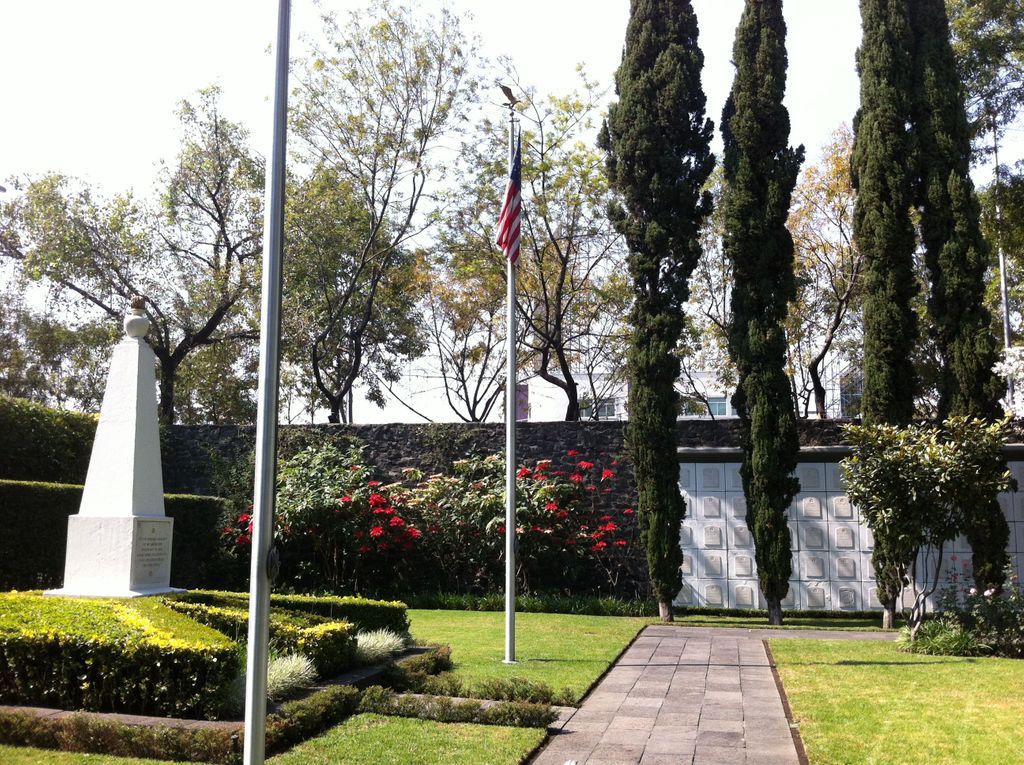
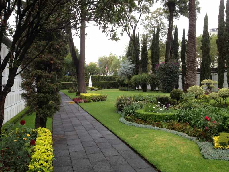
| Description | : | Cemetery contains remains of 750 unidentified soldiers of the Mexican War, with a single marker for all. The Mexico City National Cemetery is a cemetery in Mexico City. It was established in 1851 by the United States Congress to gather the American dead of the Mexican–American War that lay in the nearby fields and to provide burial space for Americans who died in the vicinity. The first dedicated United States military cemetery abroad, it served as a model for later cemeteries. Cemetery contains remains of 750 unidentified soldiers of the Mexican War, with a single marker for all. |
frequently asked questions (FAQ):
-
Where is Mexico City National Cemetery and Memorial?
Mexico City National Cemetery and Memorial is located at 31 Virginia Fabregas; Colonia San Rafael Cuauhtemoc, Cuauhtémoc Borough ,Distrito Federal ,Mexico.
-
Mexico City National Cemetery and Memorial cemetery's updated grave count on graveviews.com?
2 memorials
-
Where are the coordinates of the Mexico City National Cemetery and Memorial?
Latitude: 19.4420280
Longitude: -99.1661660


Nearby Cemetories:
1. British Cemetery (Defunct)
Cuauhtémoc Borough, Mexico
Coordinate: 19.4431080, -99.1654450
2. Parroquia de San Cosme y San Damián
Cuauhtemoc, Cuauhtémoc Borough, Mexico
Coordinate: 19.4407130, -99.1589220
3. Cementerio de San Cosme (Defunct)
Cuauhtemoc, Cuauhtémoc Borough, Mexico
Coordinate: 19.4405539, -99.1584287
4. Mausoleo Gayosso Sullivan
Cuauhtemoc, Cuauhtémoc Borough, Mexico
Coordinate: 19.4340330, -99.1627180
5. Monumento a la Revolución
Tabacalera, Cuauhtémoc Borough, Mexico
Coordinate: 19.4362100, -99.1546900
6. Ángel de la Independencia
Colonia Juarez, Cuauhtémoc Borough, Mexico
Coordinate: 19.4270040, -99.1676810
7. Iglesia de San Fernando
Guerrero, Cuauhtémoc Borough, Mexico
Coordinate: 19.4394940, -99.1486160
8. Panteón de San Fernando
Guerrero, Cuauhtémoc Borough, Mexico
Coordinate: 19.4390300, -99.1479600
9. Ex-Convento de San Diego
Centro, Cuauhtémoc Borough, Mexico
Coordinate: 19.4365580, -99.1462980
10. Cementerio de San Diego (Defunct)
Centro, Cuauhtémoc Borough, Mexico
Coordinate: 19.4355220, -99.1465890
11. Parroquia de la Sagrada Familia
Colonia Roma, Cuauhtémoc Borough, Mexico
Coordinate: 19.4224690, -99.1611980
12. Museo Tamayo Arte Contemporáneo
Miguel Hidalgo, Miguel Hidalgo Borough, Mexico
Coordinate: 19.4257402, -99.1817187
13. Panteón de la Iglesia de la Santa Veracruz (Defunct)
Guerrero, Cuauhtémoc Borough, Mexico
Coordinate: 19.4366733, -99.1424712
14. Iglesia de la Santa Veracruz
Guerrero, Cuauhtémoc Borough, Mexico
Coordinate: 19.4367660, -99.1422500
15. Panteón de Santa Paula (Defunct)
Guerrero, Cuauhtémoc Borough, Mexico
Coordinate: 19.4427610, -99.1411550
16. Camposanto de Santa María la Redonda (Defunct)
Guerrero, Cuauhtémoc Borough, Mexico
Coordinate: 19.4412300, -99.1410260
17. Panteón de Nuestra Señora de los Ángeles (Defunct)
Guerrero, Cuauhtémoc Borough, Mexico
Coordinate: 19.4494300, -99.1421310
18. Santuario de Nuestra Señora de los Ángeles
Guerrero, Cuauhtémoc Borough, Mexico
Coordinate: 19.4491622, -99.1419566
19. Altar a la Patria
Miguel Hidalgo, Miguel Hidalgo Borough, Mexico
Coordinate: 19.4214630, -99.1794010
20. Museo Nacional de Antropología
Polanco, Miguel Hidalgo Borough, Mexico
Coordinate: 19.4262610, -99.1859190
21. Templo y Exconvento de Santa Brígida (Defunct)
Centro, Cuauhtémoc Borough, Mexico
Coordinate: 19.4336791, -99.1414854
22. Camposanto de San Andrés (Defunct)
Guerrero, Cuauhtémoc Borough, Mexico
Coordinate: 19.4454640, -99.1401600
23. Panteón del Campo Florido (Defunct)
Cuauhtemoc, Cuauhtémoc Borough, Mexico
Coordinate: 19.4253300, -99.1464300
24. Capilla de Tercera Orden de San Francisco (Defunct)
Centro, Cuauhtémoc Borough, Mexico
Coordinate: 19.4344560, -99.1404470