| Memorials | : | 0 |
| Location | : | Middelkerke, Arrondissement Oostende, Belgium |
| Coordinate | : | 51.1863700, 2.8281500 |
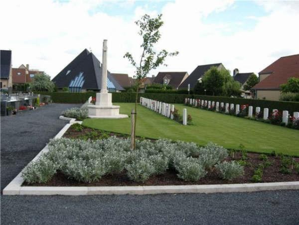
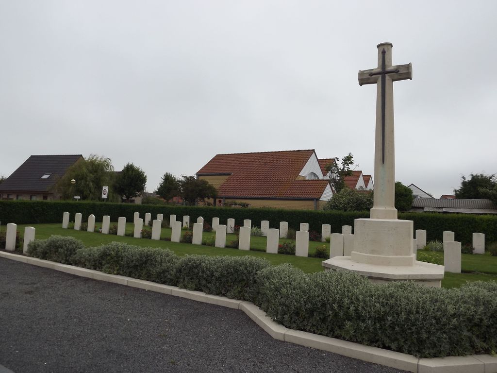
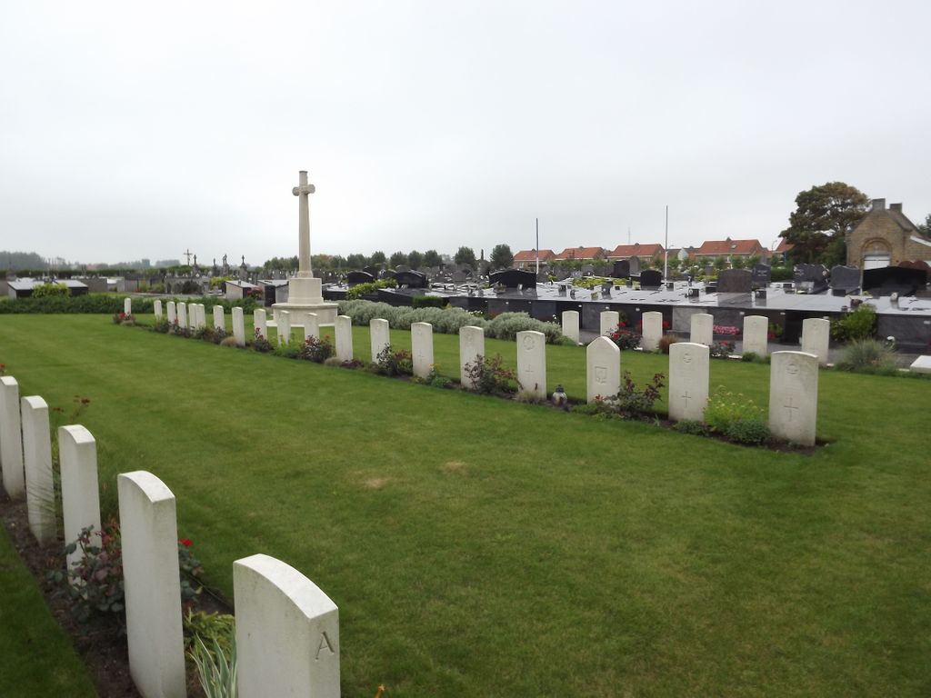
| Description | : | Visiting Information: Wheelchair access to site possible - maybe by an alternative entrance. For further information regarding wheelchair access, please contact our Enquiries Department on telephone number: 01628 634221 Location Information: Middelkerke Communal Cemetery is located 9 km south west of Oostende. From Oostende the N34 continues for 9 km to the costal town of Middelkerke. The town is approached via the C de Grootelaan which leads to the left hand turning onto Kerkstraat N325. The next immediate left hand turning leads onto the N318 Oostendelaan. 500 metres along the Oostendelaan lies the right hand turning onto the H.Prootstraat. The... Read More |
frequently asked questions (FAQ):
-
Where is Middelkerke Communal Cemetery?
Middelkerke Communal Cemetery is located at Middelkerke, Arrondissement Oostende ,West Flanders (West-Vlaanderen) ,Belgium.
-
Middelkerke Communal Cemetery cemetery's updated grave count on graveviews.com?
0 memorials
-
Where are the coordinates of the Middelkerke Communal Cemetery?
Latitude: 51.1863700
Longitude: 2.8281500
Nearby Cemetories:
1. Slijpe Communal Cemetery
Middelkerke, Arrondissement Oostende, Belgium
Coordinate: 51.1553260, 2.8477550
2. Mariakerke Churchyard
Ostend, Arrondissement Oostende, Belgium
Coordinate: 51.2114300, 2.8720900
3. Westende Communal Cemetery
Middelkerke, Arrondissement Oostende, Belgium
Coordinate: 51.1575900, 2.7725200
4. Oostende Old Communal Cemetery
Ostend, Arrondissement Oostende, Belgium
Coordinate: 51.2188200, 2.8956200
5. Stene Communal Cemetery
Ostend, Arrondissement Oostende, Belgium
Coordinate: 51.2016500, 2.9169000
6. Lombardsijde Churchyard
Middelkerke, Arrondissement Oostende, Belgium
Coordinate: 51.1489800, 2.7570500
7. Oostende New Communal Cemetery
Ostend, Arrondissement Oostende, Belgium
Coordinate: 51.2093030, 2.9152390
8. Sint-Joris Communal Cemetery
Nieuwpoort, Arrondissement Veurne, Belgium
Coordinate: 51.1290700, 2.7909400
9. Sint-Pieters-Kapelle Churchyard
Sint-Pieters-Kapelle, Arrondissement Oostende, Belgium
Coordinate: 51.1267124, 2.8753231
10. Nieuwpoort Communal Cemetery
Nieuwpoort, Arrondissement Veurne, Belgium
Coordinate: 51.1301600, 2.7641500
11. Ramscappelle Road Military Cemetery
Nieuwpoort, Arrondissement Veurne, Belgium
Coordinate: 51.1285600, 2.7678700
12. Snaaskerke Churchyard
Gistel, Arrondissement Oostende, Belgium
Coordinate: 51.1746500, 2.9372700
13. Saint Peter and Saint Paul Church
Ostend, Arrondissement Oostende, Belgium
Coordinate: 51.2296200, 2.9211600
14. Schore Churchyard
Schore, Arrondissement Oostende, Belgium
Coordinate: 51.1114550, 2.8392519
15. Ramskapelle Belgian Military Cemetery
Nieuwpoort, Arrondissement Veurne, Belgium
Coordinate: 51.1147600, 2.7640100
16. Ramskapelle Communal Cemetery
Nieuwpoort, Arrondissement Veurne, Belgium
Coordinate: 51.1092560, 2.7623940
17. Gistel Communal Cemetery
Gistel, Arrondissement Oostende, Belgium
Coordinate: 51.1600400, 2.9836700
18. Bredene Churchyard
Bredene, Arrondissement Oostende, Belgium
Coordinate: 51.2350860, 2.9770370
19. Oostduinkerke Communal Cemetery
Koksijde, Arrondissement Veurne, Belgium
Coordinate: 51.1212100, 2.6952300
20. Keiem Belgian Military Cemetery
Diksmuide, Arrondissement Diksmuide, Belgium
Coordinate: 51.0861200, 2.8844800
21. Stuivekenskerke Churchyard
Stuivekenskerke, Arrondissement Diksmuide, Belgium
Coordinate: 51.0769198, 2.8252690
22. St. Michael's Churchyard
Othery, Sedgemoor District, England
Coordinate: 51.0806000, 2.8830000
23. Booitshoeke Churchyard
Veurne, Arrondissement Veurne, Belgium
Coordinate: 51.0875040, 2.7441930
24. Pervijze Churchyard
Diksmuide, Arrondissement Diksmuide, Belgium
Coordinate: 51.0732700, 2.7945800


