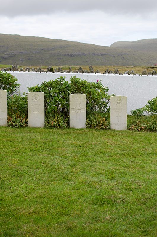
| Memorials | : | 0 |
| Location | : | Midvagur, Vága kommuna, Faroe Islands |
| Coordinate | : | 62.0470900, -7.2055300 |
| Description | : | Information from the Commonwealth War Graves Commission: Location Information- Midvaag is on the south coast of Vaago, one of the western islands of the group. The cemetery is to the west of Midvaag Harbour on the road to Sorvaag. The military cemetery is adjacent to the civil cemetery, to the west of Midvaag harbour, on the road to Sorvaag. Historical Information- The British occupation of the Faroe Islands during he Second World War, also known as 'Operation Valentine', was implemented immediately following the German invasion of Denmark and Norway. In April 1940, a small force of Commonwealth troops from the United Kingdom occupied the strategically important... Read More |
frequently asked questions (FAQ):
-
Where is Midvaag Military Cemetery?
Midvaag Military Cemetery is located at Midvagur, Vága kommuna ,Vágar ,Faroe Islands.
-
Midvaag Military Cemetery cemetery's updated grave count on graveviews.com?
0 memorials
-
Where are the coordinates of the Midvaag Military Cemetery?
Latitude: 62.0470900
Longitude: -7.2055300
Nearby Cemetories:
1. Sandavágur Church Cemetery
Sandavágur, Vága kommuna, Faroe Islands
Coordinate: 62.0537900, -7.1516000
2. Bøur Church Cemetery
Bøur, Sørvágs kommuna, Faroe Islands
Coordinate: 62.0862880, -7.3705970
3. Gásadalur Cemetery
Gásadalur, Sørvágs kommuna, Faroe Islands
Coordinate: 62.1097280, -7.4382430
4. Torshavn Cemetery
Tórshavn, Tórshavnar kommuna, Faroe Islands
Coordinate: 62.0008500, -6.7922100
5. Torshavn Cathedral
Tórshavn, Tórshavnar kommuna, Faroe Islands
Coordinate: 62.0095400, -6.7717800
6. Nýggi Kirkjugarðurin í Nólsoy
Nólsoy, Tórshavnar kommuna, Faroe Islands
Coordinate: 62.0055880, -6.6711679
7. Klaksvik Cemetery
Klaksvík, Klaksvíkar kommuna, Faroe Islands
Coordinate: 62.2266100, -6.5818900
8. Carney Family Cemetery
Fámjins kommuna, Faroe Islands
Coordinate: 61.5210600, -6.8685200
9. St Peters Kirkyard
Sandwick, Comox Valley Regional District, Canada
Coordinate: 59.0608361, -3.3441526
10. Shore Road
Scotland
Coordinate: 59.1181660, -3.0995341
11. Harray Parish Kirkyard
Scotland
Coordinate: 59.0426286, -3.1976435
12. Rendall Old Kirkyard
Scotland
Coordinate: 59.0607864, -3.0049804
13. Papeykirkjugarður
Iceland
Coordinate: 64.5900200, -14.1634800
14. Dunn Old Chapelyard
Scotland
Coordinate: 58.4850700, -3.3700400
15. Stöðvarfjarðarkirkjugarður
Iceland
Coordinate: 64.8369600, -13.8902900
16. Kolfreyjustaðarkirkjugarður
Iceland
Coordinate: 64.9124900, -13.7967900
17. Djúpavogskirkjugarður
Iceland
Coordinate: 64.6586000, -14.3162000
18. Beruneskirkjugarður
Iceland
Coordinate: 64.6983900, -14.2558200
19. Heydalakirkjugarður
Iceland
Coordinate: 64.7974000, -14.1323900
20. Badenscallie Burial Ground
Scotland
Coordinate: 58.0009120, -5.3239274
21. Hofskirkjugarður
Iceland
Coordinate: 64.5451800, -14.6172700
22. Stafafellskirkjugarður
Iceland
Coordinate: 64.4191600, -14.8591600
23. Fáskrúðsfjarðarkirkjugarður
Iceland
Coordinate: 64.9338500, -14.0286500
24. Neskaupstaðarkirkjugarður
Iceland
Coordinate: 65.1482300, -13.6654300


