| Memorials | : | 0 |
| Location | : | Oakland, Douglas County, USA |
| Coordinate | : | 43.4737260, -123.2267760 |
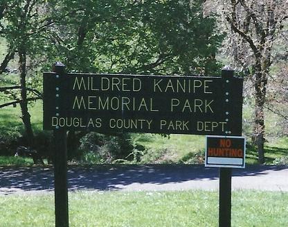
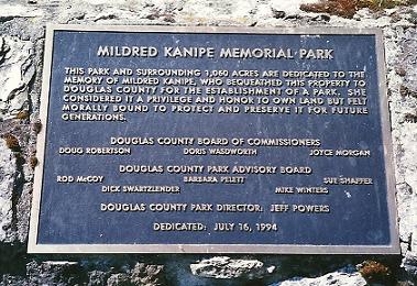
| Description | : | This is the site of the Mildred Kanipe Memorial Park. It was Mildred Kanipe's ranch. She is buried next to her ranch house. Her gravesite is surrounded by a picket fence. Directions: From I-5 north of Sutherlin, Oregon, take Exit 138; turn right onto Oak St in Oakland and follow it out of town to Driver Valley Road; continue to Elkhead Rd, turn left. The Mildred Kanipe Memorial Park will be on the left side. From I-5 south, heading towards Oakland, near Yoncalla, take Exit 154, then Elkhead Rd; the Mildred Kanipe Memorial Park will be on the right side of the road. Mildred... Read More |
frequently asked questions (FAQ):
-
Where is Mildred Kanipe Memorial Park?
Mildred Kanipe Memorial Park is located at 16513 Elkhead Road Oakland, Douglas County ,Oregon ,USA.
-
Mildred Kanipe Memorial Park cemetery's updated grave count on graveviews.com?
0 memorials
-
Where are the coordinates of the Mildred Kanipe Memorial Park?
Latitude: 43.4737260
Longitude: -123.2267760
Nearby Cemetories:
1. Harvey Cemetery
Douglas County, USA
Coordinate: 43.4542007, -123.2208023
2. Harris Family Cemetery
Douglas County, USA
Coordinate: 43.5056000, -123.2069016
3. Schoolmarm Wood Family Cemetery
Oakland, Douglas County, USA
Coordinate: 43.4239100, -123.2077570
4. Fair Oaks Cemetery
Sutherlin, Douglas County, USA
Coordinate: 43.4152985, -123.2193985
5. Oakland Masonic and Old Town Oakland Cemeteries
Oakland, Douglas County, USA
Coordinate: 43.4375000, -123.3028030
6. Valley View Cemetery
Sutherlin, Douglas County, USA
Coordinate: 43.4000015, -123.2444000
7. Cedar Hill Cemetery
Oakland, Douglas County, USA
Coordinate: 43.4242100, -123.3101800
8. Reason-Reed Cemetery
Oakland, Douglas County, USA
Coordinate: 43.4188995, -123.3153000
9. Metz Hill Cemetery
Douglas County, USA
Coordinate: 43.4542007, -123.3499985
10. Cowan Family Cemetery
Yoncalla, Douglas County, USA
Coordinate: 43.5929160, -123.2587980
11. Applegate Pioneer Cemetery
Yoncalla, Douglas County, USA
Coordinate: 43.5943985, -123.2889023
12. Drain-Yoncalla Masonic Cemetery
Yoncalla, Douglas County, USA
Coordinate: 43.5949120, -123.2877620
13. Goff Family Cemetery
Sutherlin, Douglas County, USA
Coordinate: 43.3681715, -123.3329146
14. Hurst Family Cemetery
Douglas County, USA
Coordinate: 43.3802986, -123.3921967
15. Tyee View Cemetery
Tyee, Douglas County, USA
Coordinate: 43.4029999, -123.4260025
16. Applegate Family Cemetery
Yoncalla, Douglas County, USA
Coordinate: 43.6273390, -123.3060960
17. Otey Cemetery
Wilbur, Douglas County, USA
Coordinate: 43.3400002, -123.3589020
18. Reed Hill Pioneer Cemetery
Wilbur, Douglas County, USA
Coordinate: 43.3258200, -123.3381000
19. Wilbur Cemetery
Wilbur, Douglas County, USA
Coordinate: 43.3254600, -123.3380600
20. Bemis Cemetery
Cottage Grove, Lane County, USA
Coordinate: 43.6152992, -123.0777969
21. Shoestring Cemetery
Elkhead, Douglas County, USA
Coordinate: 43.6513900, -123.1833300
22. Indian Burial Ground
Douglas County, USA
Coordinate: 43.6514015, -123.1832962
23. Dixon Family Cemetery
Douglas County, USA
Coordinate: 43.2902570, -123.2644610
24. East Drain Cemetery
Drain, Douglas County, USA
Coordinate: 43.6542015, -123.2944031


