
| Memorials | : | 0 |
| Location | : | Jackson, Washington County, USA |
| Coordinate | : | 43.3026800, -88.1301600 |
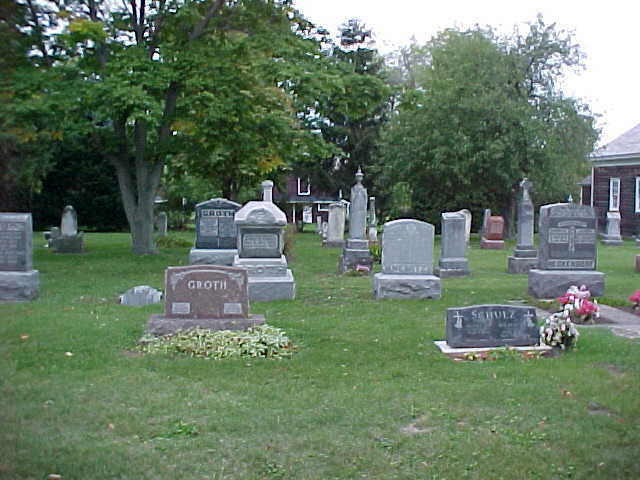
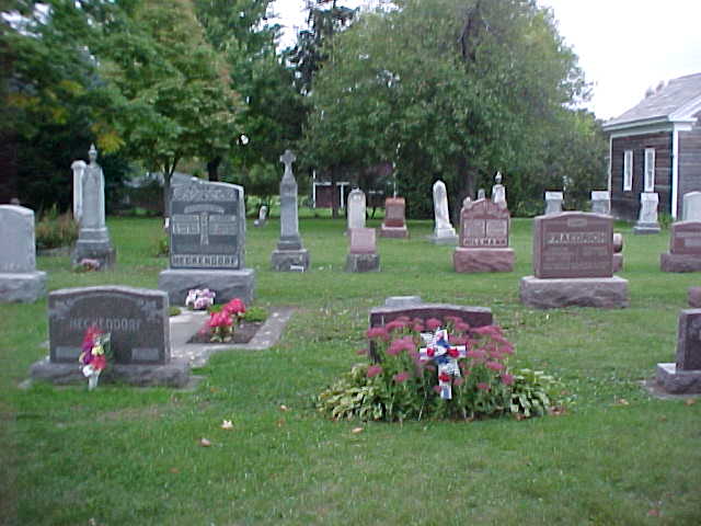
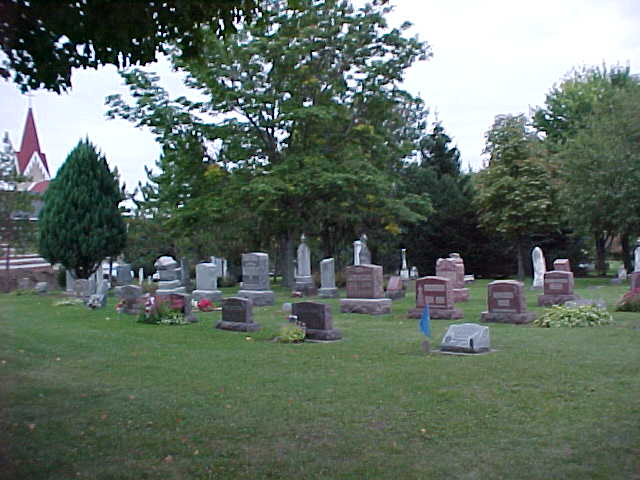
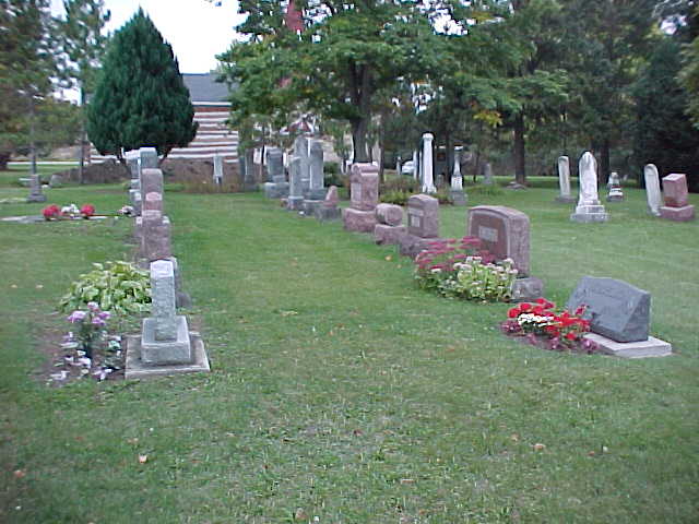
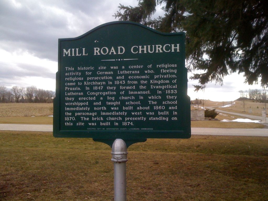
| Description | : | Mill Road Church (Immanuel Ev. Lutheran Church) is located on the north side of Mill Road, just west of the intersection with Division Road (Highway G) in the town of Jackson. The cemetery is behind the church to the left. .3 miles The Mill Road Church is now the location of the Jackson Historical Society. |
frequently asked questions (FAQ):
-
Where is Mill Road Church Cemetery?
Mill Road Church Cemetery is located at 1860 Mill Road Jackson, Washington County ,Wisconsin ,USA.
-
Mill Road Church Cemetery cemetery's updated grave count on graveviews.com?
0 memorials
-
Where are the coordinates of the Mill Road Church Cemetery?
Latitude: 43.3026800
Longitude: -88.1301600
Nearby Cemetories:
1. Saint John Cemetery
Jackson, Washington County, USA
Coordinate: 43.2930984, -88.1231003
2. Davids Star Evangelical Lutheran Cemetery
Kirchhayn, Washington County, USA
Coordinate: 43.2872100, -88.1076500
3. Zion Lutheran Cemetery
Jackson, Washington County, USA
Coordinate: 43.3212500, -88.1024600
4. Saint Peters United Church of Christ Cemetery
Jackson, Washington County, USA
Coordinate: 43.2811737, -88.1767426
5. Christ Lutheran Church Cemetery
Jackson, Washington County, USA
Coordinate: 43.3382300, -88.1655200
6. Last Home Cemetery
Jackson, Washington County, USA
Coordinate: 43.3386500, -88.1799200
7. Friedens Cemetery
Jackson, Washington County, USA
Coordinate: 43.3382200, -88.1812500
8. Christ Evangelical Church Cemetery
Germantown, Washington County, USA
Coordinate: 43.2508400, -88.1437500
9. Trinity Evangelical Lutheran Cemetery
Jackson, Washington County, USA
Coordinate: 43.3515100, -88.1006200
10. Trinity Old Evangelical Lutheran Cemetery
Jackson, Washington County, USA
Coordinate: 43.3520400, -88.1009900
11. Polk Dairy Cemetery
Mayfield, Washington County, USA
Coordinate: 43.3109400, -88.2040800
12. Our Saviour's United Church of Christ Cemetery
Germantown, Washington County, USA
Coordinate: 43.2453630, -88.1234090
13. Mayfield Cemetery
Mayfield, Washington County, USA
Coordinate: 43.3342018, -88.1980972
14. Cedar Park Cemetery
Richfield, Washington County, USA
Coordinate: 43.2807999, -88.2117004
15. Laubenheimer Family Cemetery
Richfield, Washington County, USA
Coordinate: 43.2562540, -88.1937550
16. Earling Cemetery
Rugby Junction, Washington County, USA
Coordinate: 43.2812980, -88.2153220
17. Saint Marys Cemetery
Jackson, Washington County, USA
Coordinate: 43.3516998, -88.0653000
18. Saint Boniface Cemetery
Germantown, Washington County, USA
Coordinate: 43.2355804, -88.1621628
19. Still Waters Memorial Garden
Jackson, Washington County, USA
Coordinate: 43.3208770, -88.2247920
20. Cedar Creek Cemetery
Cedar Creek, Washington County, USA
Coordinate: 43.3450012, -88.2208023
21. Last Home Cemetery
Germantown, Washington County, USA
Coordinate: 43.2244987, -88.1029816
22. Saint Jacobi Cemetery
Richfield, Washington County, USA
Coordinate: 43.2543983, -88.2210999
23. Forest Home Cemetery
Richfield, Washington County, USA
Coordinate: 43.2532997, -88.2210999
24. Saint Marys Church Cemetery
Richfield, Washington County, USA
Coordinate: 43.2775497, -88.2407684