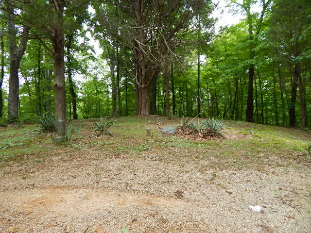
| Memorials | : | 0 |
| Location | : | Eckerty, Crawford County, USA |
| Coordinate | : | 38.2892000, -86.6262000 |
| Description | : | The cemetery is located in Johnson Township (NE quadrant of the SE quadrant of the NE quadrant of Section 4 Township 3S Range 2W) about 2200 feet east of the S Speedy Road (County Road 111) about 0.4 miles south of its intersection with Mitchell Creek Road. Indiana Cemetery Locations, Volume 1, published by the Indiana Genealogical Society (02 April 2005), gives the primary cemetery name as Mitchell Cemetery. The cemetery is listed in the Cemetery and Burial Grounds Registry of the Indiana Department of Natural Resources (DNR) and in the State Historical Architectural and Archaeological Research Database... Read More |
frequently asked questions (FAQ):
-
Where is Mitchell Cemetery?
Mitchell Cemetery is located at S Speedy Road (County Road 111) Eckerty, Crawford County ,Indiana , 47116USA.
-
Mitchell Cemetery cemetery's updated grave count on graveviews.com?
0 memorials
-
Where are the coordinates of the Mitchell Cemetery?
Latitude: 38.2892000
Longitude: -86.6262000
Nearby Cemetories:
1. Newton-Cole-Jones Cemetery
Eckerty, Crawford County, USA
Coordinate: 38.2957000, -86.6283000
2. Mingus Cemetery
Eckerty, Crawford County, USA
Coordinate: 38.2748790, -86.6298800
3. Rowland-Potter Cemetery
Crawford County, USA
Coordinate: 38.3074989, -86.6247025
4. Gilmore Cemetery
Crawford County, USA
Coordinate: 38.2994003, -86.6050034
5. Adams Cemetery
Eckerty, Crawford County, USA
Coordinate: 38.3053000, -86.6414000
6. Newton Cemetery
Eckerty, Crawford County, USA
Coordinate: 38.2819300, -86.5895000
7. Oak Hill-Wright Cemetery
Eckerty, Crawford County, USA
Coordinate: 38.2781950, -86.6623880
8. Davis-King Cemetery
Riceville, Crawford County, USA
Coordinate: 38.3072014, -86.6616974
9. Bethany Union Cemetery
Eckerty, Crawford County, USA
Coordinate: 38.2848710, -86.5813420
10. Eckerty Cemetery
Eckerty, Crawford County, USA
Coordinate: 38.3253340, -86.6106480
11. Blunk Cemetery
Riceville, Crawford County, USA
Coordinate: 38.3106003, -86.6706009
12. Sigler Cemetery
Perry County, USA
Coordinate: 38.2534990, -86.6560660
13. Sigler Cemetery
Perry County, USA
Coordinate: 38.2588997, -86.6663971
14. Valley Cemetery
Perry County, USA
Coordinate: 38.2430992, -86.6057968
15. Doolittle Mills Cemetery
Doolittle Mills, Perry County, USA
Coordinate: 38.2427000, -86.6057000
16. Newton-Cummins Cemetery
Birdseye, Dubois County, USA
Coordinate: 38.2869700, -86.6902300
17. Pleasant Ridge Cemetery
West Fork, Crawford County, USA
Coordinate: 38.2802620, -86.5630493
18. Farmer Cemetery
Crawford County, USA
Coordinate: 38.3019676, -86.5595856
19. Garland Cemetery
Birdseye, Dubois County, USA
Coordinate: 38.2993700, -86.6960710
20. Birdseye Cemetery
Birdseye, Dubois County, USA
Coordinate: 38.3131676, -86.6917648
21. Brady Cemetery
Jefferson Township, Dubois County, USA
Coordinate: 38.2604500, -86.6888500
22. Sinclair Cemetery #2
Wickliffe, Crawford County, USA
Coordinate: 38.3432210, -86.6549310
23. Enlow Cemetery
Uniontown, Perry County, USA
Coordinate: 38.2338982, -86.6508026
24. Underhill Cemetery
Saint Croix, Perry County, USA
Coordinate: 38.2305984, -86.6260986

