
| Memorials | : | 20 |
| Location | : | Stellenbosch, Cape Winelands District Municipality, South Africa |
| Phone | : | +27 21 883 3458 |
| Website | : | www.moederkerk.co.za |
| Coordinate | : | -33.9376595, 18.8642422 |
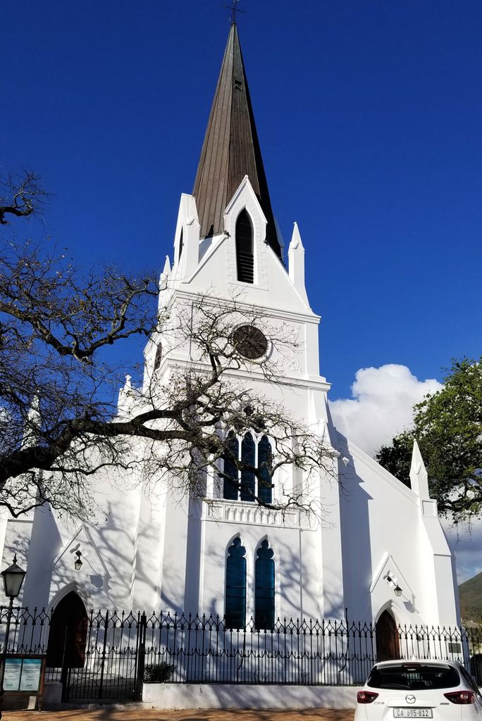
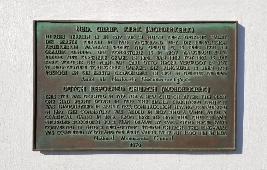
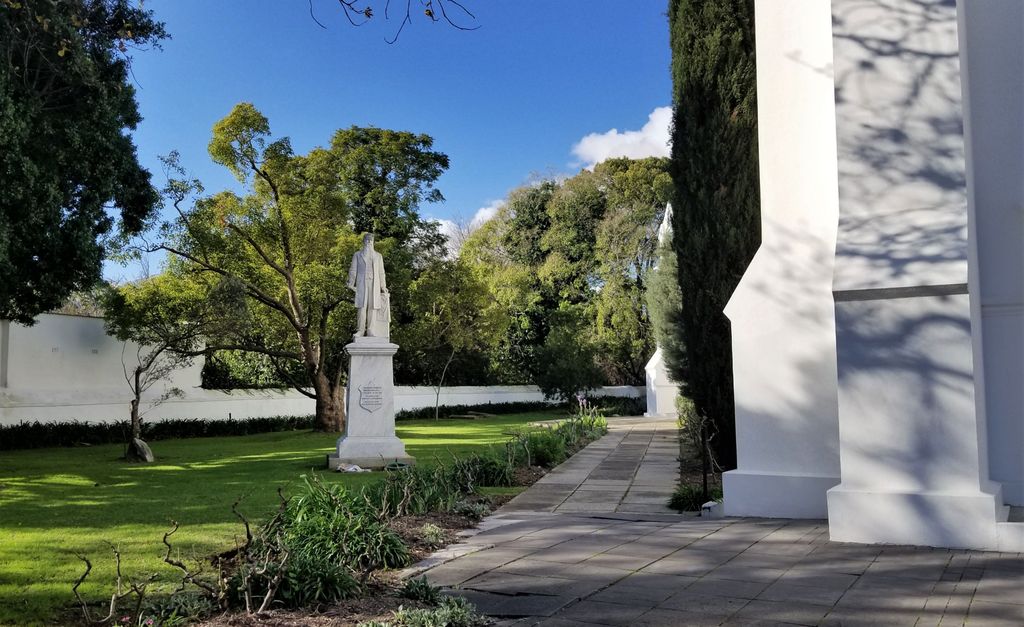
| Description | : | 'n kort geskiedenis van die Moederkerk Stellenbosch grafkelder en gedenkmure by E. Smith The town of Stellenbosch, also known as Eikestad (City of Oaks), was founded in the late 17th century by the first European governor of the Cape Colony, Simon van der Stel (b. 1639 – d. 1712). The town, which bears his name, was nearly destroyed completely by a fire in 1710. Following the fire, the town returned unhindered rebuilt the church in its current location in 1717. As the town grew, the new church soon became too small to hold the growing Dutch Reformed population, so... Read More |
frequently asked questions (FAQ):
-
Where is Moederkerk Stellenbosch grafkelder en gedenkmure?
Moederkerk Stellenbosch grafkelder en gedenkmure is located at Drostdystraat 2 Stellenbosch, Cape Winelands District Municipality ,Western Cape , 7600South Africa.
-
Moederkerk Stellenbosch grafkelder en gedenkmure cemetery's updated grave count on graveviews.com?
20 memorials
-
Where are the coordinates of the Moederkerk Stellenbosch grafkelder en gedenkmure?
Latitude: -33.9376595
Longitude: 18.8642422
Nearby Cemetories:
1. NG Kerk - Stellenbosch-Sentraal Gedenkmuur
Stellenbosch, Cape Winelands District Municipality, South Africa
Coordinate: -33.9302330, 18.8832500
2. Jamestown Cemetery
Jamestown, Cape Winelands District Municipality, South Africa
Coordinate: -33.9819734, 18.8410321
3. St. John's Churchayrd
Kylemore, Cape Winelands District Municipality, South Africa
Coordinate: -33.9116485, 18.9486597
4. Pniel Cemetery
Pniel, Cape Winelands District Municipality, South Africa
Coordinate: -33.8967389, 18.9577026
5. Lanquedoc Cemetery
Cape Winelands District Municipality, South Africa
Coordinate: -33.9046149, 18.9652538
6. Pniel United Congregational Church Cemetery
Pniel, Cape Winelands District Municipality, South Africa
Coordinate: -33.8915330, 18.9585000
7. Raithby Cemetery
City of Cape Town Metropolitan Municipality, South Africa
Coordinate: -34.0194608, 18.8080611
8. St. George's Churchyard
Simondium, Cape Winelands District Municipality, South Africa
Coordinate: -33.8694533, 18.9871936
9. Franschhoek St Georges Churchyard
Franschhoek, Cape Winelands District Municipality, South Africa
Coordinate: -33.8695160, 18.9872990
10. NG Kerk - Simondium Kerkhof
Cape Winelands District Municipality, South Africa
Coordinate: -33.8391931, 18.9571992
11. Welmoed Cemetery
Kuils River, City of Cape Town Metropolitan Municipality, South Africa
Coordinate: -33.9877820, 18.7235120
12. Courtrai Cemetery
Cape Winelands District Municipality, South Africa
Coordinate: -33.8382805, 18.9596530
13. NG Kerk - Simondium Begraafplaas
Cape Winelands District Municipality, South Africa
Coordinate: -33.8393489, 18.9618987
14. Wallace Dene Cemetery
Kraaifontein, City of Cape Town Metropolitan Municipality, South Africa
Coordinate: -33.8508770, 18.7514990
15. St. Paul's Churchyard
City of Cape Town Metropolitan Municipality, South Africa
Coordinate: -34.0270891, 18.7444875
16. Kleinvlei Cemetery
Cape Town, City of Cape Town Metropolitan Municipality, South Africa
Coordinate: -33.9906530, 18.7038480
17. Kuils River Cemetery
Kuils River, City of Cape Town Metropolitan Municipality, South Africa
Coordinate: -33.9383670, 18.6864040
18. NG Kerk - Somerset West Kerkhof
Somerset West, City of Cape Town Metropolitan Municipality, South Africa
Coordinate: -34.0860560, 18.8476110
19. Eikendalm Memorial Park
Kraaifontein, City of Cape Town Metropolitan Municipality, South Africa
Coordinate: -33.8590830, 18.7111170
20. Somerset West Cemetery
Somerset West, City of Cape Town Metropolitan Municipality, South Africa
Coordinate: -34.0863700, 18.8414100
21. NG Kerk - Kuilsrivier de Eike Muur van Herinnering
Kuils River, City of Cape Town Metropolitan Municipality, South Africa
Coordinate: -33.9129830, 18.6822000
22. NG Kerk - Kuilsrivier Gedenktuin
Kuils River, City of Cape Town Metropolitan Municipality, South Africa
Coordinate: -33.9241170, 18.6792000
23. Makassar Muslim Cemetery
Macassar, City of Cape Town Metropolitan Municipality, South Africa
Coordinate: -34.0640274, 18.7506466
24. Goedehoop Cemetery
Strand, City of Cape Town Metropolitan Municipality, South Africa
Coordinate: -34.0958690, 18.8329780