
| Memorials | : | 5 |
| Location | : | Mogote, Conejos County, USA |
| Coordinate | : | 37.0522003, -106.0868988 |
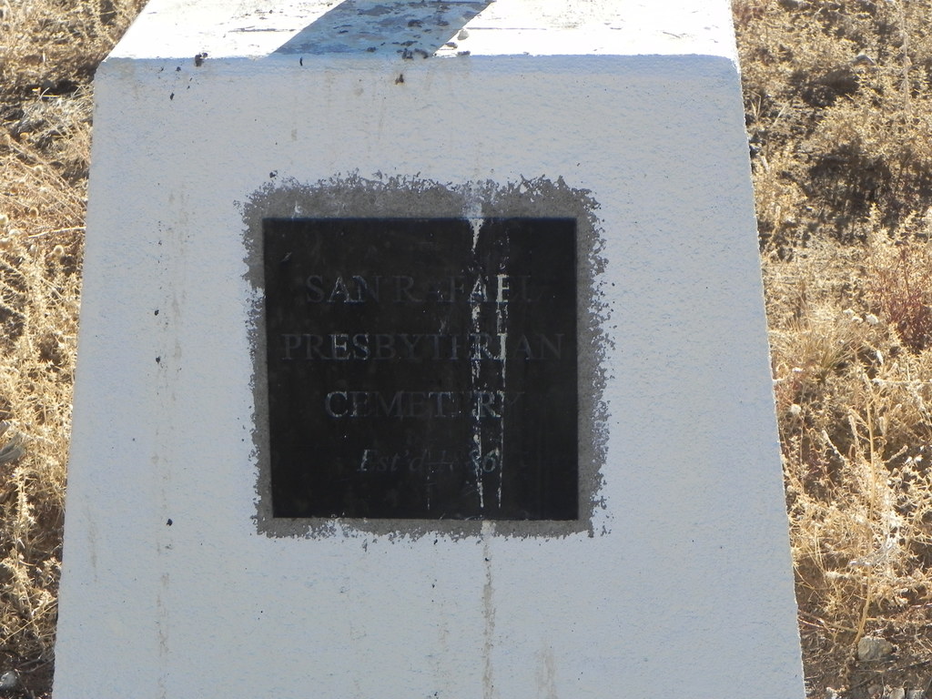
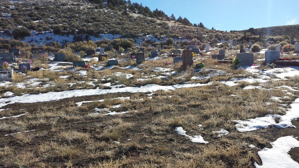
| Description | : | The Magote Presbyterian Church was built in 1885 and is one of the oldest protestant churches in the San Luis Valley. It was originally called the San Rafael Presbyterian Church. The Cemetery is located about a mile south east from the church on County Road 9 in Magote Colorado. It was established in 1865. A lot of the older markers are not legible. |
frequently asked questions (FAQ):
-
Where is Mogote Presbyterian Cemetery?
Mogote Presbyterian Cemetery is located at Mogote, Conejos County ,Colorado ,USA.
-
Mogote Presbyterian Cemetery cemetery's updated grave count on graveviews.com?
5 memorials
-
Where are the coordinates of the Mogote Presbyterian Cemetery?
Latitude: 37.0522003
Longitude: -106.0868988
Nearby Cemetories:
1. Las Mesitas Cemetery
Las Mesitas, Conejos County, USA
Coordinate: 37.0651770, -106.1091540
2. Martinez Cemetery
Las Mesitas, Conejos County, USA
Coordinate: 37.0642100, -106.1277700
3. Ortiz Cemetery
Antonito, Conejos County, USA
Coordinate: 37.0099983, -106.0492020
4. Old Ortiz Cemetery
Antonito, Conejos County, USA
Coordinate: 37.0093180, -106.0438870
5. Conejos Cemetery
Antonito, Conejos County, USA
Coordinate: 37.0842018, -106.0175018
6. Antonito Cemetery
Antonito, Conejos County, USA
Coordinate: 37.0819016, -106.0156021
7. Warshaver Cemetery
Antonito, Conejos County, USA
Coordinate: 37.0828018, -106.0152969
8. San Antonio Cemetery
San Antonio, Conejos County, USA
Coordinate: 37.0161018, -106.0194016
9. San Miguel Cemetery
Rio Arriba County, USA
Coordinate: 36.9585991, -106.1477966
10. Fox Creek Cemetery
Fox Creek, Conejos County, USA
Coordinate: 37.0750008, -106.2177963
11. La Isla Cemetery
Manassa, Conejos County, USA
Coordinate: 37.0864860, -105.9555750
12. Lobatos Cemetery
Conejos County, USA
Coordinate: 37.0630989, -105.9116974
13. Nance Family Cemetery
Manassa, Conejos County, USA
Coordinate: 37.1569020, -105.9380870
14. Sowards Cemetery
Manassa, Conejos County, USA
Coordinate: 37.1577988, -105.9381027
15. Old Manassa Cemetery
Manassa, Conejos County, USA
Coordinate: 37.1575012, -105.9366989
16. New Manassa Cemetery
Manassa, Conejos County, USA
Coordinate: 37.1486015, -105.9203033
17. Los Cerritos Cemetery
Los Cerritos, Conejos County, USA
Coordinate: 37.1494000, -105.9127000
18. Flower Family Graves
Manassa, Conejos County, USA
Coordinate: 37.1519000, -105.8915000
19. Saint Joseph Church Old Cemetery
Capulin, Conejos County, USA
Coordinate: 37.2814000, -106.1118000
20. Saint Joseph Cemetery
Conejos County, USA
Coordinate: 37.2841988, -106.0980988
21. Sanford Cemetery
Sanford, Conejos County, USA
Coordinate: 37.2374992, -105.9103012
22. Old Capulin Cemetery
Capulin, Conejos County, USA
Coordinate: 37.2980995, -106.1097031
23. La Jara Cemetery
La Jara, Conejos County, USA
Coordinate: 37.2977982, -105.9610977
24. De la Luz Cemetery
Conejos County, USA
Coordinate: 37.3347015, -106.2146988