
| Memorials | : | 18 |
| Location | : | Roosevelt County, USA |
| Coordinate | : | 48.0203018, -104.0466995 |
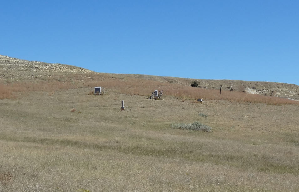
| Description | : | Township 26N - Range 59E - Section 12. Located across the highway from the Ft. Union turnoff and across the railroad tracks. Approx. 1 mile West of Mondak (with very few buildings still standing -- a jail and school). The cemetery can be reached today only in a 4-wheel drive vehicle as there is no road into the area. It is located on 4 acres of land and is owned today by Greg Heen. Today the fence no longer stands around the cemetery itself but there are several graves with headstones and nice fences around some... Read More |
frequently asked questions (FAQ):
-
Where is Mondak Cemetery?
Mondak Cemetery is located at Roosevelt County ,Montana ,USA.
-
Mondak Cemetery cemetery's updated grave count on graveviews.com?
1 memorials
-
Where are the coordinates of the Mondak Cemetery?
Latitude: 48.0203018
Longitude: -104.0466995

Nearby Cemetories:
1. Fort Union Cemetery West
Buford, Williams County, USA
Coordinate: 47.9993950, -104.0427180
2. Fort Union Cemetery East
Buford, Williams County, USA
Coordinate: 47.9992210, -104.0389010
3. Buford Cemetery
Buford, Williams County, USA
Coordinate: 48.0125008, -103.9946976
4. Fort Buford Cemetery
Fort Buford, Williams County, USA
Coordinate: 47.9840000, -104.0032800
5. Nohly Cemetery
Richland County, USA
Coordinate: 48.0133018, -104.1268997
6. Westview Cemetery
Buford, Williams County, USA
Coordinate: 48.0964012, -104.0081024
7. Fourmile Cemetery
Richland County, USA
Coordinate: 47.9542007, -104.1355972
8. Fairview Cemetery
East Fairview, McKenzie County, USA
Coordinate: 47.8764000, -104.0397034
9. Trenton Cemetery
Trenton, Williams County, USA
Coordinate: 48.0742500, -103.8327500
10. Round Prairie Cemetery
Williston, Williams County, USA
Coordinate: 48.1688580, -103.9722990
11. Pioneer Cemetery
Fairview, Richland County, USA
Coordinate: 47.8558006, -104.0522003
12. Bainville Cemetery
Bainville, Roosevelt County, USA
Coordinate: 48.1418991, -104.2127991
13. Yellowstone Point Cemetery
Cartwright, McKenzie County, USA
Coordinate: 47.8983002, -103.8597031
14. Painted Woods Cemetery
Williston, Williams County, USA
Coordinate: 48.1516991, -103.8197021
15. Nameless Cemetery
McKenzie County, USA
Coordinate: 47.8657990, -103.8386002
16. Saint Peters Lutheran Cemetery
Richland County, USA
Coordinate: 47.8969002, -104.3300018
17. Bethel Cemetery
Cartwright, McKenzie County, USA
Coordinate: 47.7867012, -104.0227966
18. Cherry Creek Cemetery
Richland County, USA
Coordinate: 47.9928017, -104.4167023
19. Saint Lucas Cemetery
Williston, Williams County, USA
Coordinate: 48.2557300, -103.9206500
20. Charbonneau Cemetery
Charbonneau, McKenzie County, USA
Coordinate: 47.8551140, -103.7545624
21. Saint Paul Lutheran Cemetery
Williston, Williams County, USA
Coordinate: 48.2277832, -103.8069153
22. Seventh Day Adventist Cemetery
Williston, Williams County, USA
Coordinate: 48.2853280, -104.0150860
23. Camp Creek Cemetery
McKenzie County, USA
Coordinate: 47.9343987, -103.6691971
24. Hebron Ukrainian Russian Cemetery
Williston, Williams County, USA
Coordinate: 48.2701420, -103.8955900