
| Memorials | : | 3 |
| Location | : | Greenville, Montcalm County, USA |
| Coordinate | : | 43.2338982, -85.2716980 |
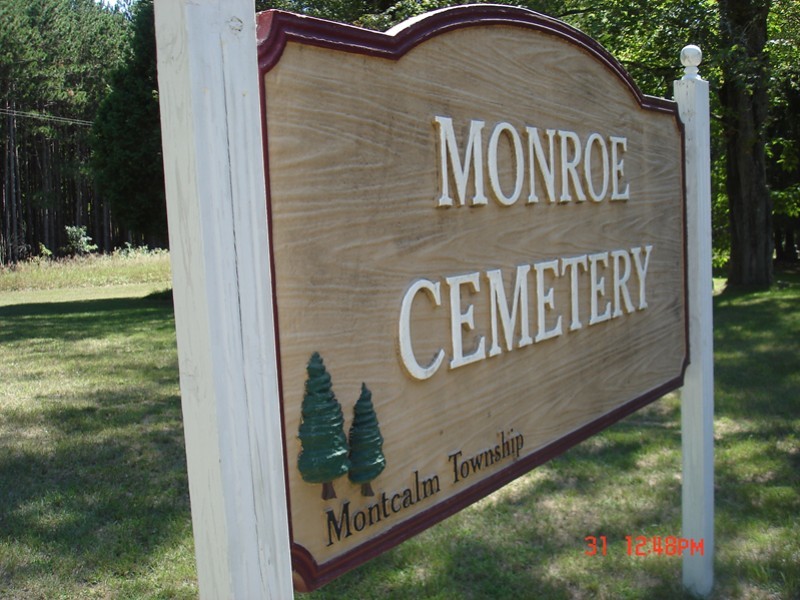
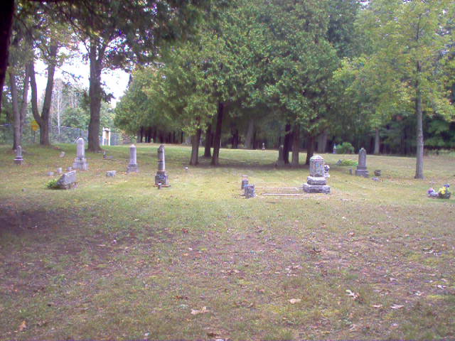
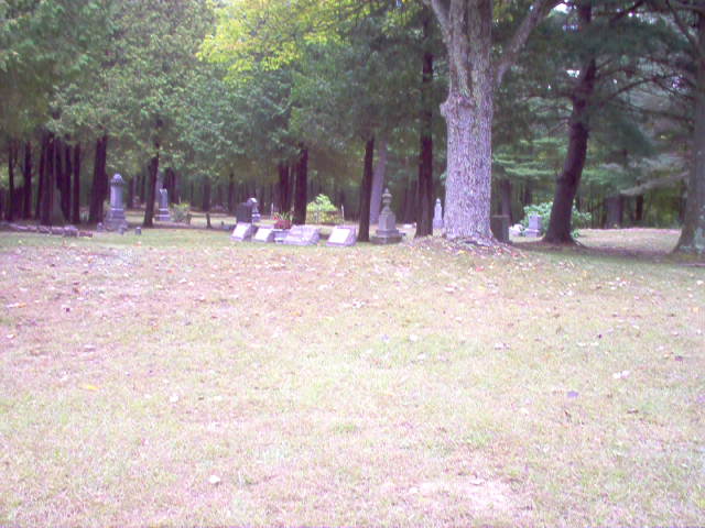
| Description | : | The cemetery is located in Montcalm Township on the east side of Monroe Road about 0.1 miles south of its intersection with W Holland Lake Road. The U.S. Geological Survey (USGS) Geographic Names Information System (GNIS) feature ID for the cemetery is 632581 (Monroe Roads Cemetery / Monroe Road Cemetery / Monroe Settlement Cemetery / Saint Jorgens-Peters Cemetery). |
frequently asked questions (FAQ):
-
Where is Monroe Cemetery?
Monroe Cemetery is located at Monroe Road Greenville, Montcalm County ,Michigan , 48838USA.
-
Monroe Cemetery cemetery's updated grave count on graveviews.com?
3 memorials
-
Where are the coordinates of the Monroe Cemetery?
Latitude: 43.2338982
Longitude: -85.2716980
Nearby Cemetories:
1. Bethania Cemetery
Gowen, Montcalm County, USA
Coordinate: 43.2333540, -85.2716950
2. East Montcalm Cemetery
Greenville, Montcalm County, USA
Coordinate: 43.2266998, -85.2510986
3. Wolverton Plains Cemetery
Greenville, Montcalm County, USA
Coordinate: 43.2094002, -85.3024979
4. Little Denmark Cemetery
Gowen, Montcalm County, USA
Coordinate: 43.2677994, -85.3013992
5. Saint Charles Catholic Cemetery
Greenville, Montcalm County, USA
Coordinate: 43.1889000, -85.2733002
6. First United Methodist Church Columbarium
Greenville, Montcalm County, USA
Coordinate: 43.1787690, -85.2550860
7. First Congregational Chapel Columbarium
Greenville, Montcalm County, USA
Coordinate: 43.1787370, -85.2527370
8. Saint Paul Episcopal Church Columbarium
Greenville, Montcalm County, USA
Coordinate: 43.1785420, -85.2517710
9. Spencer Mills Cemetery
Spencer Township, Kent County, USA
Coordinate: 43.2209920, -85.3556680
10. South Sidney Cemetery
Sidney, Montcalm County, USA
Coordinate: 43.2208050, -85.1826570
11. Forest Home Cemetery
Greenville, Montcalm County, USA
Coordinate: 43.1638985, -85.2613983
12. Eureka Township Cemetery
Greenville, Montcalm County, USA
Coordinate: 43.1622500, -85.2603000
13. Amish Greenville Church District Cemetery
Stanton, Montcalm County, USA
Coordinate: 43.3060570, -85.2311130
14. Riverside Cemetery
Langston, Montcalm County, USA
Coordinate: 43.3136400, -85.2400300
15. Potters Field
Greenville, Montcalm County, USA
Coordinate: 43.1922500, -85.1628000
16. North Sidney Cemetery
Sidney, Montcalm County, USA
Coordinate: 43.2658600, -85.1533500
17. Sidney Township Cemetery
Sidney, Montcalm County, USA
Coordinate: 43.2503100, -85.1369600
18. Trufant Cemetery
Maple Valley Township, Montcalm County, USA
Coordinate: 43.3083000, -85.3653030
19. Oakfield Cemetery
Rockford, Kent County, USA
Coordinate: 43.1693993, -85.3814011
20. Fairplains Cemetery
Greenville, Montcalm County, USA
Coordinate: 43.1561400, -85.1722400
21. Saint Margarets Catholic Cemetery
Spencer Township, Kent County, USA
Coordinate: 43.2063890, -85.4169440
22. Horton Cemetery
Oakfield Township, Kent County, USA
Coordinate: 43.1767006, -85.4111023
23. DeGraw Family Cemetery
Cedar Springs, Kent County, USA
Coordinate: 43.2066585, -85.4283281
24. Rest Haven Memory Gardens
Belding, Ionia County, USA
Coordinate: 43.1138992, -85.2613983