
| Memorials | : | 21 |
| Location | : | Romines Mills, Harrison County, USA |
| Coordinate | : | 39.1668740, -80.2621030 |
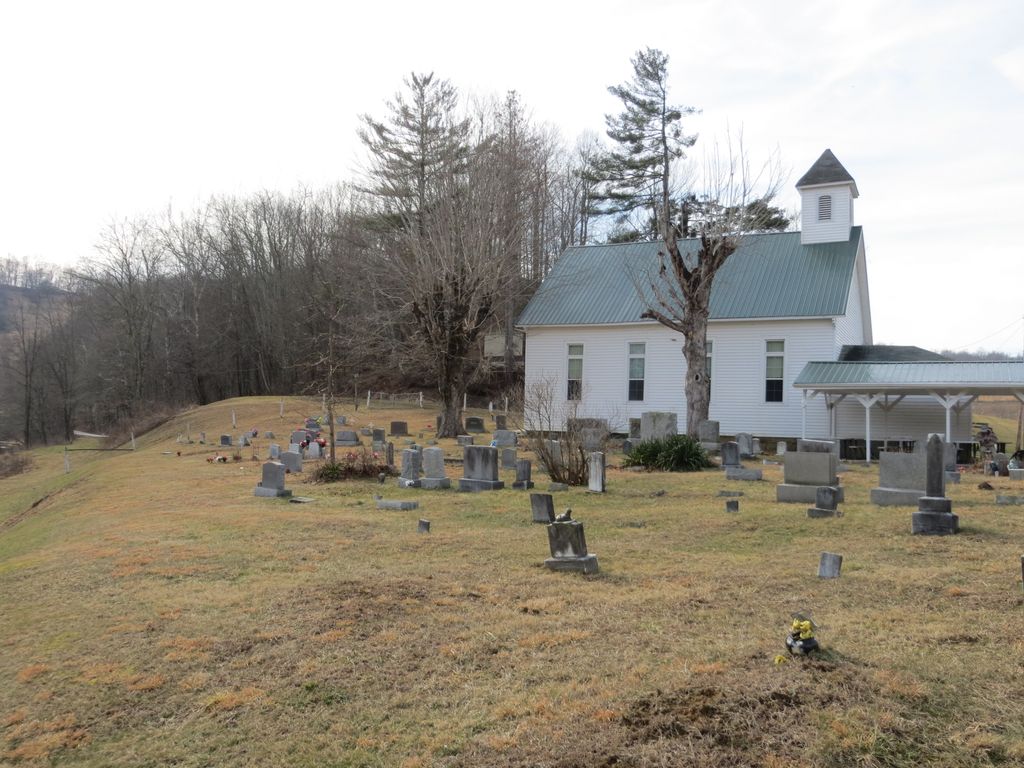
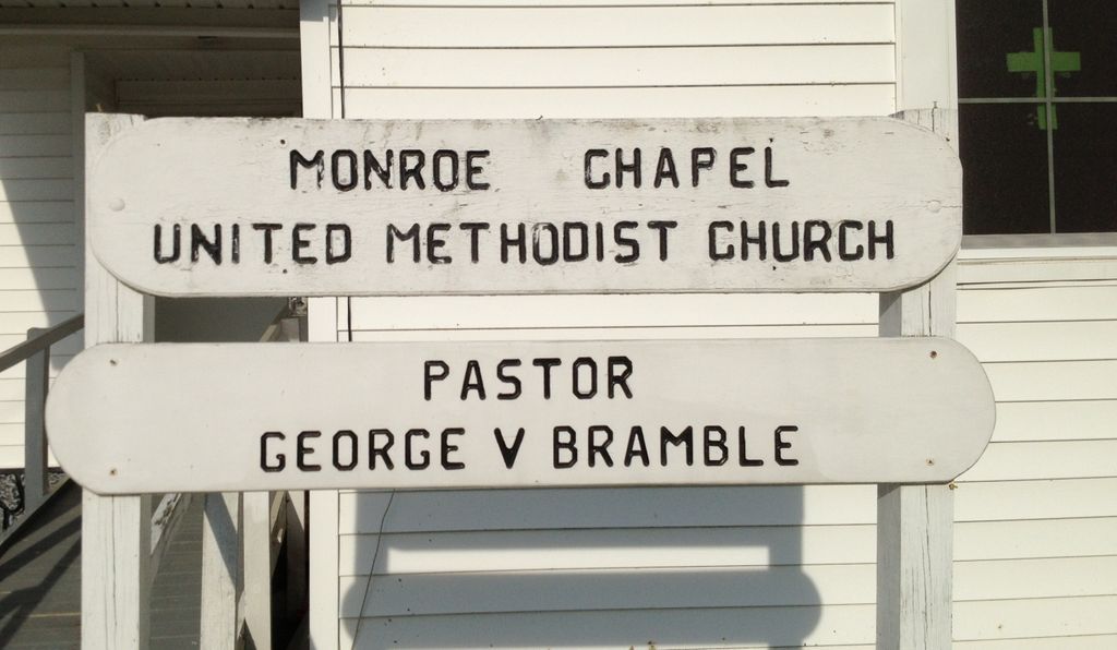
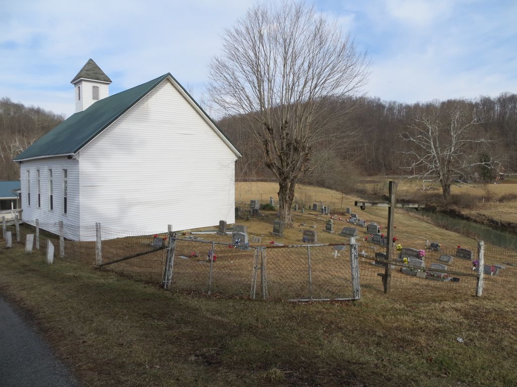
| Description | : | The Monroe Chapel Cemetery is located adjacent to the Monroe Chapel United Methodist Church in the unincorporated community of Romines Mills, Harrison County, West Virginia. To reach the cemetery from the north in Quiet Dell, West Virginia: At the intersection of I-79 (exit 115) and State Route 20, travel south on Route 20 (Buckhannon Pike) for 3.7 miles to the junction of Route 20 and Route 57. Take a slight right, staying on Route 20. G0 1.2 miles and turn right towards Romines Mills. Go 0.1 miles and turn right onto Romines Mills Road (20/20). Go 0.3 miles.... Read More |
frequently asked questions (FAQ):
-
Where is Monroe Chapel Cemetery?
Monroe Chapel Cemetery is located at Bisetown Road Romines Mills, Harrison County ,West Virginia ,USA.
-
Monroe Chapel Cemetery cemetery's updated grave count on graveviews.com?
20 memorials
-
Where are the coordinates of the Monroe Chapel Cemetery?
Latitude: 39.1668740
Longitude: -80.2621030
Nearby Cemetories:
1. Radcliffe Cemetery
Harrison County, USA
Coordinate: 39.1800003, -80.2557983
2. Pleasant Hill Cemetery
Lost Creek, Harrison County, USA
Coordinate: 39.1549988, -80.2774963
3. Hopewell Baptist Church Cemetery
Quiet Dell, Harrison County, USA
Coordinate: 39.1849870, -80.2553670
4. Horeb Cemetery
Craigmoor, Harrison County, USA
Coordinate: 39.1927986, -80.2794037
5. Old Batten Cemetery
Mount Clare, Harrison County, USA
Coordinate: 39.1693993, -80.3021164
6. Green Hill Methodist Church Cemetery
Union, Barbour County, USA
Coordinate: 39.1673300, -80.2205700
7. Overfield Cemetery
Barbour County, USA
Coordinate: 39.1696460, -80.2031640
8. Johnstown Cemetery
Johnstown, Harrison County, USA
Coordinate: 39.1189003, -80.2771988
9. Norman Cemetery
Quiet Dell, Harrison County, USA
Coordinate: 39.2083015, -80.2981033
10. Haymond Cemetery
Quiet Dell, Harrison County, USA
Coordinate: 39.2132988, -80.2863998
11. New Johnstown Cemetery
Harrison County, USA
Coordinate: 39.1175003, -80.2769012
12. Floral Hills Memorial Gardens
Mount Clare, Harrison County, USA
Coordinate: 39.2155880, -80.2871940
13. Wolfe Cemetery
Quiet Dell, Harrison County, USA
Coordinate: 39.2043991, -80.3131027
14. Burns Cemetery
Harrison County, USA
Coordinate: 39.2127991, -80.3024979
15. Stouts Cemetery
Lost Creek, Harrison County, USA
Coordinate: 39.1903000, -80.3328018
16. Rockford Cemetery
Lost Creek, Harrison County, USA
Coordinate: 39.1338997, -80.3274994
17. Trinity United Methodist Church Cemetery
Bridgeport, Harrison County, USA
Coordinate: 39.2264560, -80.2413880
18. Seventh Day Baptist Church Cemetery
Lost Creek, Harrison County, USA
Coordinate: 39.1713982, -80.3419037
19. Bond Cemetery
Harrison County, USA
Coordinate: 39.2280998, -80.3007965
20. Davisson Cemetery
Clarksburg, Harrison County, USA
Coordinate: 39.2374992, -80.2789001
21. Frame Seventh Day Baptist Church Cemetery
Clarksburg, Harrison County, USA
Coordinate: 39.1630690, -80.3547570
22. Old Frame Meeting House Graveyard
Lost Creek, Harrison County, USA
Coordinate: 39.1630550, -80.3548340
23. Adkinson Cemetery
Harrison County, USA
Coordinate: 39.2069016, -80.3396988
24. Union Cemetery
Quiet Dell, Harrison County, USA
Coordinate: 39.2168999, -80.3349991