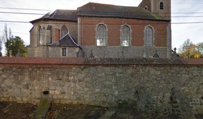
| Memorials | : | 0 |
| Location | : | Ramillies, Arrondissement de Nivelles, Belgium |
| Coordinate | : | 50.6548800, 4.8634900 |
| Description | : | Location Information: The village of Mont St. Andre is situated to the north-west of Ramillies off the N91 which runs between Namur and Louvain. From the motorway E411/A4, turn off at Junction 11, Thorembais-St-Trond, and take the N29 in the direction of Jodoigne. Follow the N29 to the junction with the N91. At this junction turn right onto the N29 in the direction of Namur. After a short distance there is a road to the left signed for Mont St. Andre, this road is called Rue Petit Wariche. Turn left here and follow the road into the village. The church... Read More |
frequently asked questions (FAQ):
-
Where is Mont Saint Andre Churchyard?
Mont Saint Andre Churchyard is located at Ramillies, Arrondissement de Nivelles ,Walloon Brabant ,Belgium.
-
Mont Saint Andre Churchyard cemetery's updated grave count on graveviews.com?
0 memorials
-
Where are the coordinates of the Mont Saint Andre Churchyard?
Latitude: 50.6548800
Longitude: 4.8634900
Nearby Cemetories:
1. Thorembais-les-Beguines Cemetery
Perwez, Arrondissement de Nivelles, Belgium
Coordinate: 50.6574800, 4.8200500
2. Autre-Eglise Churchyard
Ramillies, Arrondissement de Nivelles, Belgium
Coordinate: 50.6634100, 4.9252900
3. Perwez Churchyard
Perwez, Arrondissement de Nivelles, Belgium
Coordinate: 50.6225100, 4.8113400
4. Thorembais-St. Trond Communal Cemetery
Perwez, Arrondissement de Nivelles, Belgium
Coordinate: 50.6370500, 4.7853500
5. Jauche Cemetery
Orp-Jauche, Arrondissement de Nivelles, Belgium
Coordinate: 50.6829405, 4.9655923
6. Jodoigne Communal Cemetery
Jodoigne, Arrondissement de Nivelles, Belgium
Coordinate: 50.7257900, 4.8607400
7. Longchamps Churchyard
Eghezée, Arrondissement de Namur, Belgium
Coordinate: 50.5783477, 4.8978224
8. Saint Remy-Geest Churchyard
Jodoigne, Arrondissement de Nivelles, Belgium
Coordinate: 50.7468700, 4.8583400
9. Piétrebais Communal Cemetery
Incourt, Arrondissement de Nivelles, Belgium
Coordinate: 50.7281000, 4.7645700
10. Cimetiere de Meux
Meux, Arrondissement de Namur, Belgium
Coordinate: 50.5505000, 4.8041000
11. Outgaarden Communal Cemetery
Hoegaarden, Arrondissement Leuven, Belgium
Coordinate: 50.7666600, 4.9139500
12. Saint Martin Churchyard
Nil Saint-Martin, Arrondissement de Nivelles, Belgium
Coordinate: 50.6425200, 4.6726100
13. Eglise Saint-Denis
La Bruyère, Arrondissement de Namur, Belgium
Coordinate: 50.5355555, 4.7844546
14. Avin Communal Cemetery
Hannut, Arrondissement de Waremme, Belgium
Coordinate: 50.6239600, 5.0663300
15. Gembloux Communal Cemetery
Gembloux, Arrondissement de Namur, Belgium
Coordinate: 50.5649100, 4.7086900
16. Gottechain Cemetery
Grez-Doiceau, Arrondissement de Nivelles, Belgium
Coordinate: 50.7567100, 4.7131400
17. Hanneche Churchyard
Burdinne, Arrondissement de Huy, Belgium
Coordinate: 50.5797800, 5.0492100
18. Cimetière communale de Hannut
Hannut, Arrondissement de Waremme, Belgium
Coordinate: 50.6786227, 5.0857895
19. Waasmont Begraafplaats
Landen, Arrondissement Leuven, Belgium
Coordinate: 50.7339300, 5.0623600
20. Burdinne Communal Cemetery
Burdinne, Arrondissement de Huy, Belgium
Coordinate: 50.5874100, 5.0777100
21. Champion Military Cemetery
Namur, Arrondissement de Namur, Belgium
Coordinate: 50.5051400, 4.9164600
22. Rhisnes Churchyard
La Bruyère, Arrondissement de Namur, Belgium
Coordinate: 50.5043200, 4.8035200
23. Chastre French Cemetery
Chastre, Arrondissement de Nivelles, Belgium
Coordinate: 50.6046486, 4.6265321
24. Hevillers Cemetery
Mont-Saint-Guibert, Arrondissement de Nivelles, Belgium
Coordinate: 50.6187900, 4.6178300

