
| Memorials | : | 2 |
| Location | : | Polk County, USA |
| Coordinate | : | 44.7686005, -123.3760986 |
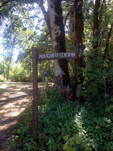
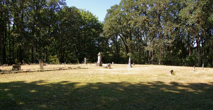
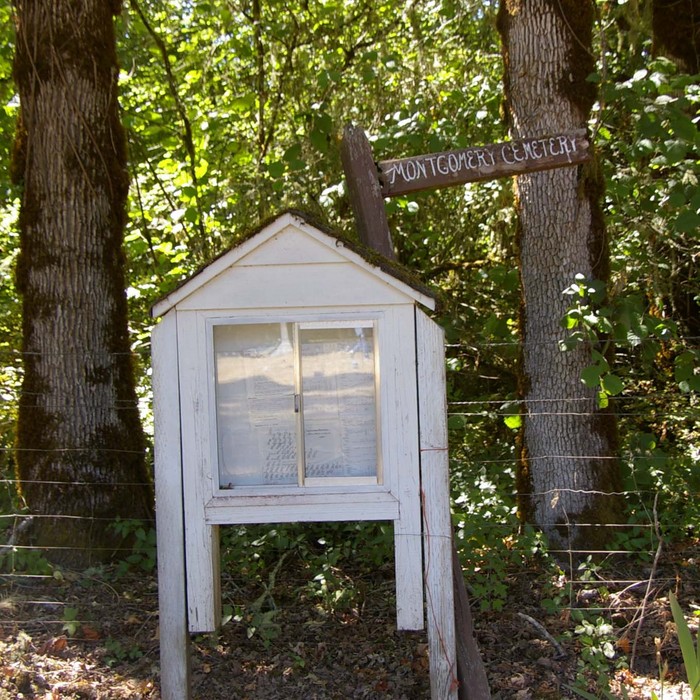
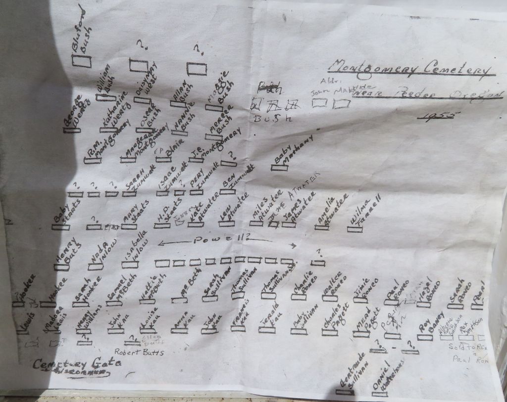
| Description | : | Montgomery Cemetery is a pioneer cemetery and had its first burial in 1854 according to a survey of Oregon cemeteries conducted in 1977. The cemetery was established on John Zumwalt DLC (donation land claim) and is located 2 miles east of Pedee. As such, it was at times also been known as the Zumwalt Family Cemetery. Several of those buried here were among the early pioneers and pioneer families that arrived in Oregon by wagon train. The cemetery in 2019-2021 had extensive repair and cleaning of headstones which some had not been set upright for 60 years. All of the... Read More |
frequently asked questions (FAQ):
-
Where is Montgomery Cemetery?
Montgomery Cemetery is located at Polk County ,Oregon ,USA.
-
Montgomery Cemetery cemetery's updated grave count on graveviews.com?
2 memorials
-
Where are the coordinates of the Montgomery Cemetery?
Latitude: 44.7686005
Longitude: -123.3760986
Nearby Cemetories:
1. Taylor Cemetery
Polk County, USA
Coordinate: 44.7472000, -123.4194031
2. Williams Cemetery
Polk County, USA
Coordinate: 44.7472000, -123.3305969
3. Kovash Farm Cemetery
Pedee, Polk County, USA
Coordinate: 44.7648800, -123.4487600
4. Edwards Pioneer Cemetery
Pedee, Polk County, USA
Coordinate: 44.7472000, -123.4527969
5. Womer Cemetery
Pedee, Polk County, USA
Coordinate: 44.7463989, -123.4535980
6. Hart Riggs Cemetery
Dallas, Polk County, USA
Coordinate: 44.8471985, -123.3591995
7. Luckiamute Meadows Memorial Site
Kings Valley, Benton County, USA
Coordinate: 44.6927857, -123.4388198
8. Hubbard Cemetery
Falls City, Polk County, USA
Coordinate: 44.8535995, -123.4194031
9. Butler Davidson Cemetery
Monmouth, Polk County, USA
Coordinate: 44.8356018, -123.2711029
10. Falls City Lower Cemetery
Falls City, Polk County, USA
Coordinate: 44.8652992, -123.4175034
11. Kings Valley Cemetery
Kings Valley, Benton County, USA
Coordinate: 44.6782990, -123.4408035
12. King Family Cemetery
Hoskins, Benton County, USA
Coordinate: 44.6735050, -123.4332850
13. Falls City Cemetery
Falls City, Polk County, USA
Coordinate: 44.8680992, -123.4167023
14. Claremont Cemetery
Polk County, USA
Coordinate: 44.7213000, -123.5130000
15. Fort Hoskins Military Cemetery
Benton County, USA
Coordinate: 44.6770150, -123.4578470
16. English Cemetery
Polk County, USA
Coordinate: 44.8212800, -123.2358800
17. Smith Cemetery
Monmouth, Polk County, USA
Coordinate: 44.8219200, -123.2359100
18. Fircrest Cemetery
Monmouth, Polk County, USA
Coordinate: 44.8216900, -123.2344100
19. Schrag Cemetery
Polk County, USA
Coordinate: 44.8972015, -123.3480988
20. Hilltop Cemetery
Independence, Polk County, USA
Coordinate: 44.8061600, -123.1883600
21. Whiteaker Cemetery
Dallas, Polk County, USA
Coordinate: 44.8830556, -123.2644444
22. Dallas Cemetery
Dallas, Polk County, USA
Coordinate: 44.9091988, -123.3324966
23. Ridders Cemetery
Lewisburg, Benton County, USA
Coordinate: 44.7188988, -123.1821976
24. Robinson Cemetery
Corvallis, Benton County, USA
Coordinate: 44.6249860, -123.2828910